

Site name: Ballymaccormick Point
Location: Descriptive location referring to nearest landfall i.e. town, village, harbour or island
GroomsportType: Describes whether this dive site can be dived from the shore, from a boat, or both
ShoreWreck: Dive sites which include a shipwreck (or part of a shipwreck) are labelled with a ‘Yes’
NoMin. dive depth (m): The approximate minimum depth of the dive given in metres
1Max. dive depth (m): The approximate maximum depth of the dive given in metres
4Max. seabed depth (m): The maximum depth of the seabed at the site taken from the intersect between the dive site point and the depth contour on an Admiralty Standard Nautical Chart
7Diving experience (min level): The recommended minimum level of diving experience for a specific site, described as Novice (<50 dives in temperate/cold waters and minimum certification of PADI Open/Advanced Open Water, BSAC Ocean Diver or CMAS 1 star), Intermediate (50-100 dives in temperate/cold waters and minimum certification of PADI Rescue Dive, BSAC Sports Dive or CMAS 2 star) or Advanced (>250 dives in temperate/cold waters and minimum certification of PADI Divemaster, BSAC Dive Leader or CMAS 3 star
NoviceOptimal wind direction: The general wind direction which causes minimal exposure at the site, corresponding to 8 points of the compass: North (N), North East (NE), East (E, South East (SE), South (S), South West (SW), West, North West (NW)
SE/S/SWExposure: The approximate level of exposure to wind and wave action at the site on any given day, described as Sheltered (inshore sites surrounded by a form of shelter on all sides), Moderate (sites which are partially sheltered) or Exposed (sites with little to no shelter)
ModerateTidal strength: Anecdotal description of tidal strength at the site
Marine Protected Area: A Yes or No highlighting whether or not the site occurs within a Marine Protected Area
NoVisibility: Anecdotal description of the typical underwater visibility at the site
During fine weather the visibility at this site can be amazingBest time to dive: Anecdotal recommendation for the best time to dive the site for optimal underwater conditions. This typically relates to the stage of the tide
Ideally an hour before HW Belfast due to a rocky and soft entry and exit.Getting There: Directions for getting to the site
Come off Main Street in Groomsport village onto The Point, a dead ended residential uneven road. Park on the verge here. On foot, head north for 50m, then break left and head 40m west towards fence. From the fence, head 50m NE over sand to the entry point.
Facilities: Details of nearest facilities to dive site i.e. public car parking and toilets, slipways etc
Public toilets, a slipway and free car parking are available nearby at Groomsport Harbour.
Nearest tank filling: DV Diving, Newtownards
Hazards: Anecdotal information on possible hazards at the site for divers and snorkellers
- Rocks, slippery seaweed and soft sand make entry at low tide hazardous (to be avoided!).
- Occasional recreational boat traffic out of Groomsport Harbour
Description: A general description of the physical features of the dive site
An easy shallow dive with sand and rocky areas and plenty to see. Also suitable for snorkelling.
Biodiversity: A description of the species composition at the site. Species of interest are highlighted. Follow the links for more information about the species on the NBN Atlas Northern Ireland website
The usual suspects but with recent records for the cushion star Asterina gibbosa and volcano sponge Haliclona viscosa.
View all species records from this site
A link to the dive site location on the NBN Atlas Northern Ireland website, showing all species records from within a 1km boundary of the site centroid. Any new species records from the site submitted to Seasearch, iRecord, CEDaR Online Recording or iNaturalist will appear here
Local Charters: A link to the website for the nearest Dive Centre to the site. A map of all dive centres is provided under ‘Go Diving’
Environmental and Historical Designations: A list of any environmental or historical designations attributed to the site, or overlapping it. Follow the link for more information
More Information: Links to additional information found online for the dive site
Safety: Safety tips
- In an emergency call 999 or 112 and ask for the coastguard.
- Follow VHF radio Channel 16 (156.8 MHz), the international distress frequency.
- Find nearest defibrillator (AED) here
Latitude, Longitude: The approximate XY coordinates for the dive site in Decimel Degrees (DD). These can be converted to DMS or DDM by following the link below
54.680283, -5.621008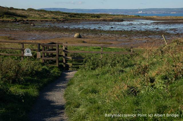


Leave a Comment
Dived here recently? Then let other divers know about this site from your experience!