Record Heritage
Underwater Cultural Heritage (UCH) is an important aspect of our common heritage and should be conserved for future generations of divers. Please report any new discoveries and take part in its recording.
Historic Environment Record of Northern Ireland
The Historic Environment Record of Northern Ireland (HERoNI) holds information on all elements of Northern Ireland’s historic environment in the form of databases, written records, maps, photographic, drawn and digital material. The Record is curated by the Department for Communities Historic Environment Division.
Shipwreck Records
A database of shipwreck incidents based on historical sources, UK Hydrographic Office data, Sports Diver information and marine geophysical surveys has been developed. Historical background information on historic wrecks from the HERoNI has been used for many of the wreck descriptions on the DiveNI website.
Designated wreck zones, historic wrecks and a density map of documented marine losses can be viewed on the Historic Environment Map Viewer and Marine Map Viewer.
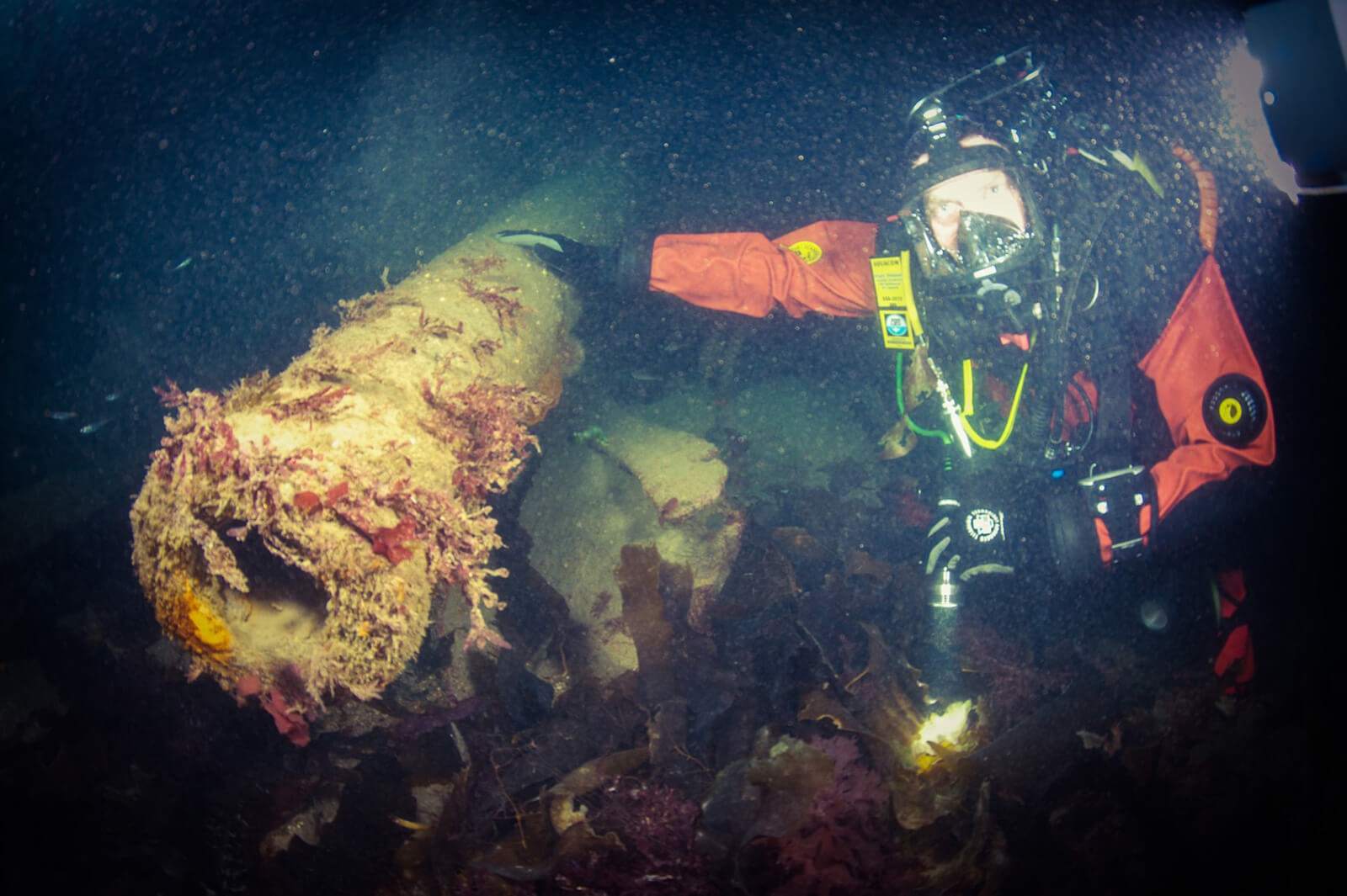
Reporting new information
The records staff at the Historic Environment Division recognise that the general public has always been instrumental in discovering and recording new underwater sites and would like to hear of any new discoveries. In addition they would encourage divers to send them a short report on any diving undertaken on the HMS Drake wreck site in Church Bay, Rathlin Island, to assist in monitoring the wreck.
In 2017 HMS Drake was scheduled for protection under the Historic Monuments and Archaeological Objects (Northern Ireland) Order 1995. Public access, i.e., diving on the site is permitted on a ‘look but do not touch’ basis. Find out more information on this scheduling here.
To report information on historic wrecks and/or HMS Drake please contact: HERoNI@communities-ni.gov.uk
Marine Antiquities Scheme
The Marine Antiquities Scheme (MAS), an initiative created to improve knowledge of our underwater heritage through the recording of marine finds, was launched in Northern Ireland in February 2018.
The scheme aims to enhance awareness of Northern Ireland’s marine heritage by helping record archaeological finds in the marine environment. Through its website and mobile app, MAS enables users to record archaeological material discovered anywhere from the Mean Low Water Level.
Guided by the approach ‘record any discovery before any recovery’, the scheme allows finders to learn more about their discoveries, help characterise the archaeological nature of the marine environment, and allow public access to the data for research.
Record a find
If you have discovered archaeological material from a marine area of Northern Ireland the MAS team would like to hear from you. Any details you have could help to enhance our knowledge of how people lived in the past, for example how they interacted with the landscape, sea and seabed.
If you are a fisherman, you may have come across an upstanding object on the seabed that could be the remains of an aircraft. If you are a diver you may have found an anchor or cannonball lying on the seabed.
Whatever the case and whatever the find, we encourage you to record the details via the online recording form or MAS app for Android or iOS.
To learn more about MAS, go to: The Marine Antiquities Scheme
Pericles
PERICLES is an EU-funded research and innovation project running until 2021. The project promotes sustainable, participatory governance of cultural heritage in European coastal and maritime regions. Find out more about the project here.
Cultural Heritage Mapping Portal
PERICLES has developed an interactive, online cultural heritage mapping platform. This portal enables data collection and analysis of the distribution of tangible and intangible cultural heritage. The aim of the portal is to allow users to better understand cultural heritage, particularly in the way that it is situated within marine and coastal land and seascapes.
What can I do in the portal?
The portal provides a space that enables users to upload photos, videos, sound recordings, and documents relating to a place on the map.
Find instructions on how to upload data to the portal here.
Online Resources
There are online resources to assist divers with the recording of historic shipwrecks, see for example:
Divers might also want to take part in the Big Anchor Project, the Big Cannon Project or Adopt a Wreck.
