All Dives Dive
Snorkelling Snorkelling

Ballyvester Beach

Donaghadee

Average score: 5

Site name: Ballyvester Beach
Location: Descriptive location referring to nearest landfall i.e. town, village, harbour or island
Donaghadee
Type: Describes whether this dive site can be dived from the shore, from a boat, or both
Shore
Wreck: Dive sites which include a shipwreck (or part of a shipwreck) are labelled with a ‘Yes’
No
Min. dive depth (m): The approximate minimum depth of the dive given in metres
1
Max. dive depth (m): The approximate maximum depth of the dive given in metres
6

Max. seabed depth (m): The maximum depth of the seabed at the site taken from the intersect between the dive site point and the depth contour on an Admiralty Standard Nautical Chart
7

Diving experience (min level): The recommended minimum level of diving experience for a specific site, described as Novice (<50 dives in temperate/cold waters and minimum certification of PADI Open/Advanced Open Water, BSAC Ocean Diver or CMAS 1 star), Intermediate (50-100 dives in temperate/cold waters and minimum certification of PADI Rescue Dive, BSAC Sports Dive or CMAS 2 star) or Advanced (>250 dives in temperate/cold waters and minimum certification of PADI Divemaster, BSAC Dive Leader or CMAS 3 star
Novice

Optimal wind direction: The general wind direction which causes minimal exposure at the site, corresponding to 8 points of the compass: North (N), North East (NE), East (E, South East (SE), South (S), South West (SW), West, North West (NW)
SW/W/NW

Exposure: The approximate level of exposure to wind and wave action at the site on any given day, described as Sheltered (inshore sites surrounded by a form of shelter on all sides), Moderate (sites which are partially sheltered) or Exposed (sites with little to no shelter)
Moderate

Tidal strength: Anecdotal description of tidal strength at the site
Weak but subject to strong currents further out

Marine Protected Area: A Yes or No highlighting whether or not the site occurs within a Marine Protected Area
Yes

Visibility: Anecdotal description of the typical underwater visibility at the site
In perfect conditions ~5-10 metres
Best time to dive: Anecdotal recommendation for the best time to dive the site for optimal underwater conditions. This typically relates to the stage of the tide
Close to LW to maximise seeing many species. But can be dived or snorkelled anytime.
Getting There: Directions for getting to the site

Travel to Donaghadee and continue on the coastal road (Millisle Road) towards Millisle. Approximately 1.5 miles from Donaghadee there is a car park on your right hand side. It’s ‘Car Park, 235-225, A2, Donaghadee, BT21 0LN’ on Google Maps. Halfway down the car park there is a gap in the wall, leading across the road to a path to the beach.

Facilities: Details of nearest facilities to dive site i.e. public car parking and toilets, slipways etc

Free public car park above site. Public toilets are available in Donaghadee (4A Parade) as well as a slipway.

Nearest tank filling is DV Diving, Newtownards.

Hazards: Anecdotal information on possible hazards at the site for divers and snorkellers

  • Very light boat traffic.
  • Lobster pots in the area.
  • Potentially stronger currents outside the bay.
Description: A general description of the physical features of the dive site

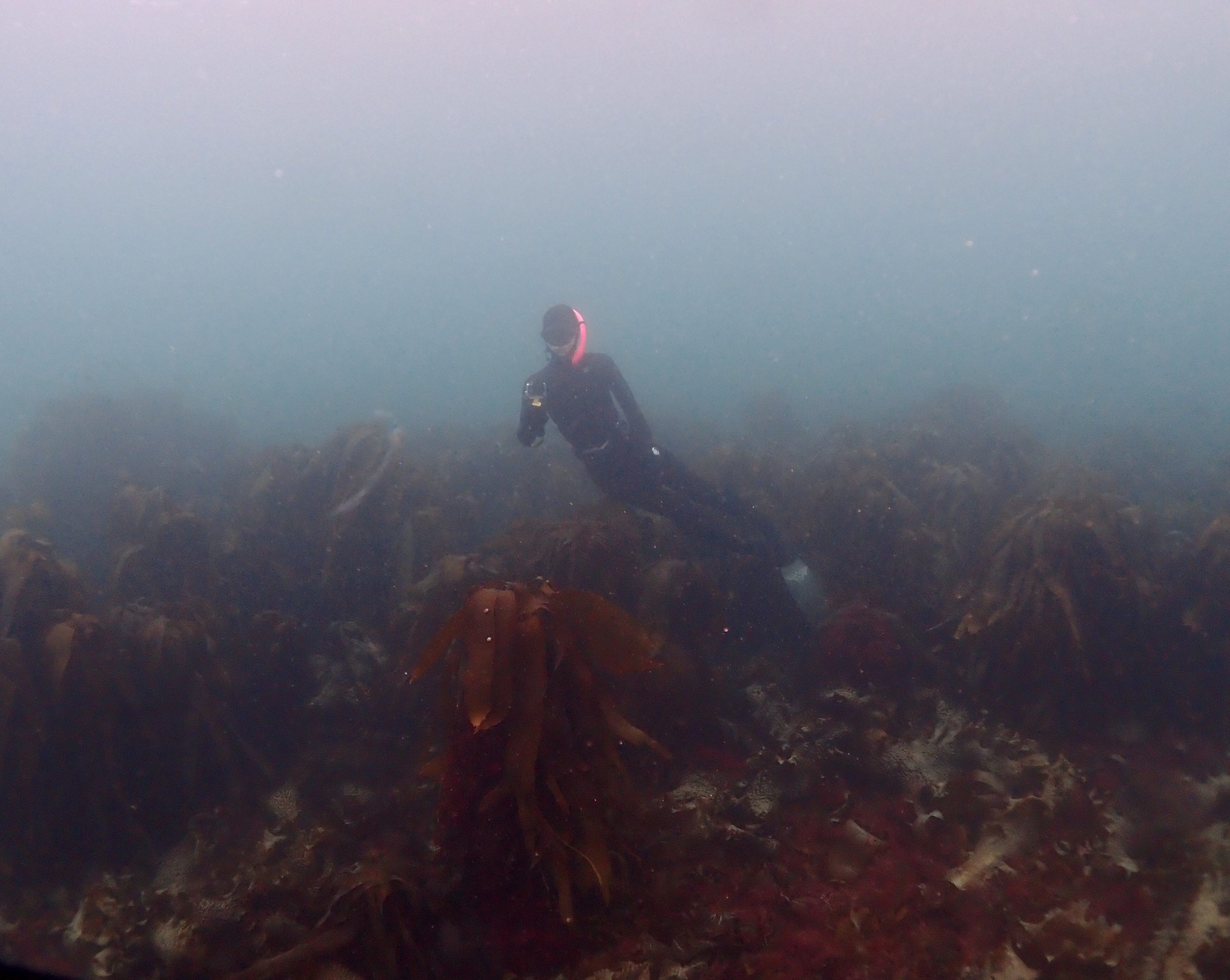
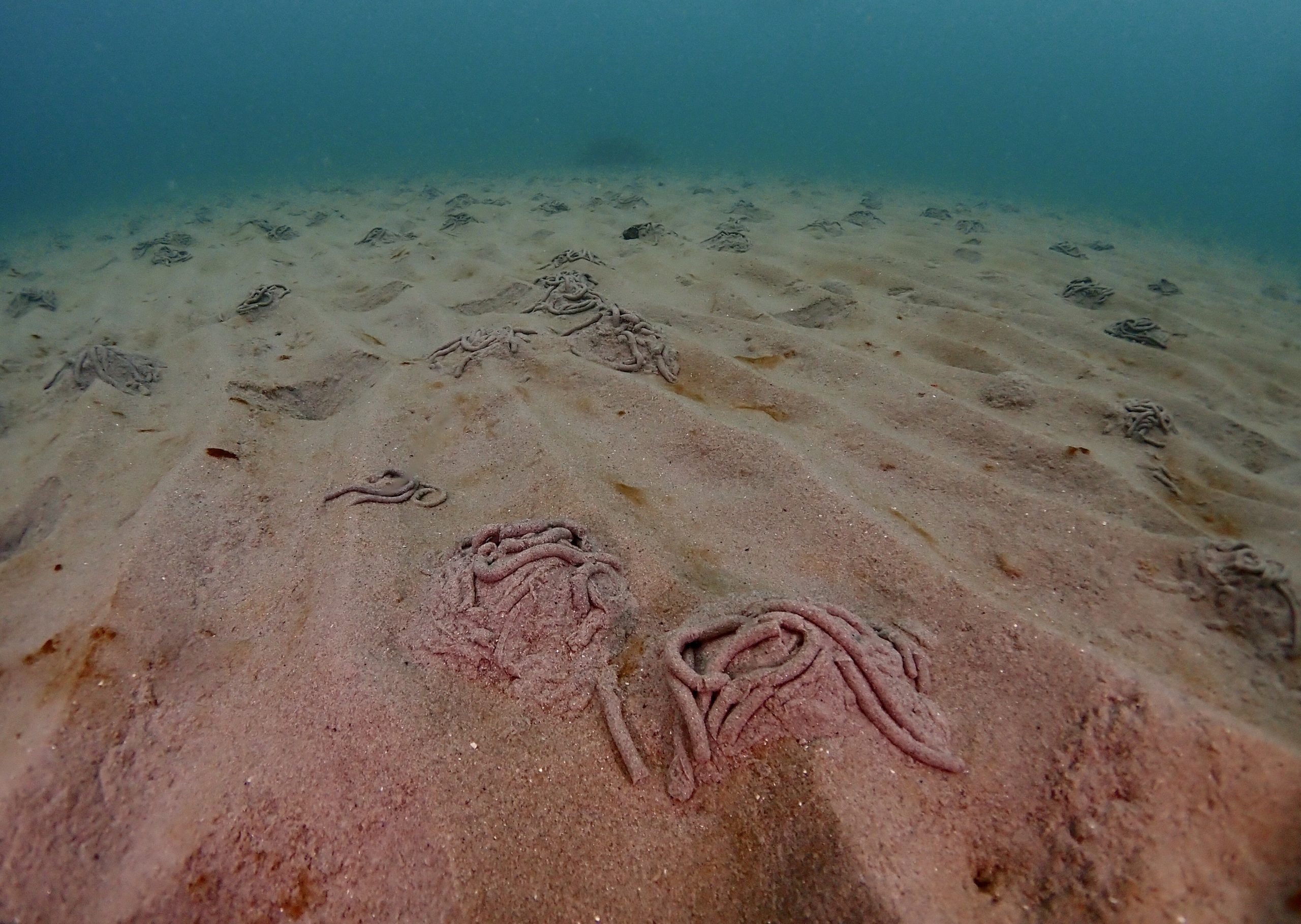
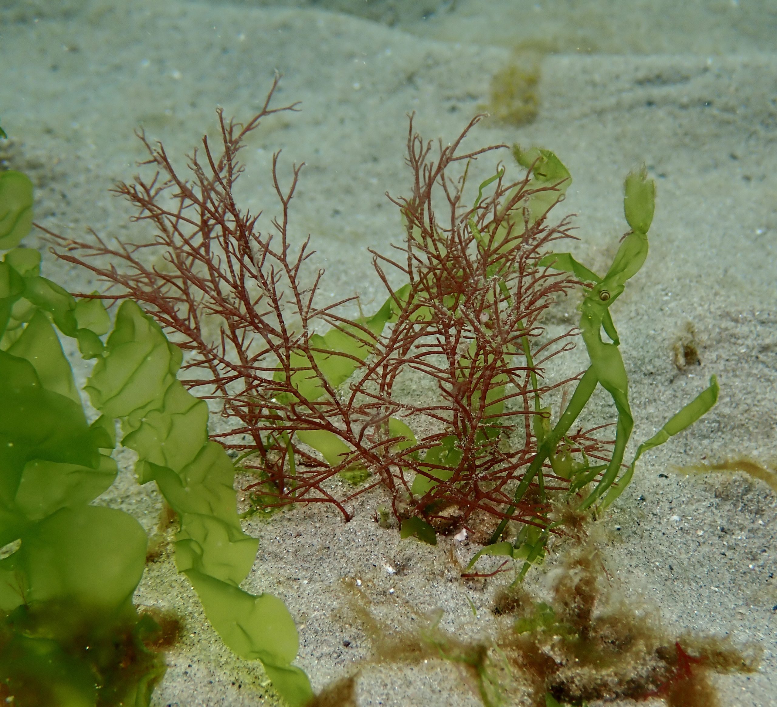
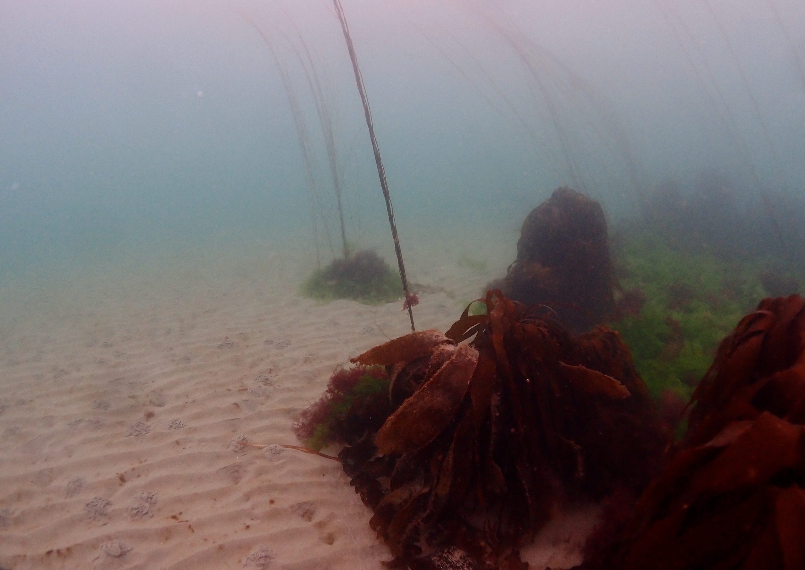
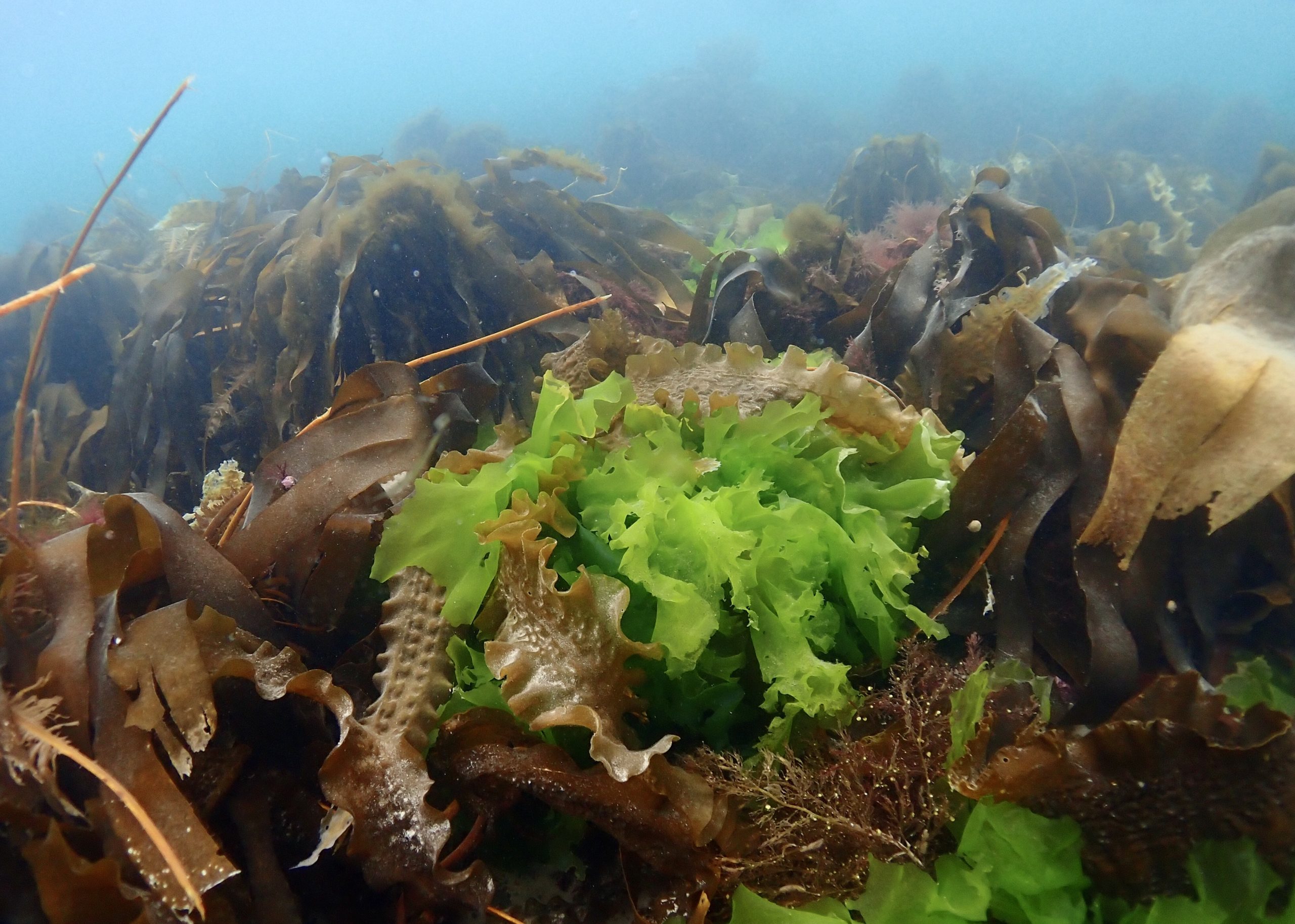
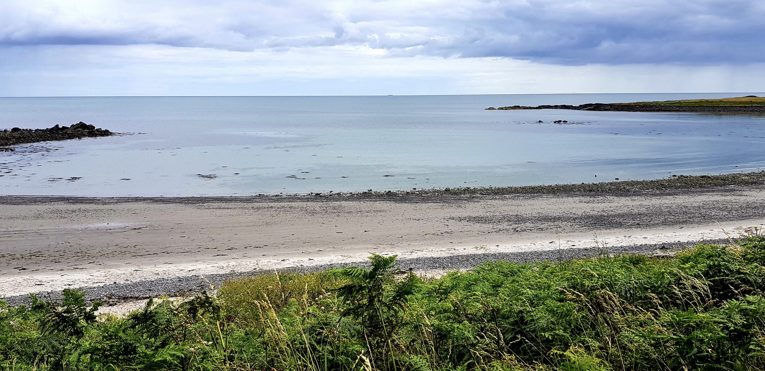
A beautiful sandy beach leading to areas of mixed seaweed and further out to areas of rocky, kelp covered reef. Bound on both sides by areas of rocky reef. Sheltered in the bay but beware of potentially stronger currents further out.

Biodiversity: A description of the species composition at the site. Species of interest are highlighted. Follow the links for more information about the species on the NBN Atlas Northern Ireland website

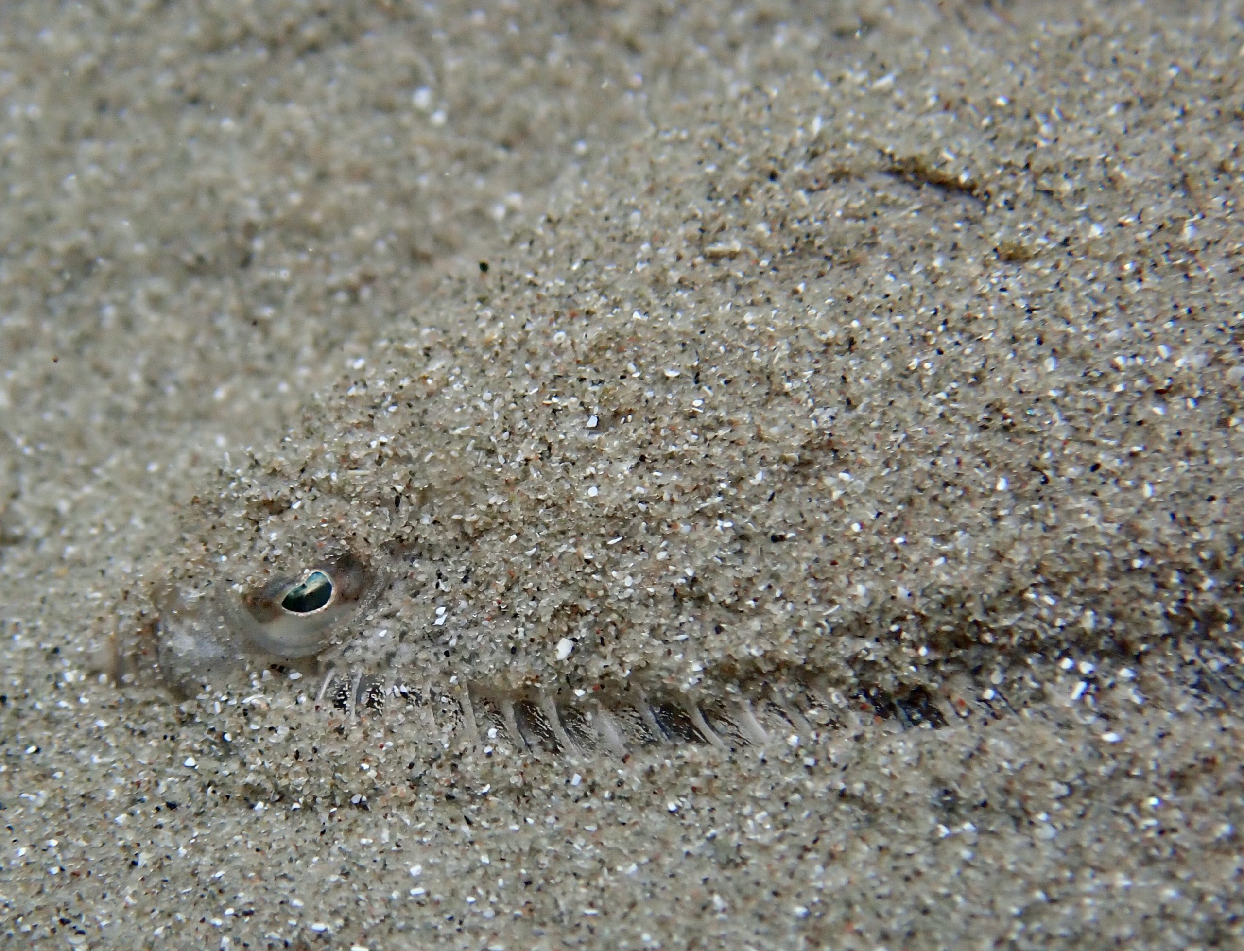
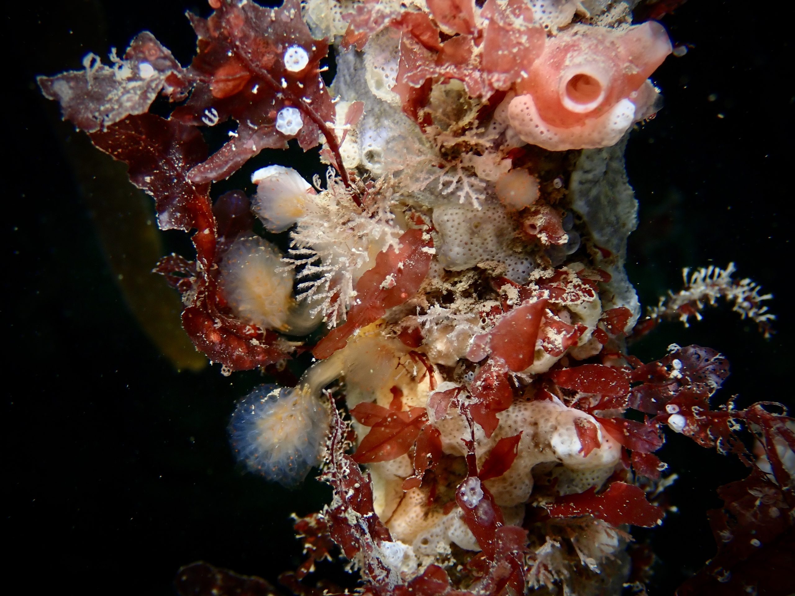
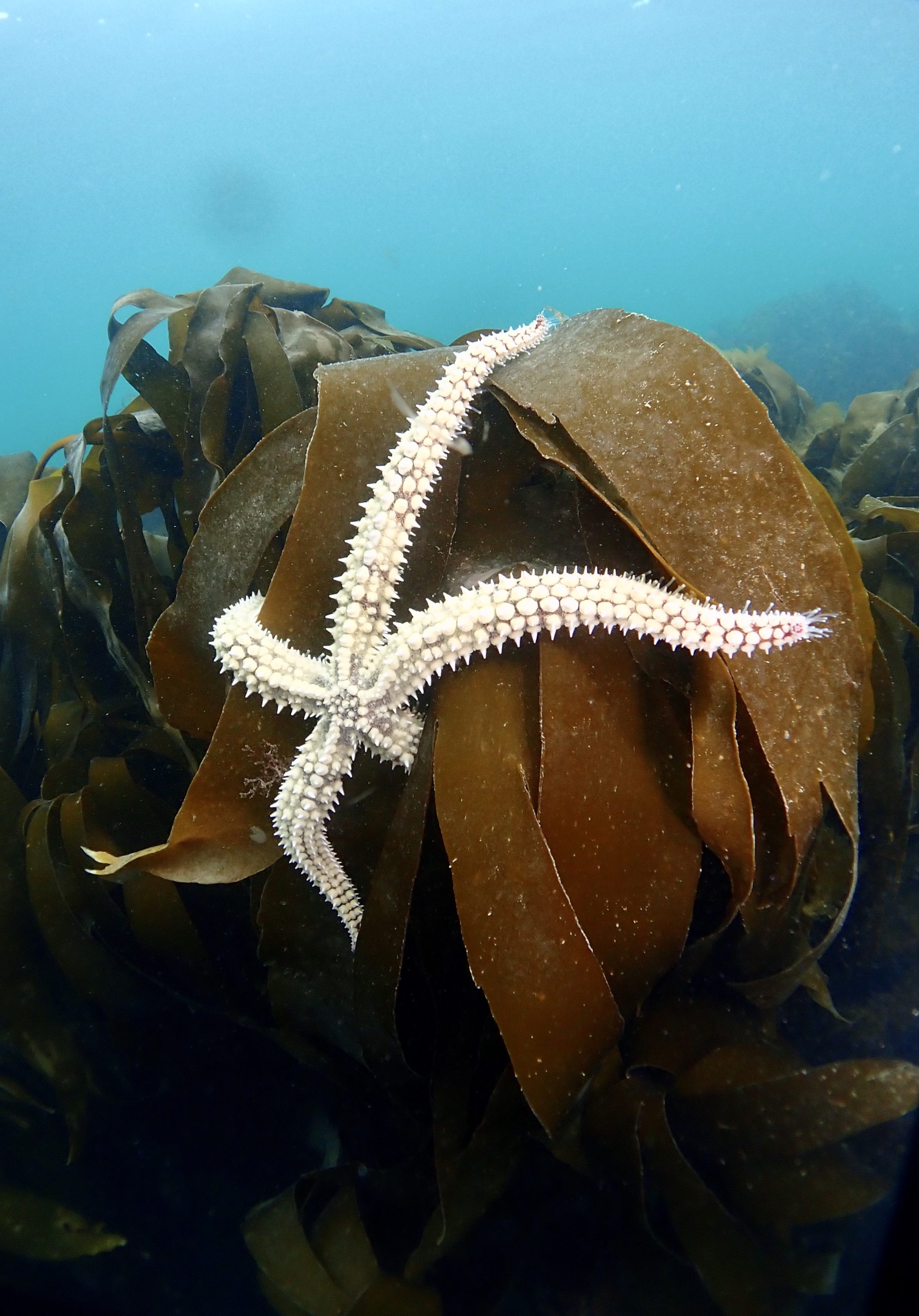
Juvenile fish, crustaceans and worms on the sandy areas, including areas of sea spaghetti, lettuce and other mixed weed. Moving further out of the bay, rocky reef areas are habitats to numerous sea squirts, starfish and other species.

View all species records from this site

A link to the dive site location on the NBN Atlas Northern Ireland website, showing all species records from within a 1km boundary of the site centroid. Any new species records from the site submitted to Seasearch, iRecord, CEDaR Online Recording or iNaturalist will appear here
Local Charters: A link to the website for the nearest Dive Centre to the site. A map of all dive centres is provided under ‘Go Diving’

DV Diving

Environmental and Historical Designations: A list of any environmental or historical designations attributed to the site, or overlapping it. Follow the link for more information

North Channel SAC
Outer Ards ASSI
East Coast Marine Proposed SPA
Outer Ards RAMSAR Site

More Information: Links to additional information found online for the dive site

Northern Ireland Marine MapViewer

Safety: Safety tips

  • In an emergency call 999 or 112 and ask for the coastguard.
  • Follow VHF radio Channel 16 (156.8 MHz), the international distress frequency. Send a distress alert followed by ‘MAYDAY, MAYDAY, MAYDAY’ and ‘This is [boat name]’.
  • Find nearest defibrillator (AED) here.
  • Donaghadee Harbour Master: 028 9188 2377
Latitude, Longitude: The approximate XY coordinates for the dive site in Decimel Degrees (DD). These can be converted to DMS or DDM by following the link below
54.623582, -5.532621

Leave a Comment

Dived here recently? Then let other divers know about this site from your experience!

Leave a Reply

Your email address will not be published. Required fields are marked *

This site uses Akismet to reduce spam. Learn how your comment data is processed.

Join our Mailing List