All Dives Dive

Blackhead

Whitehead

Average score: 0

Site name: Blackhead
Location: Descriptive location referring to nearest landfall i.e. town, village, harbour or island
Whitehead
Type: Describes whether this dive site can be dived from the shore, from a boat, or both
Boat
Wreck: Dive sites which include a shipwreck (or part of a shipwreck) are labelled with a ‘Yes’
No
Min. dive depth (m): The approximate minimum depth of the dive given in metres
4
Max. dive depth (m): The approximate maximum depth of the dive given in metres
13

Max. seabed depth (m): The maximum depth of the seabed at the site taken from the intersect between the dive site point and the depth contour on an Admiralty Standard Nautical Chart
14

Diving experience (min level): The recommended minimum level of diving experience for a specific site, described as Novice (<50 dives in temperate/cold waters and minimum certification of PADI Open/Advanced Open Water, BSAC Ocean Diver or CMAS 1 star), Intermediate (50-100 dives in temperate/cold waters and minimum certification of PADI Rescue Dive, BSAC Sports Dive or CMAS 2 star) or Advanced (>250 dives in temperate/cold waters and minimum certification of PADI Divemaster, BSAC Dive Leader or CMAS 3 star
Novice

Optimal wind direction: The general wind direction which causes minimal exposure at the site, corresponding to 8 points of the compass: North (N), North East (NE), East (E, South East (SE), South (S), South West (SW), West, North West (NW)
W/NW

Exposure: The approximate level of exposure to wind and wave action at the site on any given day, described as Sheltered (inshore sites surrounded by a form of shelter on all sides), Moderate (sites which are partially sheltered) or Exposed (sites with little to no shelter)
Moderate

Tidal strength: Anecdotal description of tidal strength at the site

Marine Protected Area: A Yes or No highlighting whether or not the site occurs within a Marine Protected Area
Yes

Visibility: Anecdotal description of the typical underwater visibility at the site
Poor. Described as 'milky', ranging from 1-4 metres
Best time to dive: Anecdotal recommendation for the best time to dive the site for optimal underwater conditions. This typically relates to the stage of the tide
Getting There: Directions for getting to the site

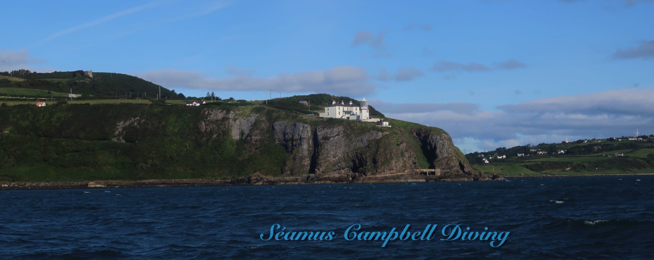
By boat from Bangor, Groomsport or Whitehead. The site is located off the shore beneath Blackhead Lighthouse.

Facilities: Details of nearest facilities to dive site i.e. public car parking and toilets, slipways etc

Free car parking and toilet facilities are available at Whitehead car park, above the Whiteharbour slipway. Whiteharbour is privately owned. For access call the Harbour Master: 028 9338 2549. Groomsport has two slipway launching points and access to public toilets on Harbour road. Car parking is available adjacent to the harbour. Free car parking is available above Bangor Marina and public toilets are available at South Pier. The slipway to the north of the car park is primarily a means of launching Bangor’s Atlantic 85 lifeboat and use is restricted to season ticket holders and Bangor Marina/harbour users. For more information, visit: http://www.quaymarinas.com/cookie-preferences-page/

Nearest tank filling is DV Diving, Mount Stewart, Newtownards.

Hazards: Anecdotal information on possible hazards at the site for divers and snorkellers

Description: A general description of the physical features of the dive site

A sandy and muddy seabed gently sloping to a depth of 14 metres. Large silty boulders are present on the upper slope, with some pebbles.

Biodiversity: A description of the species composition at the site. Species of interest are highlighted. Follow the links for more information about the species on the NBN Atlas Northern Ireland website

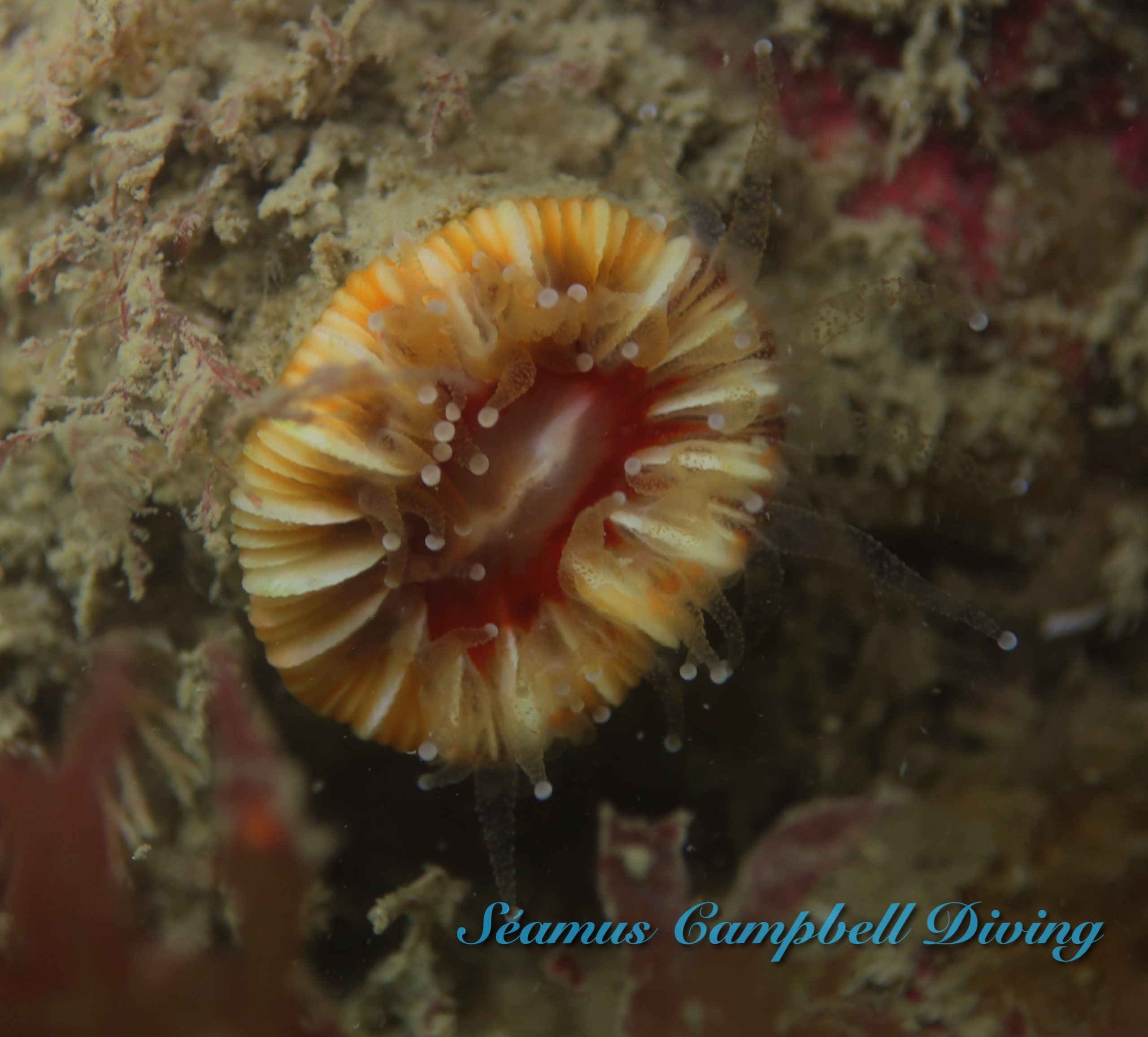
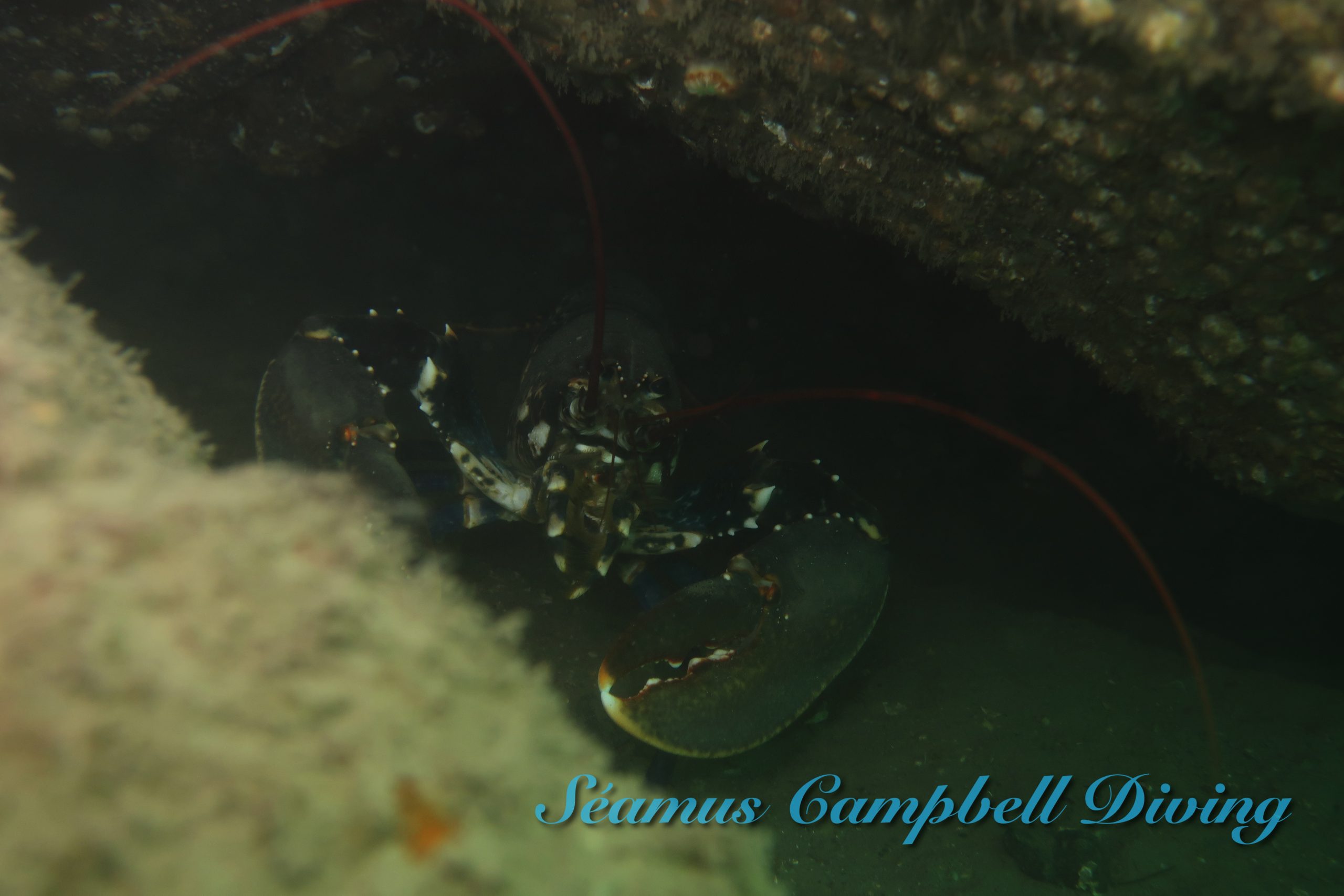
Dense kelp dominates the boulder wall. Biodiversity is relatively low, although some various fish species are found amongst the kelp, including the reticulated dragonet Callionymus reticulatus.

View all species records from this site

A link to the dive site location on the NBN Atlas Northern Ireland website, showing all species records from within a 1km boundary of the site centroid. Any new species records from the site submitted to Seasearch, iRecord, CEDaR Online Recording or iNaturalist will appear here
Local Charters: A link to the website for the nearest Dive Centre to the site. A map of all dive centres is provided under ‘Go Diving’

DV Diving

Environmental and Historical Designations: A list of any environmental or historical designations attributed to the site, or overlapping it. Follow the link for more information

North Channel SAC
East Coast Proposed Marine SPA

More Information: Links to additional information found online for the dive site

Northern Ireland Marine MapViewer

Safety: Safety tips

  • In an emergency call 999 or 112 and ask for the coastguard.
  • Follow VHF radio Channel 16 (156.8 MHz), the international distress frequency. Send a distress alert followed by ‘MAYDAY, MAYDAY, MAYDAY’ and ‘This is [boat name]’.
  • Find nearest defibrillator (AED) here.
  • Bangor Harbour Master: 028 9145 3297. When navigating within the harbour/marina, use VHF Channel 11.
  • Groomsport Harbour Master: 028 9188 2377
  • Whiterock (Whiteharbour) Harbour Master: 028 933 82549
Latitude, Longitude: The approximate XY coordinates for the dive site in Decimel Degrees (DD). These can be converted to DMS or DDM by following the link below
54.765842, -5.689127

Leave a Comment

Dived here recently? Then let other divers know about this site from your experience!

Leave a Reply

Your email address will not be published. Required fields are marked *

This site uses Akismet to reduce spam. Learn how your comment data is processed.

Join our Mailing List