Location:Descriptive location referring to nearest landfall i.e. town, village, harbour or island
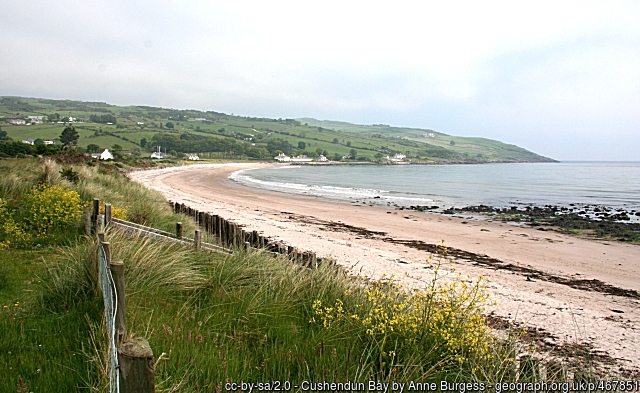
Cushendun
Type:Describes whether this dive site can be dived from the shore, from a boat, or both
Shore
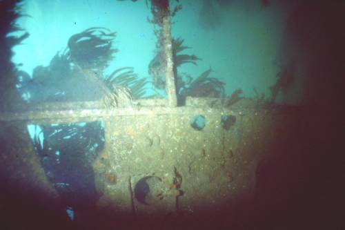
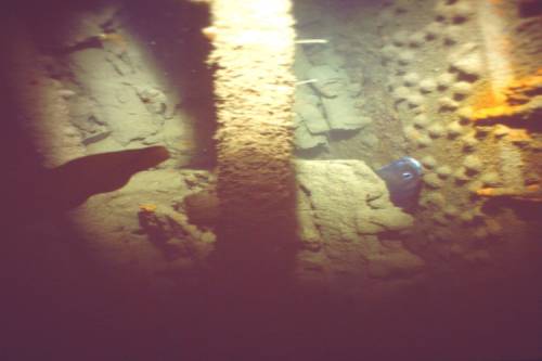
Wreck:Dive sites which include a shipwreck (or part of a shipwreck) are labelled with a ‘Yes’
Yes
Min. dive depth (m):The approximate minimum depth of the dive given in metres
4
Max. dive depth (m):The approximate maximum depth of the dive given in metres
6
Max. seabed depth (m):The maximum depth of the seabed at the site taken from the intersect between the dive site point and the depth contour on an Admiralty Standard Nautical Chart
6
Diving experience (min level):The recommended minimum level of diving experience for a specific site, described as Novice (<50 dives in temperate/cold waters and minimum certification of PADI Open/Advanced Open Water, BSAC Ocean Diver or CMAS 1 star), Intermediate (50-100 dives in temperate/cold waters and minimum certification of PADI Rescue Dive, BSAC Sports Dive or CMAS 2 star) or Advanced (>250 dives in temperate/cold waters and minimum certification of PADI Divemaster, BSAC Dive Leader or CMAS 3 star
Novice
Optimal wind direction:The general wind direction which causes minimal exposure at the site, corresponding to 8 points of the compass: North (N), North East (NE), East (E, South East (SE), South (S), South West (SW), West, North West (NW)
SW/W/NW/N
Exposure:The approximate level of exposure to wind and wave action at the site on any given day, described as Sheltered (inshore sites surrounded by a form of shelter on all sides), Moderate (sites which are partially sheltered) or Exposed (sites with little to no shelter)
Moderate
Tidal strength:Anecdotal description of tidal strength at the site
Moderate
Marine Protected Area:A Yes or No highlighting whether or not the site occurs within a Marine Protected Area
No
Visibility:Anecdotal description of the typical underwater visibility at the site
Visibility is highly variable here and ranges from 2-10 metres
Best time to dive:Anecdotal recommendation for the best time to dive the site for optimal underwater conditions. This typically relates to the stage of the tide
Flood tide
Getting there:Directions for getting to the site
For a shore dive, park in the public car park just off B92, overlooking the beach. Access the shore on foot and from the middle of the beach swim out in an easterly direction to the site which lies approx. 200m off the beach.
Facilities:Details of nearest facilities to dive site i.e. public car parking and toilets, slipways etc
Public car parking and toilet facilities are available at Cushendun Car Park (B92 above the beach).
Hazards:Anecdotal information on possible hazards at the site for divers and snorkellers
Snagged fishing lines around the wreck (entanglement hazard)
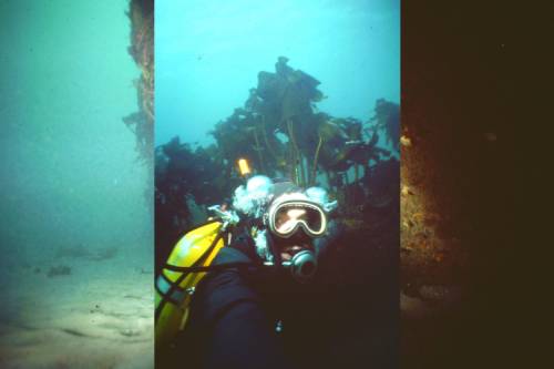
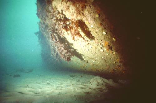
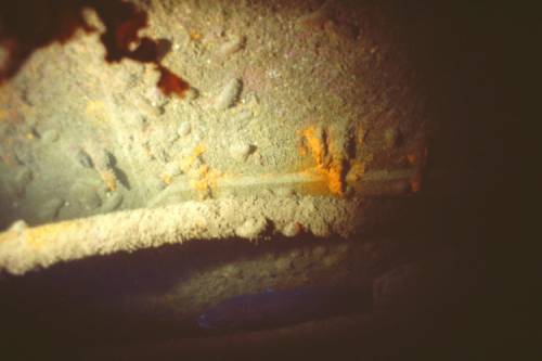
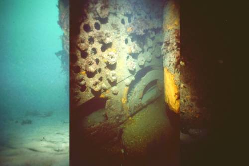
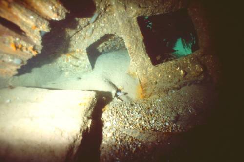
Description:A general description of the physical features of the dive site
The wreck is divided into broken sections and is well embedded in the sand. The surrounding seabed is comprised of fine sand. This is a great site for trainees!
History:The history of the wreck provided by the Senior Marine Archaeologist from the Department for Communities Historic Environment Division (only included for wreck sites)
Biodiversity:A description of the species composition at the site. Species of interest are highlighted. Follow the links for more information about the species on the NBN Atlas Northern Ireland website
The wreckage is heavily covered in pink encrusting algae and dense kelp (predominantly Laminaria hyperborea) with epiphytic red algae on its fronds. Some Devonshire cup corals Caryophyllia smithii are found on the inside of the wreck.
A link to the dive site location on the NBN Atlas Northern Ireland website, showing all species records from within a 1km boundary of the site centroid. Any new species records from the site submitted to Seasearch, iRecord, CEDaR Online Recording or iNaturalist will appear here
Local charters:A link to the website for the nearest Dive Centre to the site. A map of all dive centres is provided under ‘Go Diving’
Environmental and Historical Designations:A list of any environmental or historical designations attributed to the site, or overlapping it. Follow the link for more information
More information:Links to additional information found online for the dive site
Latitude, Longitude:The approximate XY coordinates for the dive site in Decimel Degrees (DD). These can be converted to DMS or DDM by following the link below

Leave a Comment
Dived here recently? Then let other divers know about this site from your experience!