All Dives Dive
Snorkelling Snorkelling

Dunseverick Harbour

Dunseverick

Average score: 0

Site name: Dunseverick Harbour
Location: Descriptive location referring to nearest landfall i.e. town, village, harbour or island
Dunseverick
Type: Describes whether this dive site can be dived from the shore, from a boat, or both
Shore
Wreck: Dive sites which include a shipwreck (or part of a shipwreck) are labelled with a ‘Yes’
No
Min. dive depth (m): The approximate minimum depth of the dive given in metres
10
Max. dive depth (m): The approximate maximum depth of the dive given in metres
12

Max. seabed depth (m): The maximum depth of the seabed at the site taken from the intersect between the dive site point and the depth contour on an Admiralty Standard Nautical Chart
12

Diving experience (min level): The recommended minimum level of diving experience for a specific site, described as Novice (<50 dives in temperate/cold waters and minimum certification of PADI Open/Advanced Open Water, BSAC Ocean Diver or CMAS 1 star), Intermediate (50-100 dives in temperate/cold waters and minimum certification of PADI Rescue Dive, BSAC Sports Dive or CMAS 2 star) or Advanced (>250 dives in temperate/cold waters and minimum certification of PADI Divemaster, BSAC Dive Leader or CMAS 3 star
Novice

Optimal wind direction: The general wind direction which causes minimal exposure at the site, corresponding to 8 points of the compass: North (N), North East (NE), East (E, South East (SE), South (S), South West (SW), West, North West (NW)
SE/S/SW/W

Exposure: The approximate level of exposure to wind and wave action at the site on any given day, described as Sheltered (inshore sites surrounded by a form of shelter on all sides), Moderate (sites which are partially sheltered) or Exposed (sites with little to no shelter)
Moderate

Tidal strength: Anecdotal description of tidal strength at the site
Weak

Marine Protected Area: A Yes or No highlighting whether or not the site occurs within a Marine Protected Area
Yes

Visibility: Anecdotal description of the typical underwater visibility at the site
Visibility ranges from 3-10 metres
Best time to dive: Anecdotal recommendation for the best time to dive the site for optimal underwater conditions. This typically relates to the stage of the tide
High tide
Getting There: Directions for getting to the site

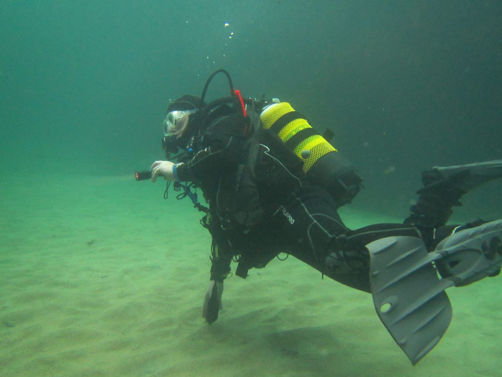
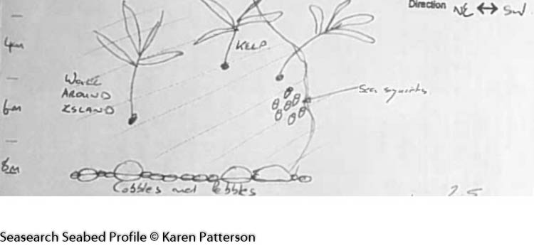
Enter at slip follow round to the left of the island. The seabed drops sharply to 10 metres past the end of the wall to an area of cobbles. It is very shallow to the right of the island.

Facilities: Details of nearest facilities to dive site i.e. public car parking and toilets, slipways etc

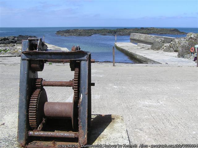
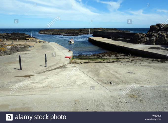
Dunseverick has a slipway, small car park and public toilets (open daily from 8am). Be sure not to park on private property!

Nearest tank filling is Aquaholics, Portstewart/ Ballycastle (028 7083 2584)

Hazards: Anecdotal information on possible hazards at the site for divers and snorkellers

  • Strong currents exist to the north-east, out from the harbour.
  • Boat traffic in/out of the harbour.
Description: A general description of the physical features of the dive site

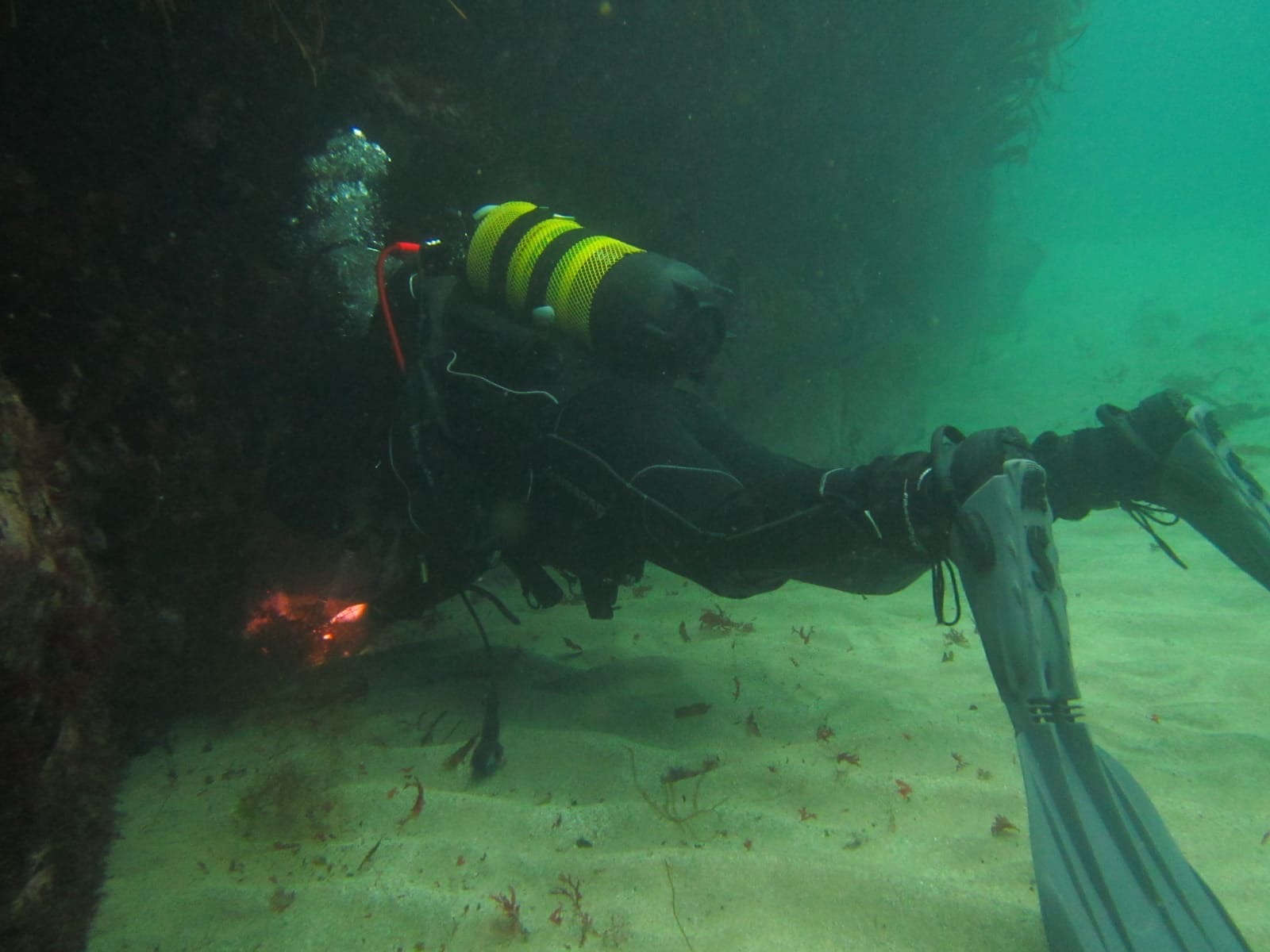
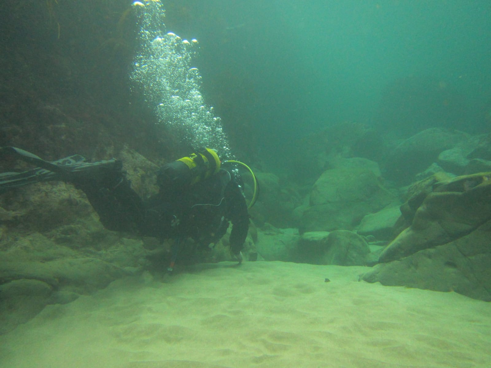
The site has deep pools, gullies, crevasses and a rocky, stony seafloor with patches of sand and some boulders. There are deep pools to the west, which suits beginners.

Biodiversity: A description of the species composition at the site. Species of interest are highlighted. Follow the links for more information about the species on the NBN Atlas Northern Ireland website

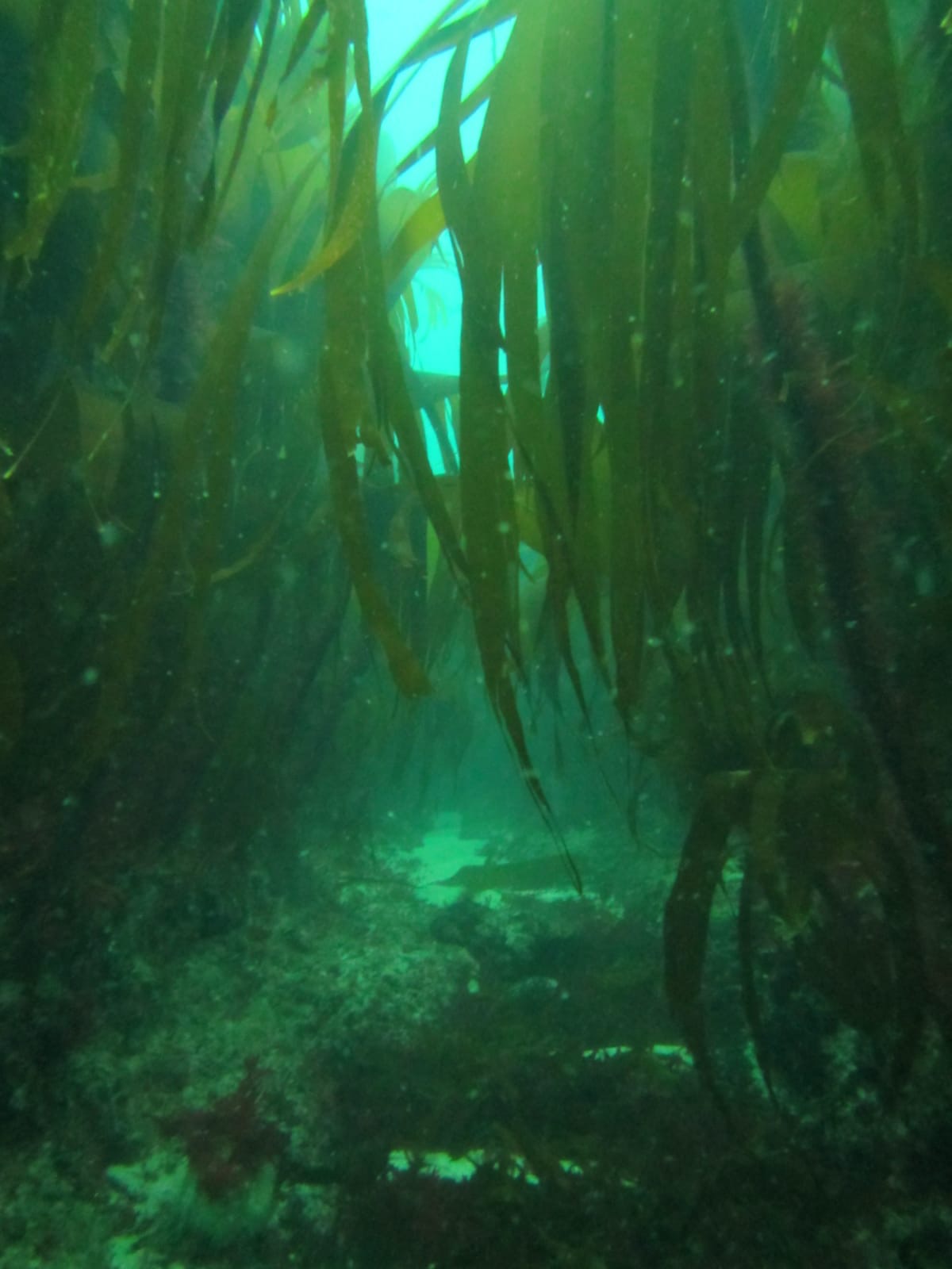
A diverse marine community can be found in the harbour, rich in seaweeds including kelp Laminaria hyperborea and the red algae sea beech Delesseria sanguinea.

View all species records from this site

A link to the dive site location on the NBN Atlas Northern Ireland website, showing all species records from within a 1km boundary of the site centroid. Any new species records from the site submitted to Seasearch, iRecord, CEDaR Online Recording or iNaturalist will appear here
Local Charters: A link to the website for the nearest Dive Centre to the site. A map of all dive centres is provided under ‘Go Diving’

Aquaholics

Environmental and Historical Designations: A list of any environmental or historical designations attributed to the site, or overlapping it. Follow the link for more information

Giant’s Causeway and Dunseverick ASSI

More Information: Links to additional information found online for the dive site

Causeway Coast and Glens Heritage Trust Rockpooling, Snorkeling and Diving Guide

Safety: Safety tips

  • In an emergency call 999 or 112 and ask for the coastguard.
  • Follow VHF radio Channel 16 (156.8 MHz), the international distress frequency.
  • Find nearest defibrillator (AED) here
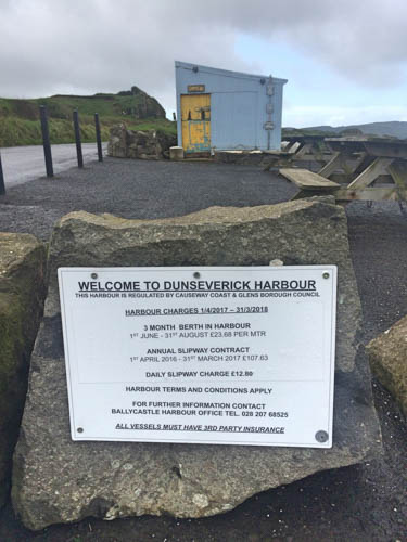
  • Dunseverick/Ballycastle Harbour Office: 028 207 68525 Mobile Number 07803 505084
  • When navigating within Dunseverick Harbour, use VHF Channel 80.
Latitude, Longitude: The approximate XY coordinates for the dive site in Decimel Degrees (DD). These can be converted to DMS or DDM by following the link below
55.237697, -6.429836

Leave a Comment

Dived here recently? Then let other divers know about this site from your experience!

Leave a Reply

Your email address will not be published. Required fields are marked *

This site uses Akismet to reduce spam. Learn how your comment data is processed.

Join our Mailing List