All Dives Dive
Snorkelling Snorkelling

Eisenhower Pier

Bangor

Average score: 0

Site name: Eisenhower Pier
Location: Descriptive location referring to nearest landfall i.e. town, village, harbour or island
Bangor
Type: Describes whether this dive site can be dived from the shore, from a boat, or both
Shore
Wreck: Dive sites which include a shipwreck (or part of a shipwreck) are labelled with a ‘Yes’
No
Min. dive depth (m): The approximate minimum depth of the dive given in metres
2
Max. dive depth (m): The approximate maximum depth of the dive given in metres
7

Max. seabed depth (m): The maximum depth of the seabed at the site taken from the intersect between the dive site point and the depth contour on an Admiralty Standard Nautical Chart
8

Diving experience (min level): The recommended minimum level of diving experience for a specific site, described as Novice (<50 dives in temperate/cold waters and minimum certification of PADI Open/Advanced Open Water, BSAC Ocean Diver or CMAS 1 star), Intermediate (50-100 dives in temperate/cold waters and minimum certification of PADI Rescue Dive, BSAC Sports Dive or CMAS 2 star) or Advanced (>250 dives in temperate/cold waters and minimum certification of PADI Divemaster, BSAC Dive Leader or CMAS 3 star
Novice

Optimal wind direction: The general wind direction which causes minimal exposure at the site, corresponding to 8 points of the compass: North (N), North East (NE), East (E, South East (SE), South (S), South West (SW), West, North West (NW)
SE/S/SW/W

Exposure: The approximate level of exposure to wind and wave action at the site on any given day, described as Sheltered (inshore sites surrounded by a form of shelter on all sides), Moderate (sites which are partially sheltered) or Exposed (sites with little to no shelter)
Moderate

Tidal strength: Anecdotal description of tidal strength at the site
Weak

Marine Protected Area: A Yes or No highlighting whether or not the site occurs within a Marine Protected Area
Yes

Visibility: Anecdotal description of the typical underwater visibility at the site
~4 metres
Best time to dive: Anecdotal recommendation for the best time to dive the site for optimal underwater conditions. This typically relates to the stage of the tide
HW Belfast
Getting There: Directions for getting to the site

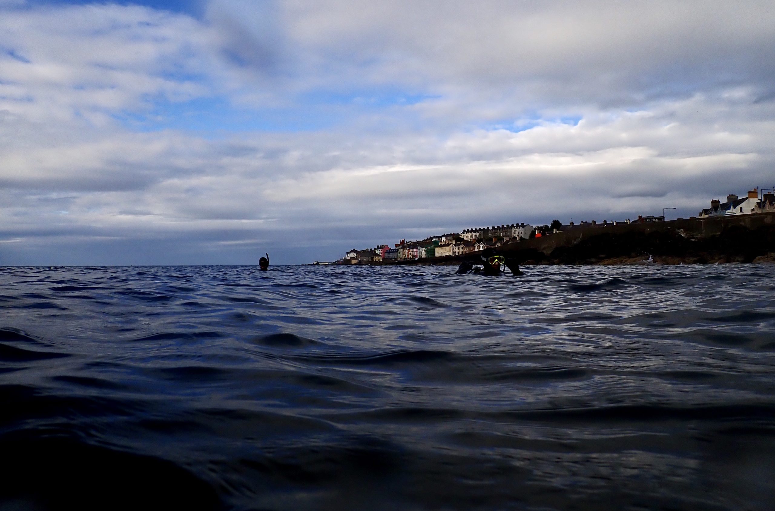
Head through Bangor town centre and park in Quay Street Car Park adjacent to the Bangor RNLI Station. Access from the car park is via a short walk to the north side of the pier/RNLI Station. Follow the steps down to an area of cobbles and pebbles for an easy entry. Head out in a NW direction following the pier.

Facilities: Details of nearest facilities to dive site i.e. public car parking and toilets, slipways etc

Free car parking at Quay Street Car Park. Public toilets are available near the marina area.

Nearest tank filling is DV Diving, Newtownards.

Hazards: Anecdotal information on possible hazards at the site for divers and snorkellers

  • Boat traffic from Bangor Marina.
  • Lobster pots at site.
  • Minor slip hazard from entry over cobbles.
  • Popular for shore fishing so beware of entanglement.
Description: A general description of the physical features of the dive site

Shallow shore dive from about 2m to 7m. Head out in a NW direction following the pier. There are areas of sand on the right and weedy rocky crevices to explore to the left. Bear SE to return.

Biodiversity: A description of the species composition at the site. Species of interest are highlighted. Follow the links for more information about the species on the NBN Atlas Northern Ireland website

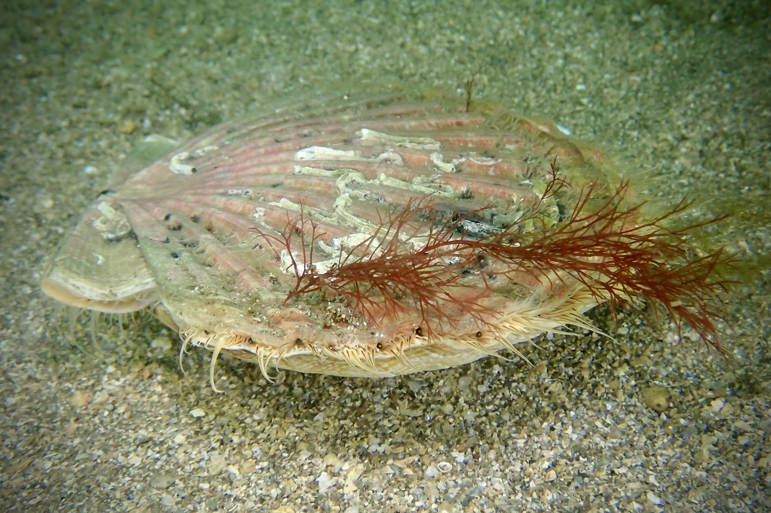
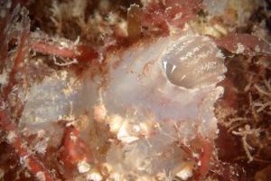
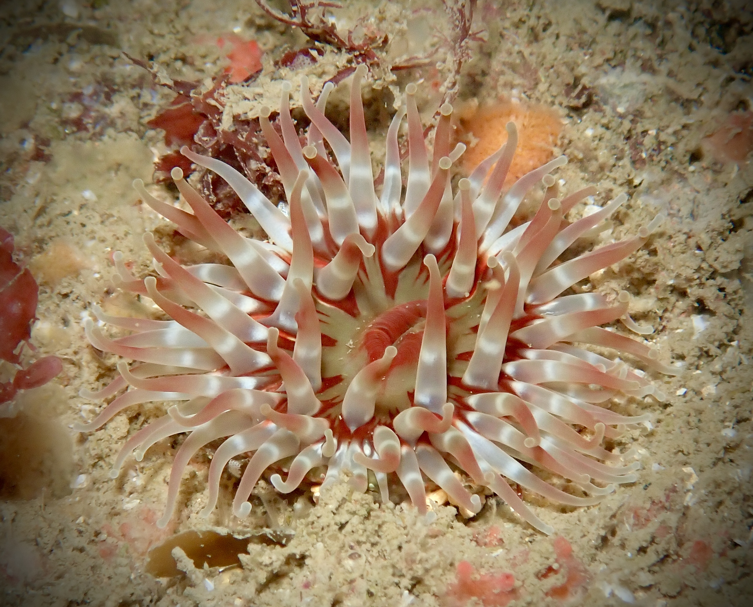
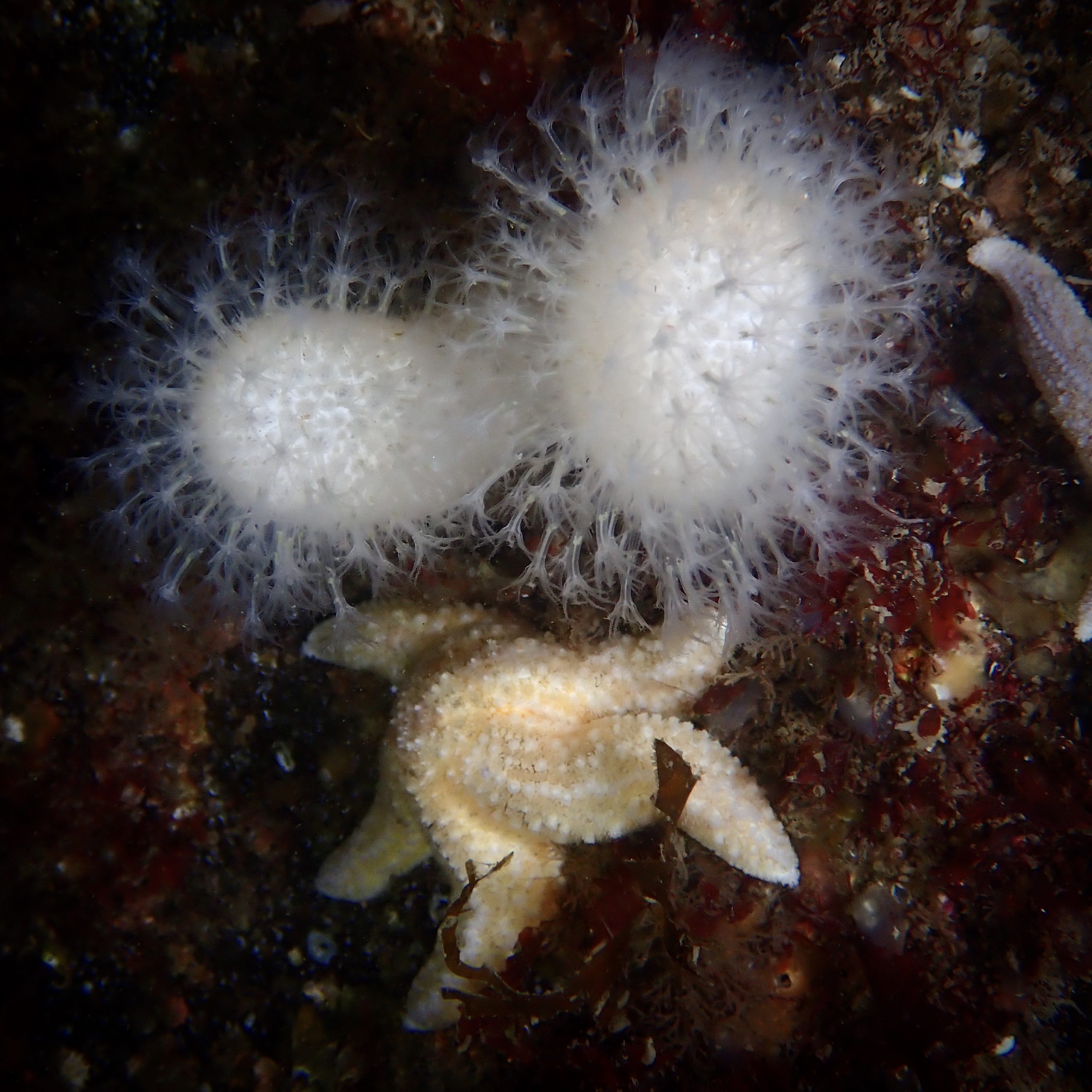
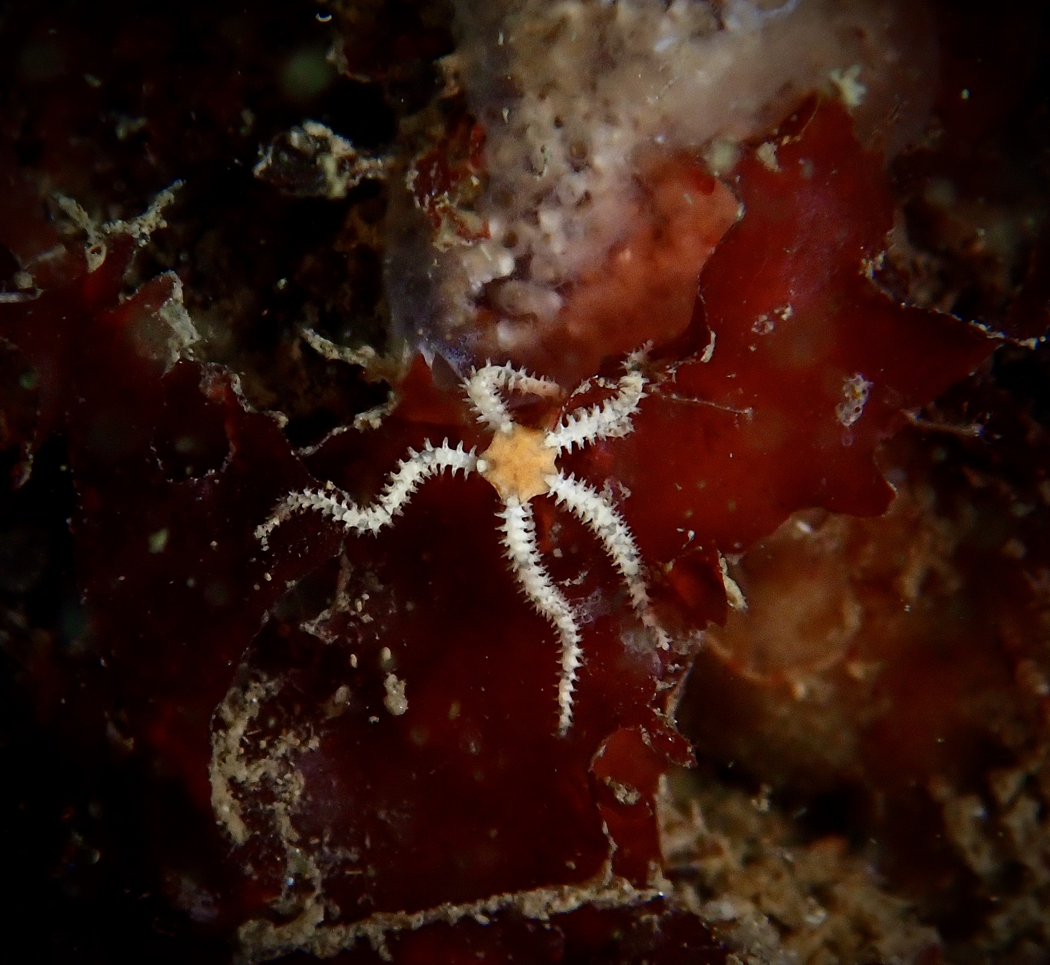
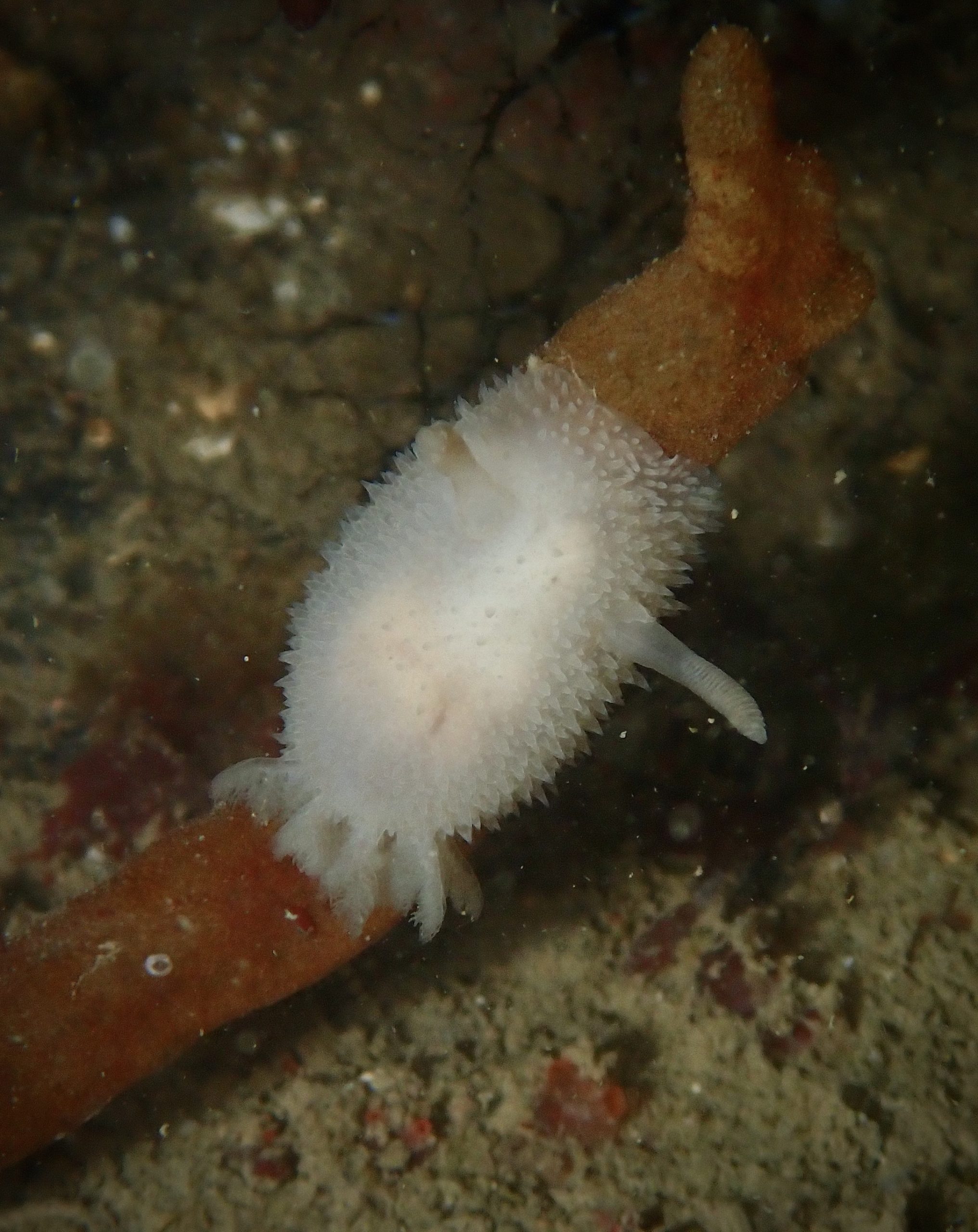
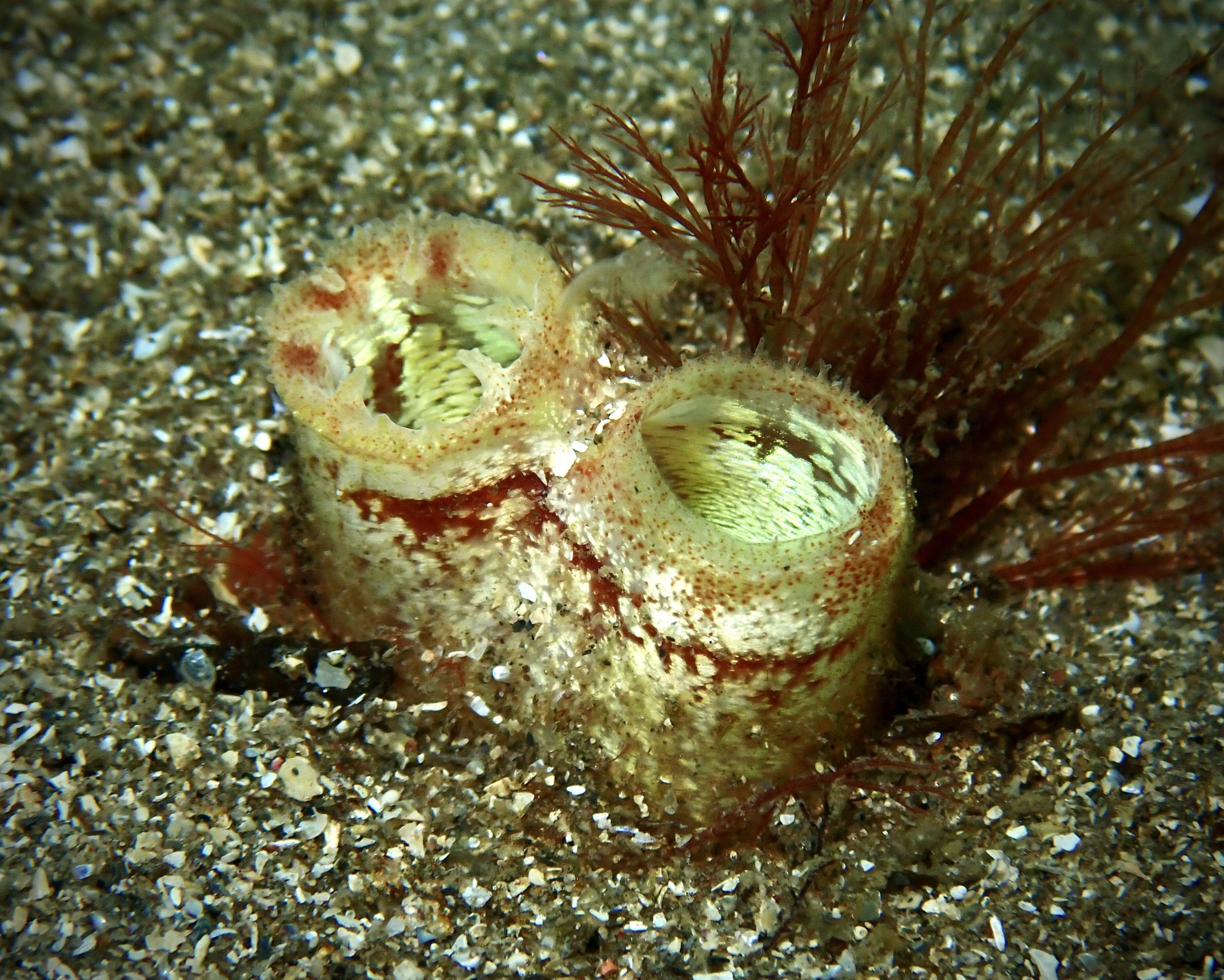
Crabs and sand eels are found on the sandy area off the pier. Wrasse, prawns, sea squirts, starfish and anemones are found on the rocky crevices immediately beneath the pier.

View all species records from this site

A link to the dive site location on the NBN Atlas Northern Ireland website, showing all species records from within a 1km boundary of the site centroid. Any new species records from the site submitted to Seasearch, iRecord, CEDaR Online Recording or iNaturalist will appear here
Local Charters: A link to the website for the nearest Dive Centre to the site. A map of all dive centres is provided under ‘Go Diving’

DV Diving

Environmental and Historical Designations: A list of any environmental or historical designations attributed to the site, or overlapping it. Follow the link for more information

Outer Ards ASSI
East Coast Marine Proposed SPA

More Information: Links to additional information found online for the dive site

Northern Ireland Marine MapViewer

Safety: Safety tips

  • In an emergency call 999 or 112 and ask for the coastguard.
  • Follow VHF radio Channel 16 (156.8 MHz), the international distress frequency. Send a distress alert followed by ‘MAYDAY, MAYDAY, MAYDAY’ and ‘This is [boat name]’.
  • Find nearest defibrillator (AED) here.
  • Bangor Harbour Master: 028 9145 3297.
  • When navigating within the harbour/marina, use VHF Channel 11.
Latitude, Longitude: The approximate XY coordinates for the dive site in Decimel Degrees (DD). These can be converted to DMS or DDM by following the link below
54.666030, -5.667764

Leave a Comment

Dived here recently? Then let other divers know about this site from your experience!

Leave a Reply

Your email address will not be published. Required fields are marked *

This site uses Akismet to reduce spam. Learn how your comment data is processed.

Join our Mailing List