Location:Descriptive location referring to nearest landfall i.e. town, village, harbour or island
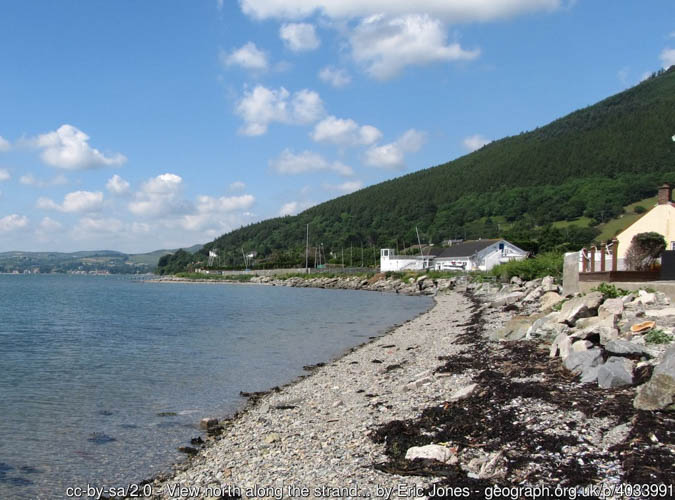
Cranfield
Type:Describes whether this dive site can be dived from the shore, from a boat, or both
Boat
Wreck:Dive sites which include a shipwreck (or part of a shipwreck) are labelled with a ‘Yes’
Yes
Min. dive depth (m):The approximate minimum depth of the dive given in metres
3
Max. dive depth (m):The approximate maximum depth of the dive given in metres
10
Max. seabed depth (m):The maximum depth of the seabed at the site taken from the intersect between the dive site point and the depth contour on an Admiralty Standard Nautical Chart
10
Diving experience (min level):The recommended minimum level of diving experience for a specific site, described as Novice (<50 dives in temperate/cold waters and minimum certification of PADI Open/Advanced Open Water, BSAC Ocean Diver or CMAS 1 star), Intermediate (50-100 dives in temperate/cold waters and minimum certification of PADI Rescue Dive, BSAC Sports Dive or CMAS 2 star) or Advanced (>250 dives in temperate/cold waters and minimum certification of PADI Divemaster, BSAC Dive Leader or CMAS 3 star
Intermediate
Optimal wind direction:The general wind direction which causes minimal exposure at the site, corresponding to 8 points of the compass: North (N), North East (NE), East (E, South East (SE), South (S), South West (SW), West, North West (NW)
W/N
Exposure:The approximate level of exposure to wind and wave action at the site on any given day, described as Sheltered (inshore sites surrounded by a form of shelter on all sides), Moderate (sites which are partially sheltered) or Exposed (sites with little to no shelter)
Exposed
Tidal strength:Anecdotal description of tidal strength at the site
Strong
Marine Protected Area:A Yes or No highlighting whether or not the site occurs within a Marine Protected Area
Yes
Visibility:Anecdotal description of the typical underwater visibility at the site
Best time to dive:Anecdotal recommendation for the best time to dive the site for optimal underwater conditions. This typically relates to the stage of the tide
Slack water
Getting there:Directions for getting to the site
By boat from Carlingford or Greenore. The site is approx. 2km SE of Cranfield Point.
Facilities:Details of nearest facilities to dive site i.e. public car parking and toilets, slipways etc
Carlingford Marina provides facilities including a slip, pontoons and toilets (visit: https://www.carlingfordmarina.com/). Public toilets are also available near to the western pier in Carlingford.
Small boats can be launched from the shore at Greenore. Free car parking is available above the launch site: https://goo.gl/maps/Xv6PPocjis3ftBMP9 The nearest public toilets are in Carlingford village.
Hazards:Anecdotal information on possible hazards at the site for divers and snorkellers
Deteriorating metal and sharp edges on the wreck
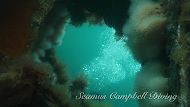
Description:A general description of the physical features of the dive site
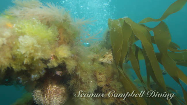
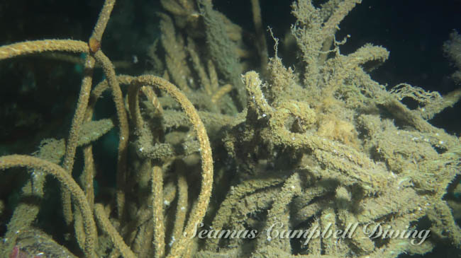
The wreck lies on a mixed sediment seabed, largely intact in an upright position with some signs of deterioration.
History:The history of the wreck provided by the Senior Marine Archaeologist from the Department for Communities Historic Environment Division (only included for wreck sites)
Date of loss 14/01/1942. Larne steamer (338 tonnes) containing general cargo and bagged flour, heading from Belfast to Newry. Stranded and wrecked at the entrance to the lough (IrishWrecksOnline.net).
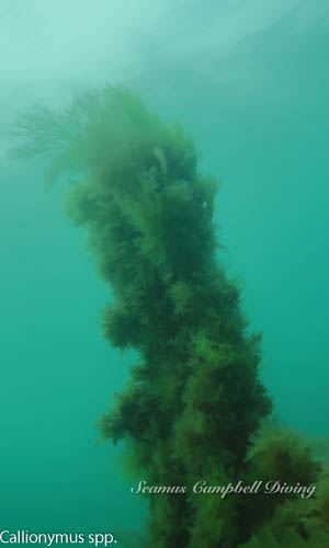
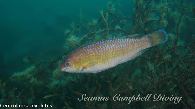
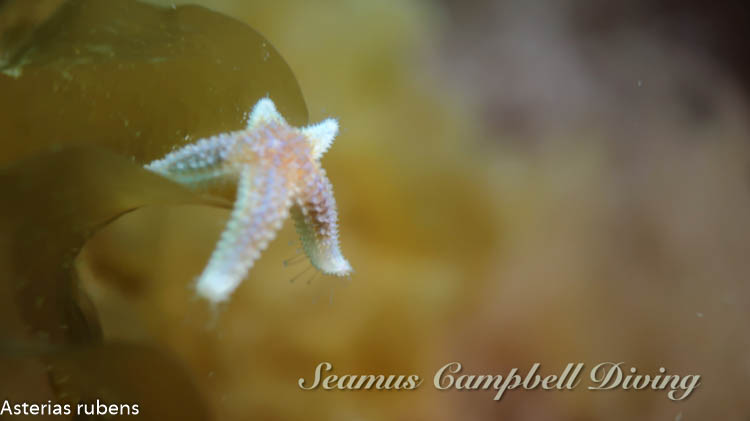
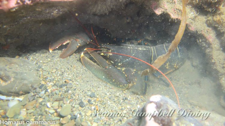
Biodiversity:A description of the species composition at the site. Species of interest are highlighted. Follow the links for more information about the species on the NBN Atlas Northern Ireland website
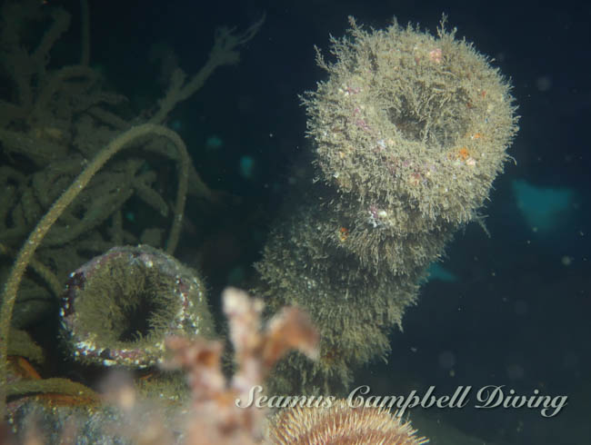
The wreck has been described as an ‘overgrown underwater garden’ as its covered in tall seaweeds, sea urchins, dead men’s fingers and bryozoans. The rare Risso’s crab Xantho pilipes has been recorded at this site.
A link to the dive site location on the NBN Atlas Northern Ireland website, showing all species records from within a 1km boundary of the site centroid. Any new species records from the site submitted to Seasearch, iRecord, CEDaR Online Recording or iNaturalist will appear here
Local charters:A link to the website for the nearest Dive Centre to the site. A map of all dive centres is provided under ‘Go Diving’
Environmental and Historical Designations:A list of any environmental or historical designations attributed to the site, or overlapping it. Follow the link for more information
In an emergency call 999 or 112 and ask for the coastguard.
Follow VHF radio Channel 16 (156.8 MHz), the international distress frequency. Send a distress alert followed by ‘MAYDAY, MAYDAY, MAYDAY’ and ‘This is [boat name]’.
When navigating within the harbour/marina, use VHF Channel 12/16.
Latitude, Longitude:The approximate XY coordinates for the dive site in Decimel Degrees (DD). These can be converted to DMS or DDM by following the link below


Leave a Comment
Dived here recently? Then let other divers know about this site from your experience!