All Dives Dive
Snorkelling Snorkelling

Glenarm Bay Seagrass

Glenarm

Average score: 0

Site name: Glenarm Bay Seagrass
Location: Descriptive location referring to nearest landfall i.e. town, village, harbour or island
Glenarm
Type: Describes whether this dive site can be dived from the shore, from a boat, or both
Shore
Wreck: Dive sites which include a shipwreck (or part of a shipwreck) are labelled with a ‘Yes’
No
Min. dive depth (m): The approximate minimum depth of the dive given in metres
Max. dive depth (m): The approximate maximum depth of the dive given in metres
5

Max. seabed depth (m): The maximum depth of the seabed at the site taken from the intersect between the dive site point and the depth contour on an Admiralty Standard Nautical Chart
9

Diving experience (min level): The recommended minimum level of diving experience for a specific site, described as Novice (<50 dives in temperate/cold waters and minimum certification of PADI Open/Advanced Open Water, BSAC Ocean Diver or CMAS 1 star), Intermediate (50-100 dives in temperate/cold waters and minimum certification of PADI Rescue Dive, BSAC Sports Dive or CMAS 2 star) or Advanced (>250 dives in temperate/cold waters and minimum certification of PADI Divemaster, BSAC Dive Leader or CMAS 3 star
Novice

Optimal wind direction: The general wind direction which causes minimal exposure at the site, corresponding to 8 points of the compass: North (N), North East (NE), East (E, South East (SE), South (S), South West (SW), West, North West (NW)
S/SW/W/NW

Exposure: The approximate level of exposure to wind and wave action at the site on any given day, described as Sheltered (inshore sites surrounded by a form of shelter on all sides), Moderate (sites which are partially sheltered) or Exposed (sites with little to no shelter)
Moderate

Tidal strength: Anecdotal description of tidal strength at the site

Marine Protected Area: A Yes or No highlighting whether or not the site occurs within a Marine Protected Area
No

Visibility: Anecdotal description of the typical underwater visibility at the site
~6m
Best time to dive: Anecdotal recommendation for the best time to dive the site for optimal underwater conditions. This typically relates to the stage of the tide
Getting There: Directions for getting to the site

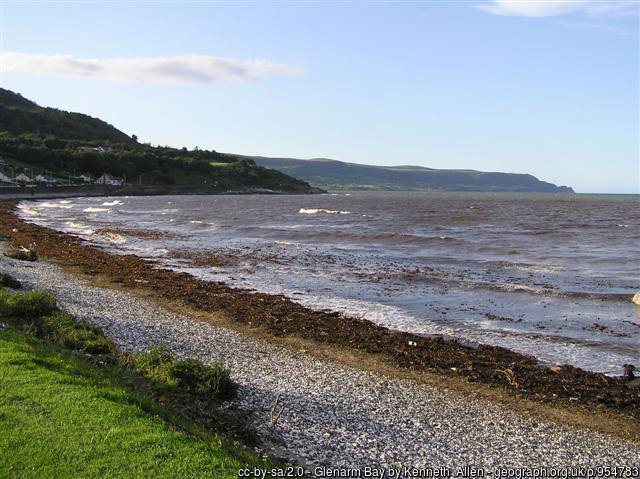
Park at Glenarm Car Park and access the beach on foot. The seagrass bed is found ~50 metres off the shore from 5-9 metres depth.

Facilities: Details of nearest facilities to dive site i.e. public car parking and toilets, slipways etc

Public toilets available in the town near the main car park on the Cloney road. Glenarm pier is 25m long, 5.9m wide and leads into deep water (4m at low tide). The marina has pontoons.

Hazards: Anecdotal information on possible hazards at the site for divers and snorkellers

  • Recreational boat traffic and moorings nearby. The site is quite exposed to the east and there can be litter in the bay.
Description: A general description of the physical features of the dive site

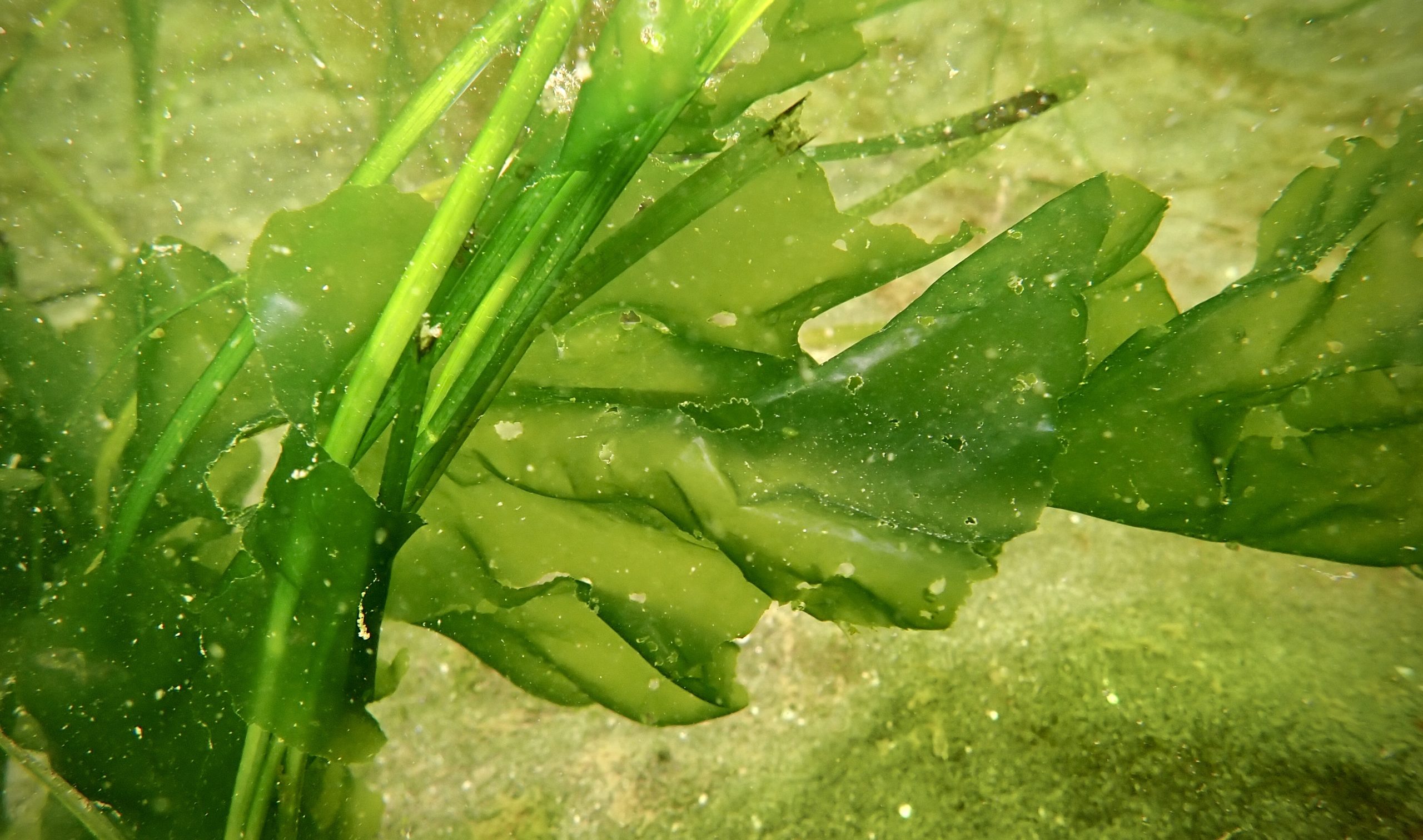
This site is great for both diving and snorkelling. There are two entry options, either to the south of the beach (for the seagrass bed) or to the north of the beach. The seabed at the southern end of the beach is made up of gently sloping fine sand with areas of seagrass bed about 100m off the shoreline. At the north end of the beach, there are rocky outcrops with dense kelp.

Biodiversity: A description of the species composition at the site. Species of interest are highlighted. Follow the links for more information about the species on the NBN Atlas Northern Ireland website

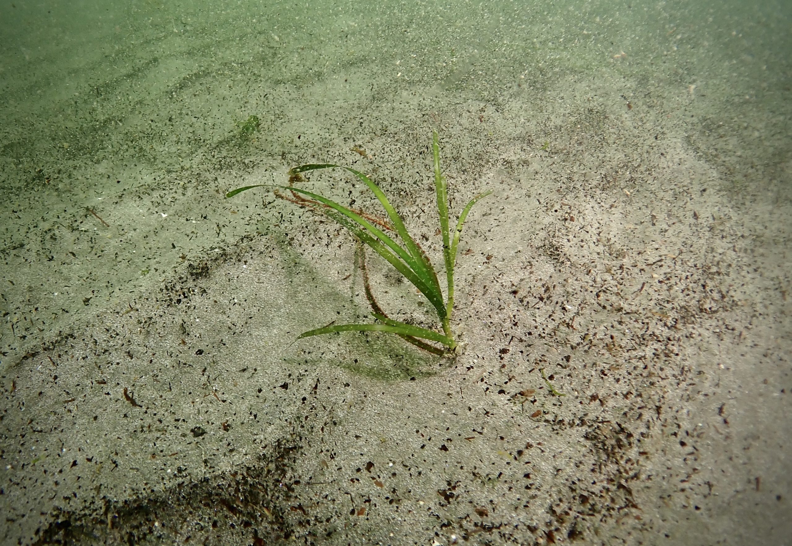
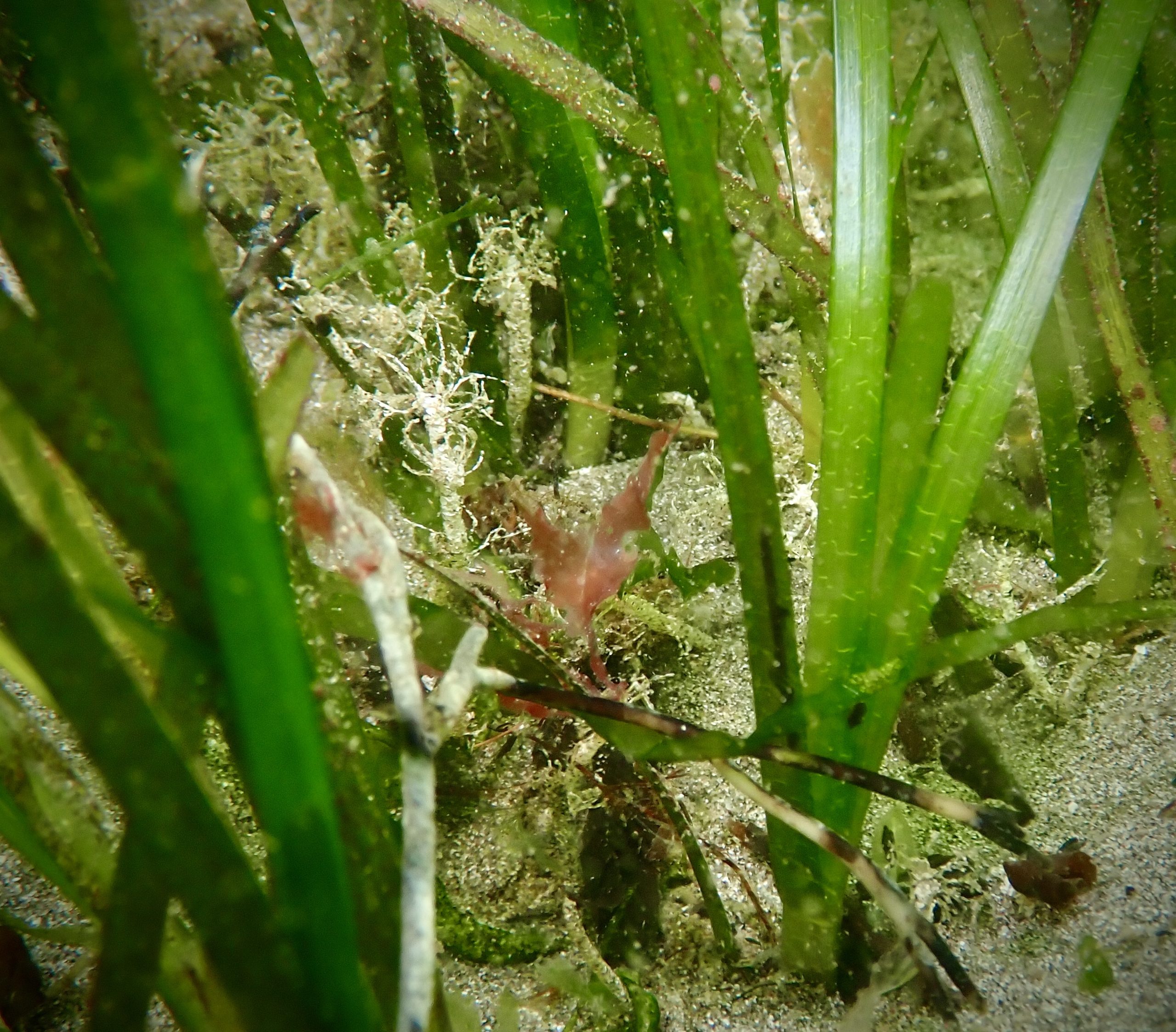
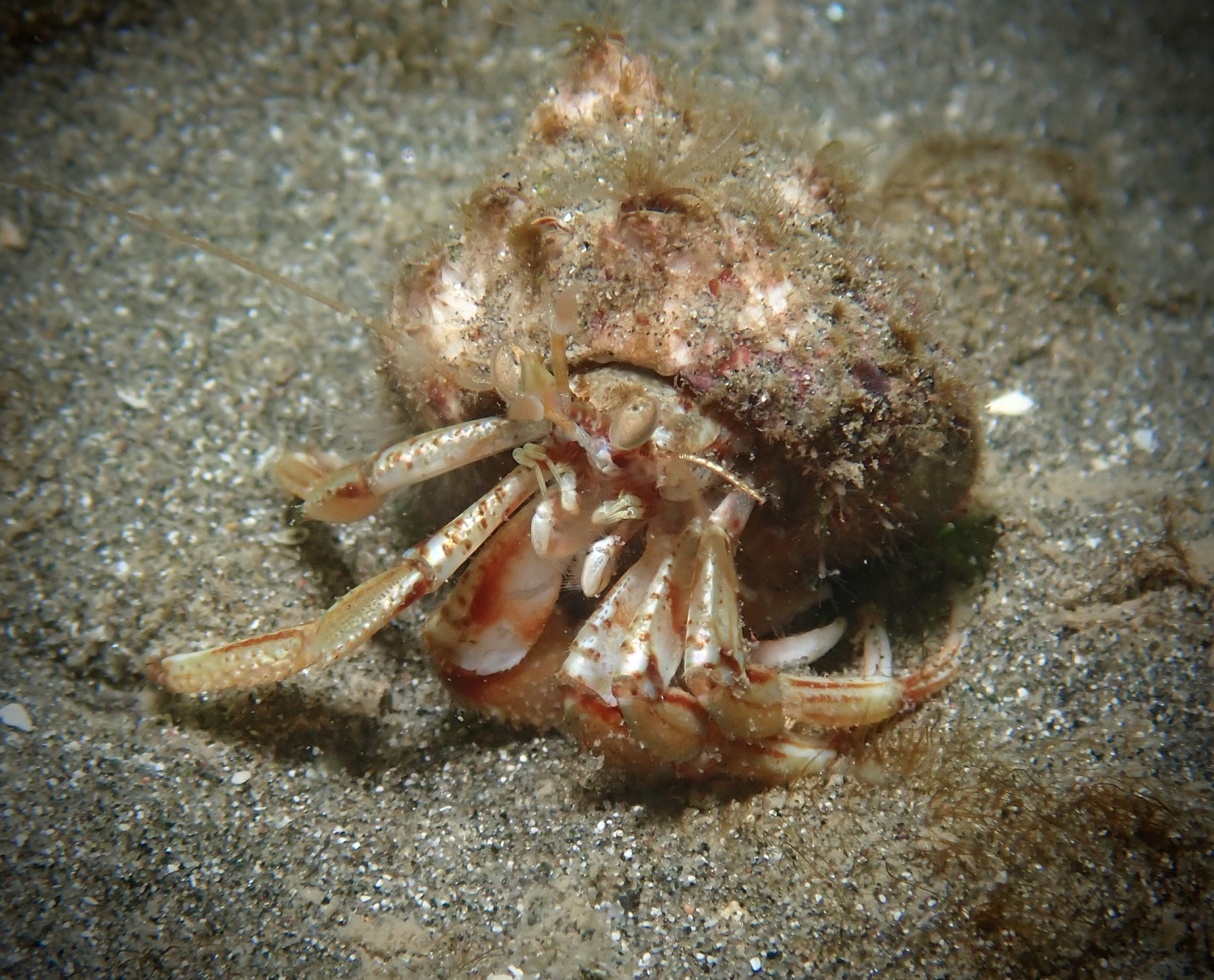
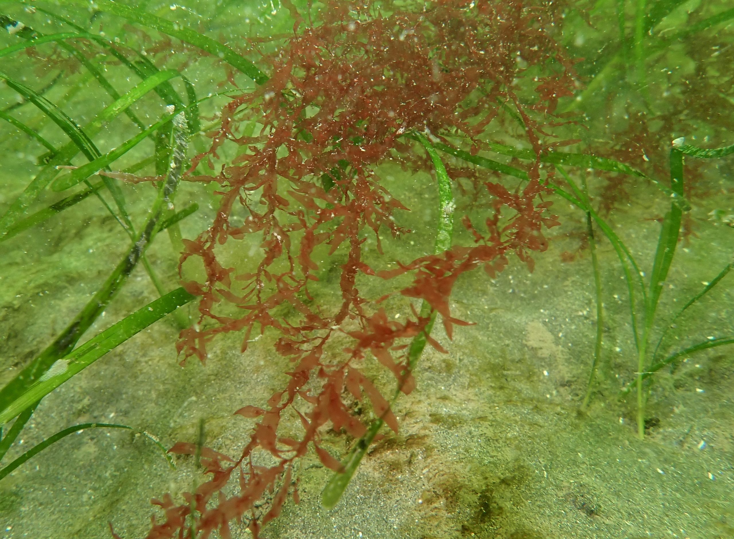
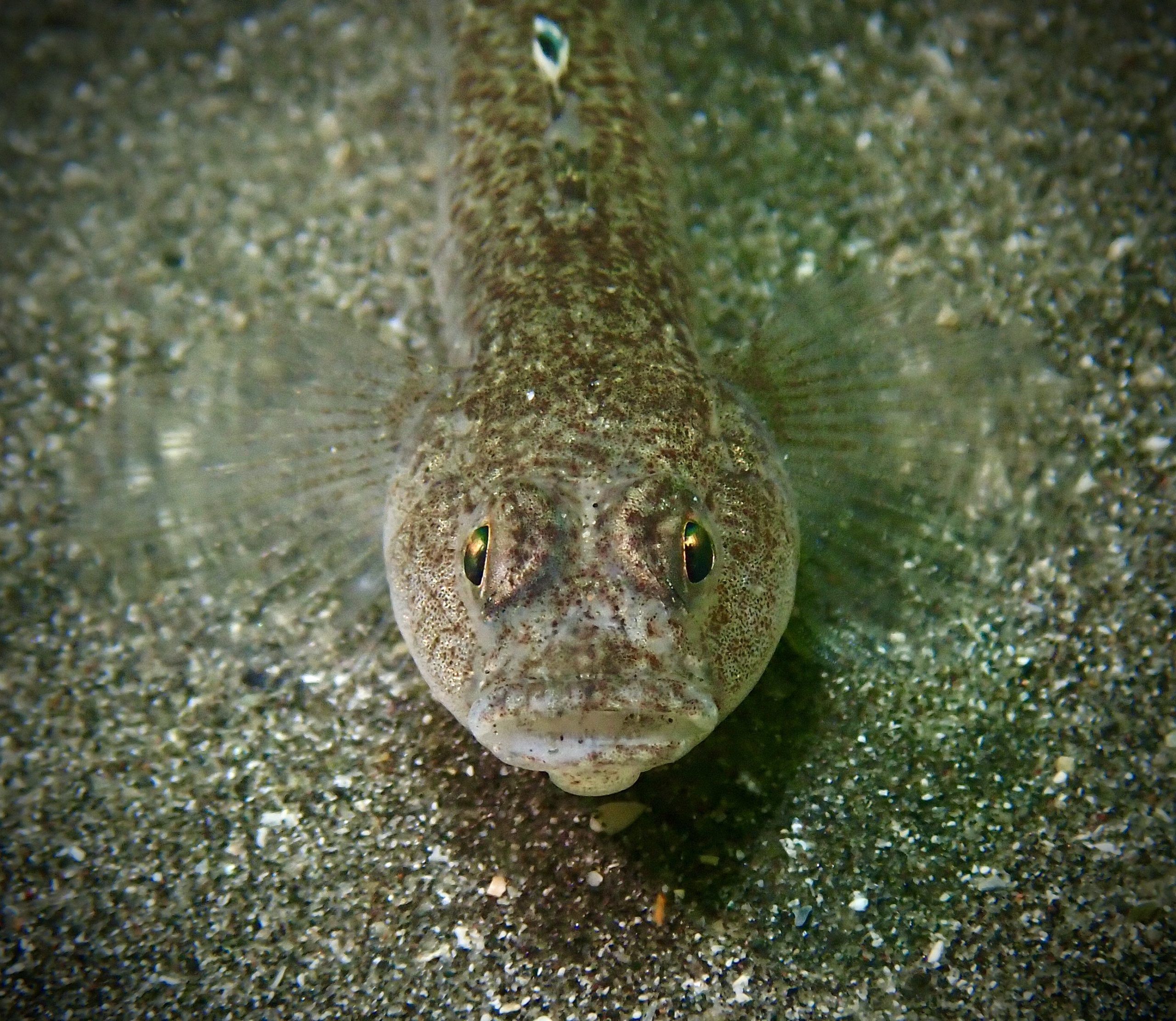
The shallow sandy seabed supports a bed of seagrass Zostera marina. Seagrass beds are listed as a priority habitat in Northern Ireland due to the important role they play in carbon sequestration, sediment stabilisation and provision of nursery grounds for many marine species. Look out for juvenile fish, spider crabs and stalked jellyfish. At the northern end of the beach, the rocky outcrops are covered in kelp, while a variety of fish, bobtail squid and crabs may be seen on the sandy seabed below.

View all species records from this site

A link to the dive site location on the NBN Atlas Northern Ireland website, showing all species records from within a 1km boundary of the site centroid. Any new species records from the site submitted to Seasearch, iRecord, CEDaR Online Recording or iNaturalist will appear here
Local Charters: A link to the website for the nearest Dive Centre to the site. A map of all dive centres is provided under ‘Go Diving’

Aquaholics

Environmental and Historical Designations: A list of any environmental or historical designations attributed to the site, or overlapping it. Follow the link for more information

More Information: Links to additional information found online for the dive site

Eoceanic -Glenarm Bay and Harbour

Northern Ireland Marine MapViewer

Safety: Safety tips

  • In an emergency call 999 or 112 and ask for the coastguard.
  • Follow VHF radio Channel 16 (156.8 MHz), the international distress frequency.
  • Find nearest defibrillator (AED) here
Latitude, Longitude: The approximate XY coordinates for the dive site in Decimel Degrees (DD). These can be converted to DMS or DDM by following the link below
54.969490, -5.955060

Leave a Comment

Dived here recently? Then let other divers know about this site from your experience!

One thought on “Glenarm Bay Seagrass

Leave a Reply

Your email address will not be published. Required fields are marked *

This site uses Akismet to reduce spam. Learn how your comment data is processed.

  1. Phil Wilkinson says:

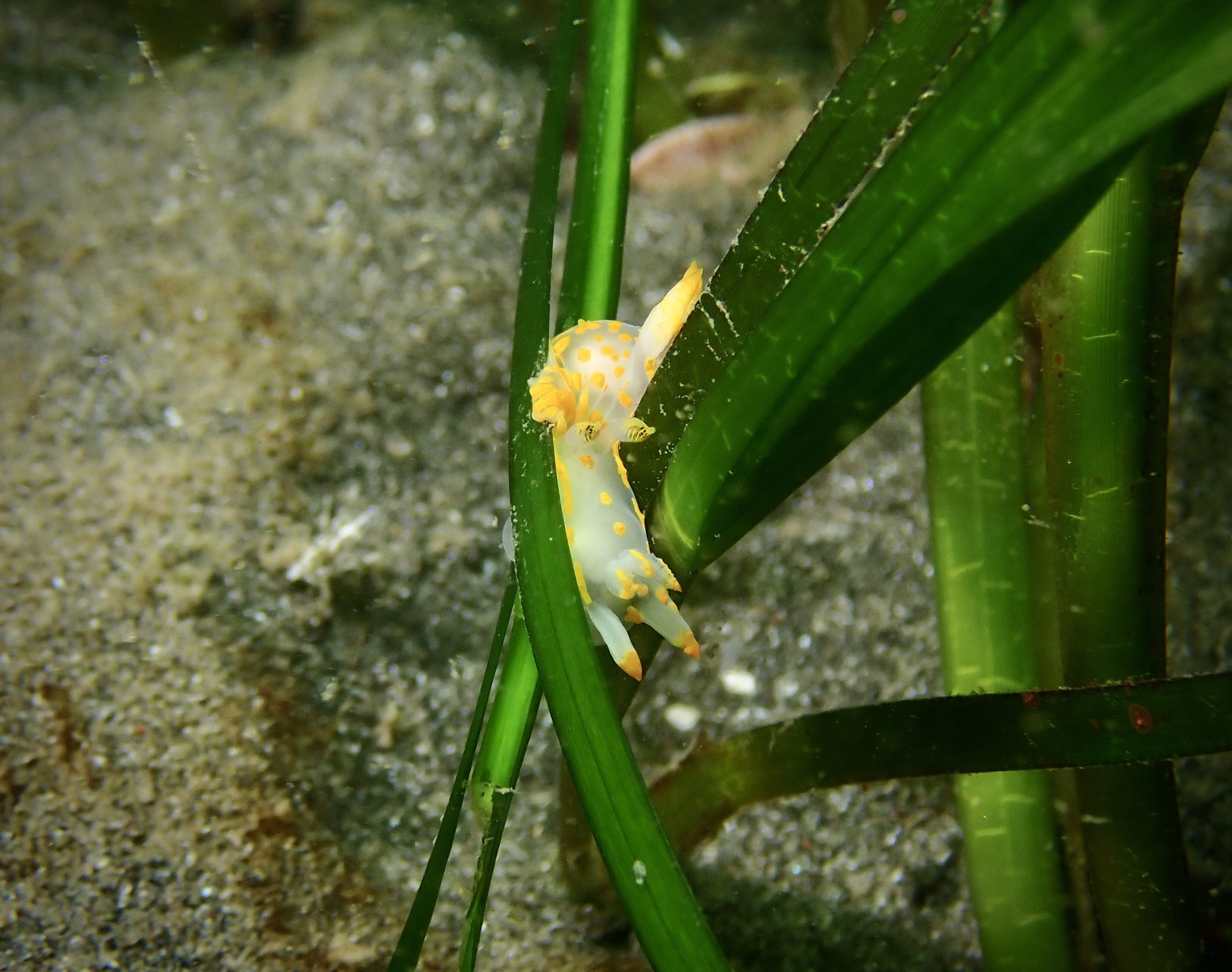
    Despite the surge and 2m vis, we had a lovely dive here on Sunday 5th July. Lots of critters hiding in the seagrass!

Join our Mailing List