All Dives Dive
Snorkelling Snorkelling

Groomsport Beach West

Groomsport

Average score: 0

Site name: Groomsport Beach West
Location: Descriptive location referring to nearest landfall i.e. town, village, harbour or island
Groomsport
Type: Describes whether this dive site can be dived from the shore, from a boat, or both
Shore
Wreck: Dive sites which include a shipwreck (or part of a shipwreck) are labelled with a ‘Yes’
No
Min. dive depth (m): The approximate minimum depth of the dive given in metres
2
Max. dive depth (m): The approximate maximum depth of the dive given in metres
6

Max. seabed depth (m): The maximum depth of the seabed at the site taken from the intersect between the dive site point and the depth contour on an Admiralty Standard Nautical Chart
8

Diving experience (min level): The recommended minimum level of diving experience for a specific site, described as Novice (<50 dives in temperate/cold waters and minimum certification of PADI Open/Advanced Open Water, BSAC Ocean Diver or CMAS 1 star), Intermediate (50-100 dives in temperate/cold waters and minimum certification of PADI Rescue Dive, BSAC Sports Dive or CMAS 2 star) or Advanced (>250 dives in temperate/cold waters and minimum certification of PADI Divemaster, BSAC Dive Leader or CMAS 3 star
Novice

Optimal wind direction: The general wind direction which causes minimal exposure at the site, corresponding to 8 points of the compass: North (N), North East (NE), East (E, South East (SE), South (S), South West (SW), West, North West (NW)
SE/S/SW/W

Exposure: The approximate level of exposure to wind and wave action at the site on any given day, described as Sheltered (inshore sites surrounded by a form of shelter on all sides), Moderate (sites which are partially sheltered) or Exposed (sites with little to no shelter)
Moderate

Tidal strength: Anecdotal description of tidal strength at the site
Very weak slightly lateral currents but subject to surge

Marine Protected Area: A Yes or No highlighting whether or not the site occurs within a Marine Protected Area
Yes

Visibility: Anecdotal description of the typical underwater visibility at the site
Best time to dive: Anecdotal recommendation for the best time to dive the site for optimal underwater conditions. This typically relates to the stage of the tide
Anytime, but best just before high water Bangor for best visibility and easier entry and exit.
Getting There: Directions for getting to the site

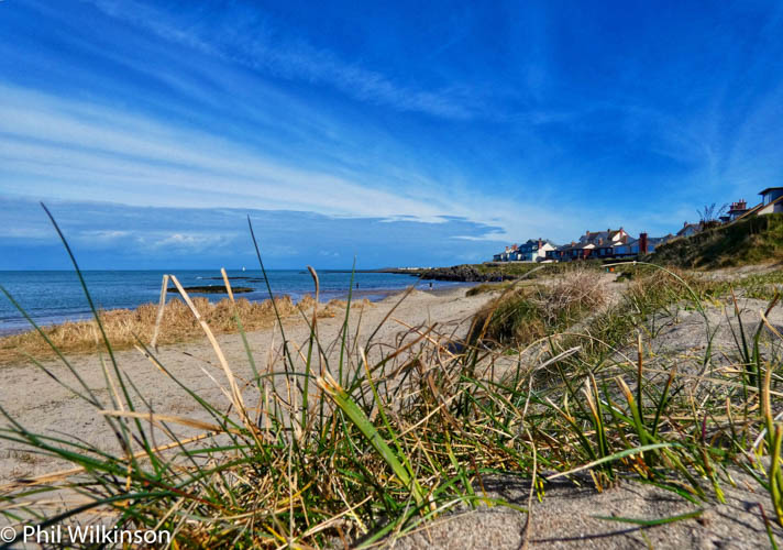
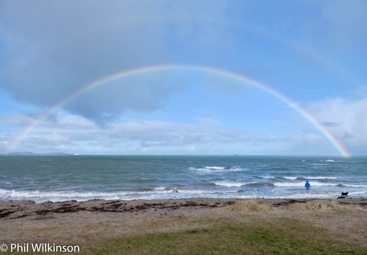
By car. Off the A2 Donaghadee Road, take the exit for B511 Donaghadee Road (signed Groomsport). Turn right onto Harbour Road and park in the car park overlooking the harbour to the west and beach to the east. Access the shore on foot via the footpath (approx. 50m). The site is  short and easy stroll out in a northerly direction from the beach

Facilities: Details of nearest facilities to dive site i.e. public car parking and toilets, slipways etc

There are public toilets available near Main Street

Hazards: Anecdotal information on possible hazards at the site for divers and snorkellers

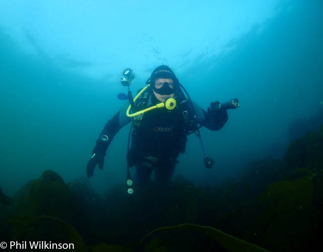
  • The main hazard is the shallow depth coupled with relatively high boat traffic. It is advisable to deploy a SMB for the duration.
  • An unlikely but possible hazard is entanglement from fishing line.
Description: A general description of the physical features of the dive site

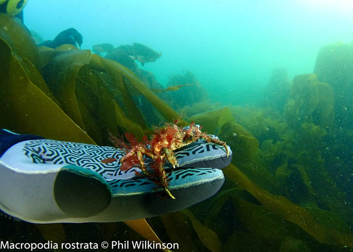
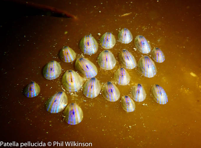
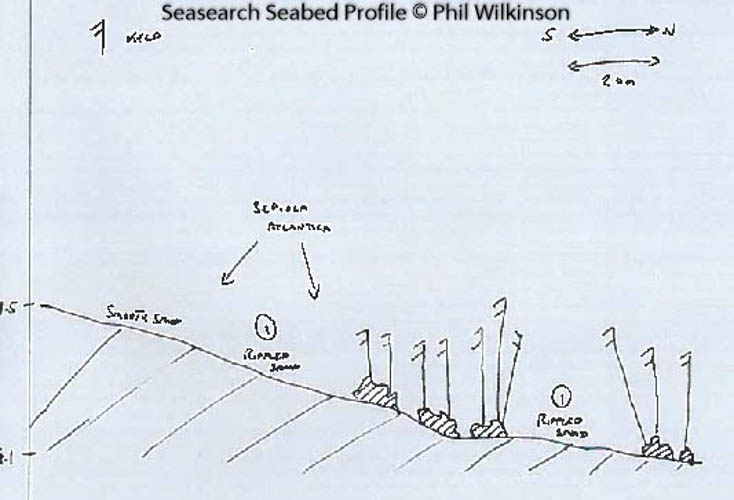
The site is a sandy seabed with areas of rock covered in mixed seaweed, including kelp (similar to the dive site at Groomsport Beach East).

Biodiversity: A description of the species composition at the site. Species of interest are highlighted. Follow the links for more information about the species on the NBN Atlas Northern Ireland website

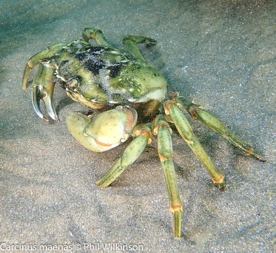
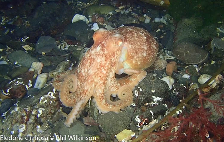
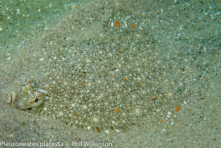
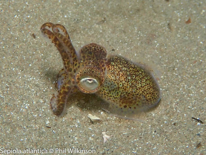
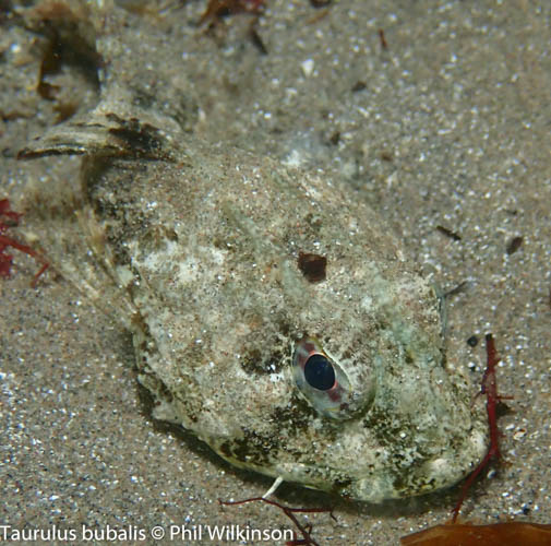
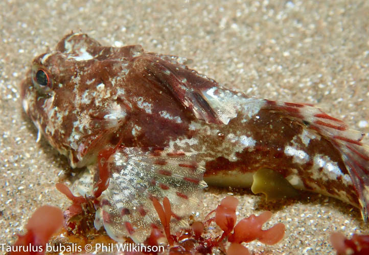
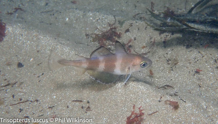
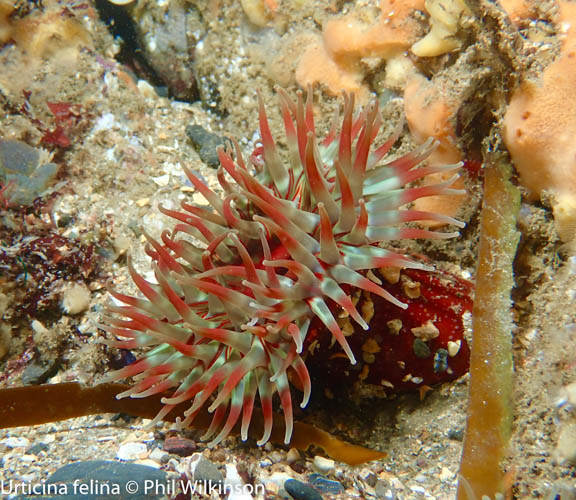
Various crustacean and anemone species, including the dahlia anemone Urticina felina, are common here. A variety of fish can be seen, such as wrasse and gobies. Keep an eye out for the unusual and slightly grotesque lumpsucker Cyclopterus lumpus which was filmed by Phil Wilkinson at this site recently. Bobtail squid Sepiola atlantica and octopus are often sighted here as well.

View all species records from this site

A link to the dive site location on the NBN Atlas Northern Ireland website, showing all species records from within a 1km boundary of the site centroid. Any new species records from the site submitted to Seasearch, iRecord, CEDaR Online Recording or iNaturalist will appear here
Local Charters: A link to the website for the nearest Dive Centre to the site. A map of all dive centres is provided under ‘Go Diving’

DV Diving

Environmental and Historical Designations: A list of any environmental or historical designations attributed to the site, or overlapping it. Follow the link for more information

Outer Ards SPA

Outer Ards RAMSAR

More Information: Links to additional information found online for the dive site

Northern Ireland Marine MapViewer

Safety: Safety tips

  • In an emergency call 999 or 112 and ask for the coastguard.
  • Follow VHF radio Channel 16 (156.8 MHz), the international distress frequency.
  • Find nearest defibrillator (AED) here
  • Groomsport Harbour Master: 028 9188 2377
Latitude, Longitude: The approximate XY coordinates for the dive site in Decimel Degrees (DD). These can be converted to DMS or DDM by following the link below
54.67617, -5.615147

Leave a Comment

Dived here recently? Then let other divers know about this site from your experience!

One thought on “Groomsport Beach West

Leave a Reply

Your email address will not be published. Required fields are marked *

This site uses Akismet to reduce spam. Learn how your comment data is processed.

  1. Phil Wilkinson says:

    Lovely night dive on 1st September. Great vis, lots to see and warm(ish) ?

Join our Mailing List