
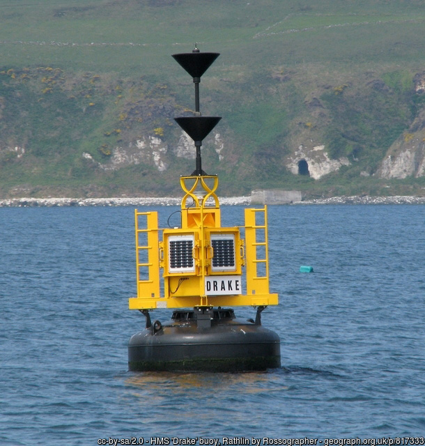
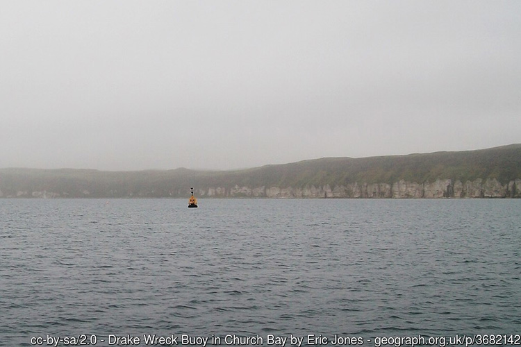
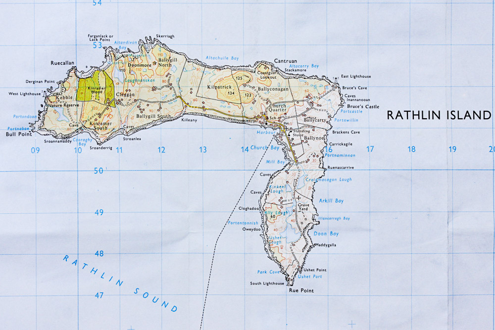
By boat from Rathlin or Ballycastle Harbour. The site is approximately 500m south-west of Church Bay and is marked with a large yellow marker buoy.
Rathlin Harbour has pontoons for around 40 boats. Water and electricity are available on the pontoon but there is no reliable source of fuel. Public toilets are available in Church Bay between the harbour and the pub, near the playground.
Ballycastle Harbour has a gated slipway (open during office hours) and pontoon berthing. Free car parking is available above the harbour and marina. Free public toilets are available in the visitor information office above the harbour.
Berthing fees apply for both Rathlin and Ballycastle Harbour Office; for use of either, contact the Ballycastle Harbour Office: 02820768525 / 07803505984.
Nearest tank filling is Aquaholics in Ballycastle or Portstewart (ring ahead: 028 7083 2584)
- Ammunition may still be lying around!
- The wreck is well broken up into large metal plates, therefore be mindful of sharp edges.
- Boat traffic between Ballycastle and Rathlin.
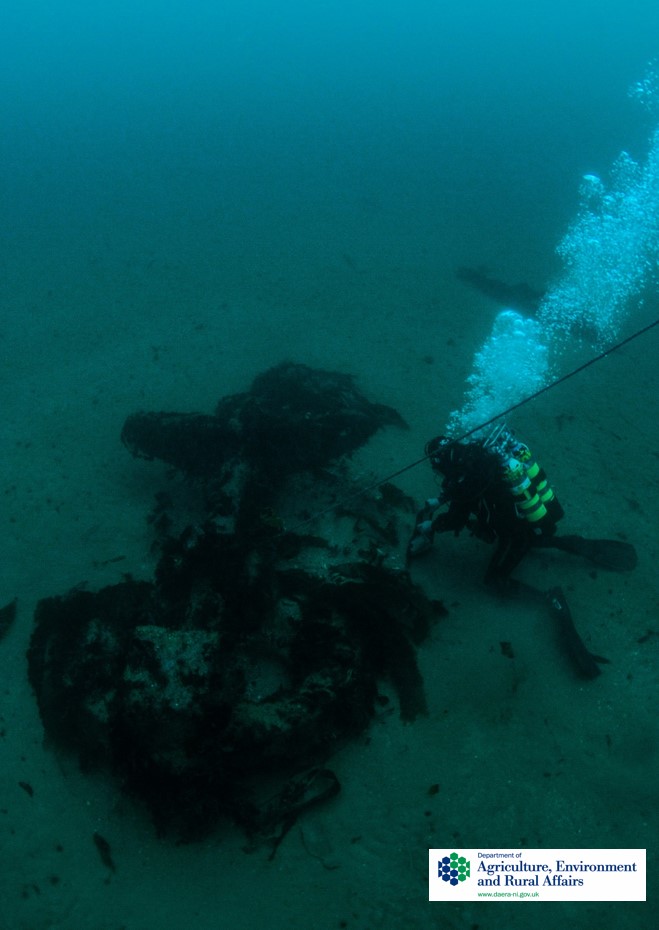
HMS Drake lies on a flat sandy seabed at a depth of between 15-19 metres. The site is comprised of the metal wreck of the Drake and a further metal wreck of a 52m Fleetwood fishing trawler, the Ella Hewett that struck and sunk atop the Drake in 1962. The Drake’s position is marked with a Commissioners of Irish Lights South Cardinal Buoy (although the buoy is currently situated to the SE of the wreck, off its stern). The Drake currently lies capsized on its starboard side (the side of the torpedo strike) and is orientated SE-NW (bow pointing NW). The wreckage extends for c. 160m and is 32m wide at its widest. The remains of the trawler partially overlays the Drake near its bow end. The trawler is severely broken up with its bow lying in the wreckage of the Drake. There remains intact and recognisable structural remains; for example, an improved Martin Type anchor and some visible chain to the west of the main wreckage (bow end); the partially buried remains of the ram bow; a praravane skeg used for mine clearance; parts of the armour belt hull; articulated elements of the stern including upright frames and horizontal beams; a hawse hole; steering gear and rudder (with fitting and machinery for turning the rudder); a probable BL 6-inch (152mm) MK VII gun; open internal spaces and bulkheads and a port propeller shaft (near SW edge of wreckage).
Information drawn from Historic Environment Record of Northern Ireland (HERoNI), Department for Communities, Historic Environment Division.
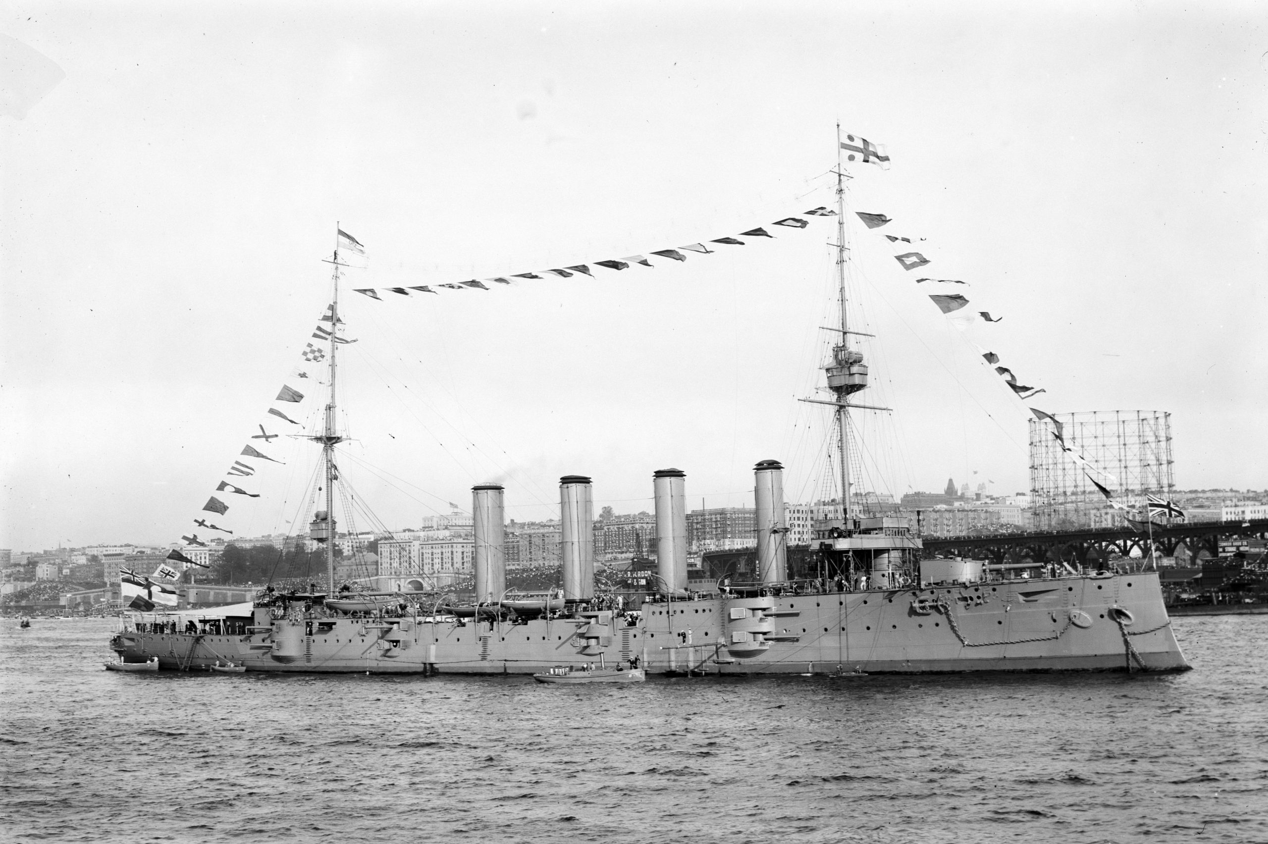
Date of Loss 02/10/1917. HMS Drake was built at HM Dockyard at Pembroke, between 1899 and 1902, as a Drake Class armoured cruiser, based on the Cressy Class cruisers. Cruisers were a class of warship developed in the 19th century designed for scouting, ‘commerce warfare’ and showing the flag, roles previously taken by frigates, corvettes and sloops. Although cruisers could be powerful ships (HMS Drake was a 14,000 ton vessel capable of 21-23 knots) cruisers were not intended for duty in the battlefleet. On 2nd October 1917 HMS Drake had just finished escort duties for convoy HH24 from America. The convoy dispersed at 08.03 am, but just over an hour later HMS Drake was torpedoed under the second funnel by a German U-boat, U-79, under the command of Lieutenant Commander Otto Rohrbeck, five miles north of Rathlin Island.
The Drake, having sustained some damage to the steering, and taking water, headed for Church Bay, but collided with the cargo ship Mendip Range as it rounded Rue Point. It proceeded to Church Bay where it anchored, but soon began to list, and eventually capsized and sank. By this time the surviving crew members had been transferred to other vessels in the vicinity. The Lugano and the Brisk were both torpedoed by U-boats on the same day. Salvage has been undertaken on the wreck of the Drake since 1918.
The Drake has been extensively damaged both by the original torpedo attack on the vessel, the wrecking of the Ella Hewett and the subsequent dispersal of both wrecks with explosives in the 1970s by divers from the Scottish and Northern Ireland Bomb and Mine Disposal Team. Despite the obvious damage sustained divers from Wessex Archaeology were able to discern in 2006 that there remains not only a main body of wreckage in ‘reasonable condition’ but ‘intact and recognisable’ structural remains. These observations were further verified by divers from DAERA’s Marine Scientific Dive Team in 2016.
The ship type is rare and represents an intermediate design of armoured cruiser that quickly became obsolete. In May 2017 the Drake was scheduled under the Historic Monuments and Archaeological Objects (NI) Order 1995 in recognition of the site’s significance and to mark the centenary of its sinking. Public access, i.e., diving on the site is permitted on a ‘look but do not touch’ basis.
The records staff at the Historic Environment Division would encourage divers to send them a short report on any diving undertaken on the HMS Drake wreck site to assist in monitoring the wreck (see Record Heritage)
Information drawn from Historic Environment Record of Northern Ireland (HERoNI), Department for Communities, Historic Environment Division.
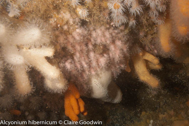
The wreckage is covered in dense kelp and mixed red algae. Sand gobies Pomatochistus minutus, the burrowing anemone Cerianthus lloydii and the slender sea pen Virgularia mirabilis (a Northern Ireland Priority Species) occur on the adjacent sandy seabed.
View all species records from this site
A link to the dive site location on the NBN Atlas Northern Ireland website, showing all species records from within a 1km boundary of the site centroid. Any new species records from the site submitted to Seasearch, iRecord, CEDaR Online Recording or iNaturalist will appear hereScheduled Monument – HMS Drake
Rathlin MCZ
Rathlin SAC
Rathlin Island SPA
Irish Wrecks Online
Wessex Archaeology – HMS Drake
Northern Ireland Marine MapViewer
- In an emergency call 999 or 112 and ask for the coastguard.
- Follow VHF radio Channel 16 (156.8 MHz), the international distress frequency. Send a distress alert followed by ‘MAYDAY, MAYDAY, MAYDAY’ and ‘This is [boat name]’.
- Find nearest defibrillator (AED) here
- Ballycastle/Rathlin Harbour Office No. 028 207 68525 Mobile Number 07803 505084.
- When navigating within Ballycastle or Rathlin Harbour, use VHF Channel 80.


Leave a Comment
Dived here recently? Then let other divers know about this site from your experience!