All Dives Dive

Jenny Watt’s Cove

Brompton Road, Bangor

Average score: 4

Site name: Jenny Watt’s Cove
Location: Descriptive location referring to nearest landfall i.e. town, village, harbour or island
Brompton Road, Bangor
Type: Describes whether this dive site can be dived from the shore, from a boat, or both
Shore
Wreck: Dive sites which include a shipwreck (or part of a shipwreck) are labelled with a ‘Yes’
Yes
Min. dive depth (m): The approximate minimum depth of the dive given in metres
3
Max. dive depth (m): The approximate maximum depth of the dive given in metres
10

Max. seabed depth (m): The maximum depth of the seabed at the site taken from the intersect between the dive site point and the depth contour on an Admiralty Standard Nautical Chart
10

Diving experience (min level): The recommended minimum level of diving experience for a specific site, described as Novice (<50 dives in temperate/cold waters and minimum certification of PADI Open/Advanced Open Water, BSAC Ocean Diver or CMAS 1 star), Intermediate (50-100 dives in temperate/cold waters and minimum certification of PADI Rescue Dive, BSAC Sports Dive or CMAS 2 star) or Advanced (>250 dives in temperate/cold waters and minimum certification of PADI Divemaster, BSAC Dive Leader or CMAS 3 star
Novice

Optimal wind direction: The general wind direction which causes minimal exposure at the site, corresponding to 8 points of the compass: North (N), North East (NE), East (E, South East (SE), South (S), South West (SW), West, North West (NW)
E/SE/S/SW

Exposure: The approximate level of exposure to wind and wave action at the site on any given day, described as Sheltered (inshore sites surrounded by a form of shelter on all sides), Moderate (sites which are partially sheltered) or Exposed (sites with little to no shelter)
Sheltered

Tidal strength: Anecdotal description of tidal strength at the site
Weak, but subject to surge

Marine Protected Area: A Yes or No highlighting whether or not the site occurs within a Marine Protected Area
No

Visibility: Anecdotal description of the typical underwater visibility at the site
Variable and difficult to predict. Best with several dry days and light south westerly and southerly winds. During a very settled period in the summer of 2018, we enjoyed 15m+ of visibility. It was like diving in our own crystal clear rock pool!
Best time to dive: Anecdotal recommendation for the best time to dive the site for optimal underwater conditions. This typically relates to the stage of the tide
Best about an hour prior to HW Belfast. Brompton can be dived anytime but is best avoided at LW due to entry and exit hazards (slippery pebbles, boulders and kelp).
Getting There: Directions for getting to the site

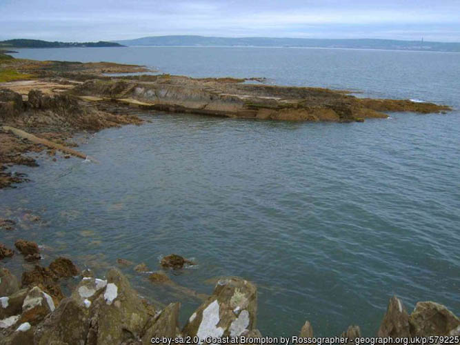
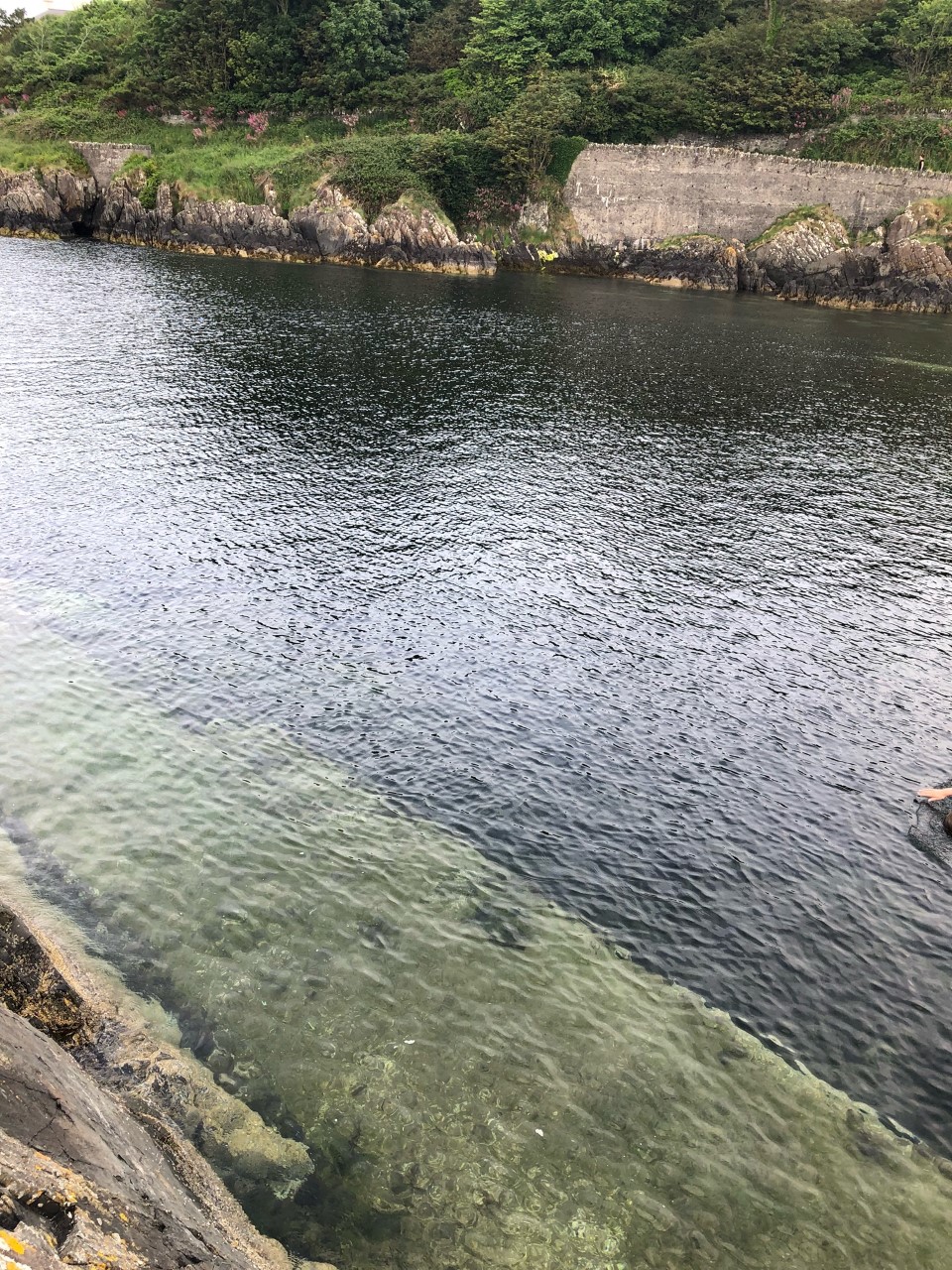
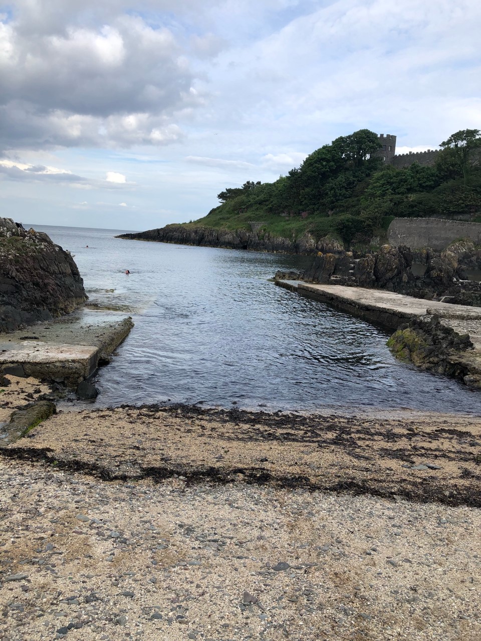
By car, from the Bryansburn Road (Bangor) roundabout take the exit onto Maxwell Road. At the crossroads, turn left onto Downshire Road and immediately right onto Brompton Road. Follow the road to the bottom, parking on the side of the road. The entry point is from the slipway or shore approx. 50m walk from the road end.

Facilities: Details of nearest facilities to dive site i.e. public car parking and toilets, slipways etc

Car parking on the road side above the site. The nearest public toilets can be found on Eisenhower pier 800 metres east by foot.

Nearest tank filling is DV Diving, Mount Stewart, Newtownards.

Hazards: Anecdotal information on possible hazards at the site for divers and snorkellers

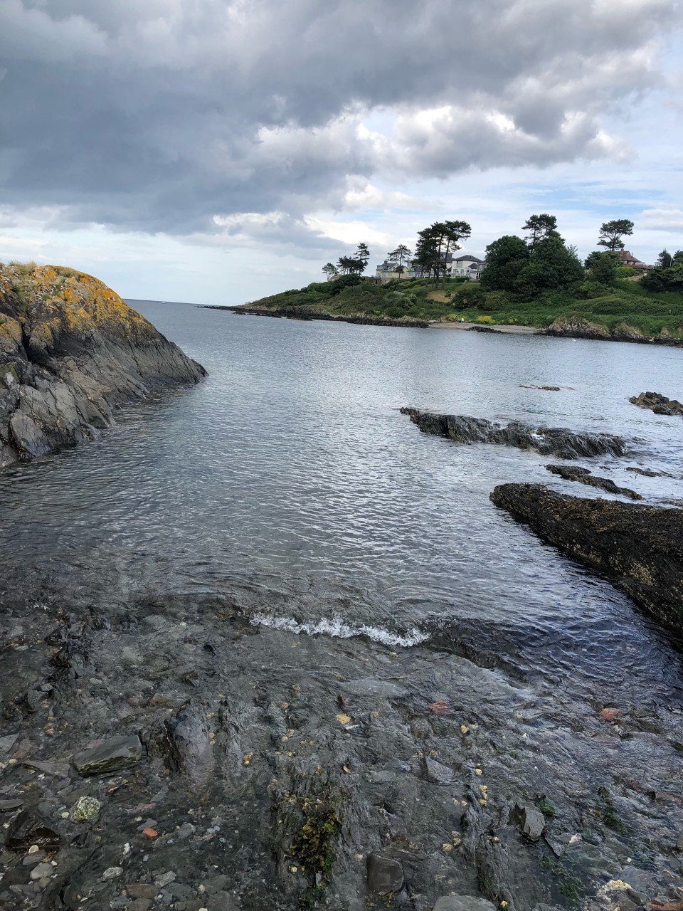
  • Private boat traffic including occasional anchoring at Jenny Watt’s Cove.
  • Other water users including sea swimmers, SUP boarders and kayakers.
  • Anglers and discarded fishing line.
  • Slippy entrance when diving at low tide.
Description: A general description of the physical features of the dive site

There are 2 seperate areas to explore at this site:

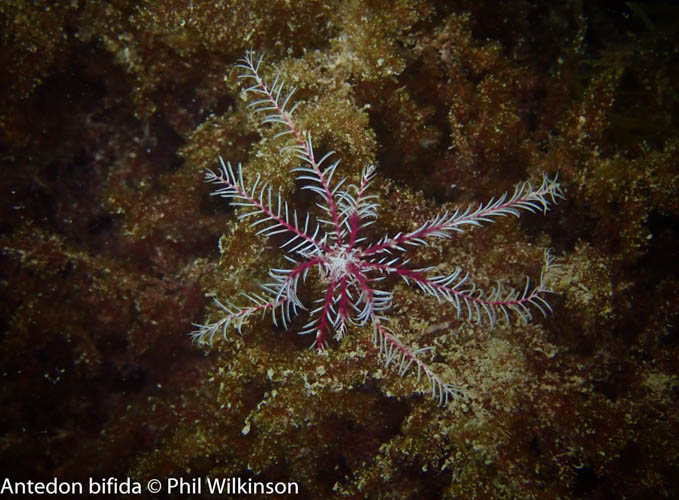
  1. Fin north of entry. Descend onto mixed weed and rock. Continuing north moving onto areas of sand. Further north there are some large rocky areas with Rosy feather stars Antedon bifida, worms, sea squirts, crustaceans and juvenile fish. Good practice to deploy a SMB due to likely boat traffic.
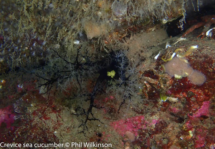
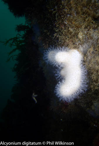
  2. Descend and fin west. Numerous gullies to explore including a small swim through. Again, soft corals, sea squirts and numerous crustaceans. Look out for octopus!
Biodiversity: A description of the species composition at the site. Species of interest are highlighted. Follow the links for more information about the species on the NBN Atlas Northern Ireland website

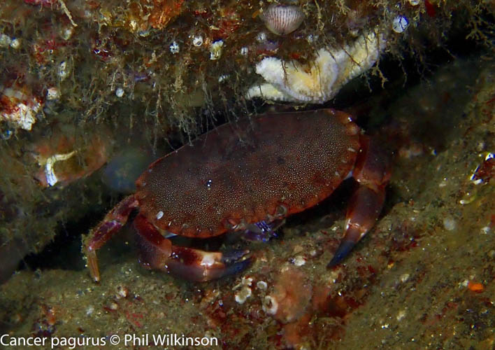
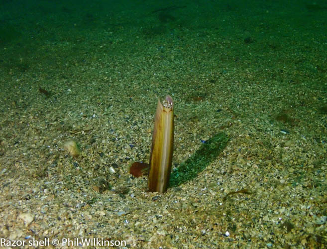
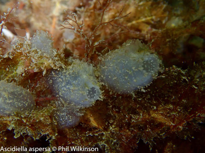
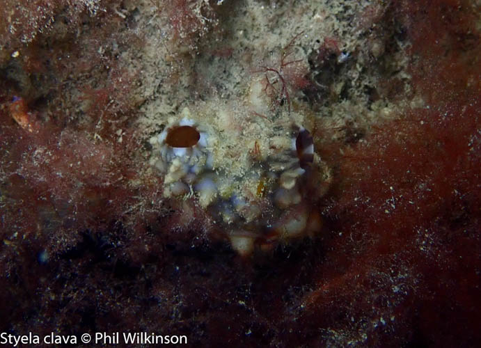
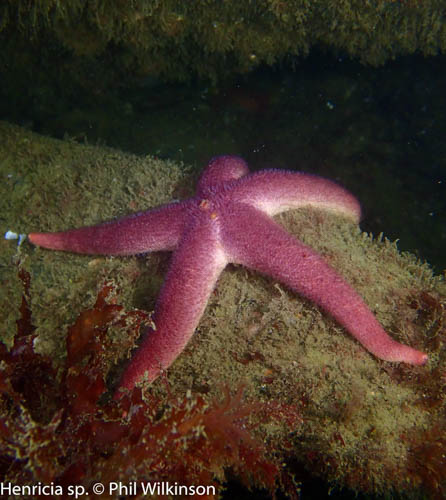
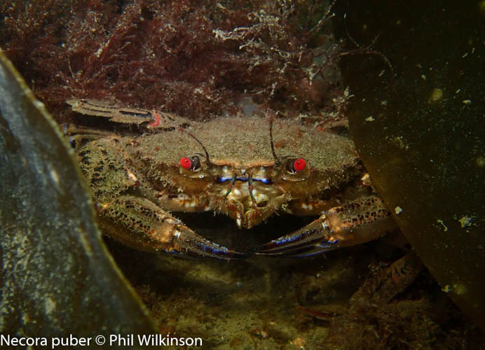
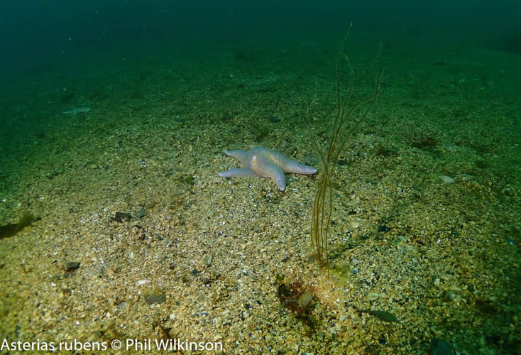
Rose feather stars Antedon bifida, starfish, sea squirts, including the invasive leathery sea squirt Styela clava, soft corals, anemones, crustaceans, worms including the bootlace worm Lineus longissimus, nudibranchs e.g. Polycera faeroensis and juvenile fish. Curled octopus are often spotted here and on an evening or night dive, look out for the bobtail squid Sepiola atlantica.

View all species records from this site

A link to the dive site location on the NBN Atlas Northern Ireland website, showing all species records from within a 1km boundary of the site centroid. Any new species records from the site submitted to Seasearch, iRecord, CEDaR Online Recording or iNaturalist will appear here
Local Charters: A link to the website for the nearest Dive Centre to the site. A map of all dive centres is provided under ‘Go Diving’

DV Diving

Environmental and Historical Designations: A list of any environmental or historical designations attributed to the site, or overlapping it. Follow the link for more information

More Information: Links to additional information found online for the dive site

Geograph – Wreckage of M.V. Oregon

Wrecksite.eu – M.V. Oregon

Northern Ireland Marine MapViewer

Safety: Safety tips

  • In an emergency call 999 or 112 and ask for the coastguard.
  • Follow VHF radio Channel 16 (156.8 MHz), the international distress frequency.
  • Find nearest defibrillator (AED) here
Latitude, Longitude: The approximate XY coordinates for the dive site in Decimel Degrees (DD). These can be converted to DMS or DDM by following the link below
54.668116, -5.683963

Leave a Comment

Dived here recently? Then let other divers know about this site from your experience!

One thought on “Jenny Watt’s Cove

Leave a Reply

Your email address will not be published. Required fields are marked *

This site uses Akismet to reduce spam. Learn how your comment data is processed.

  1. Phil Wilkinson says:

    Fantastic vis and loads to see on evening of Friday 19th June!

Join our Mailing List