
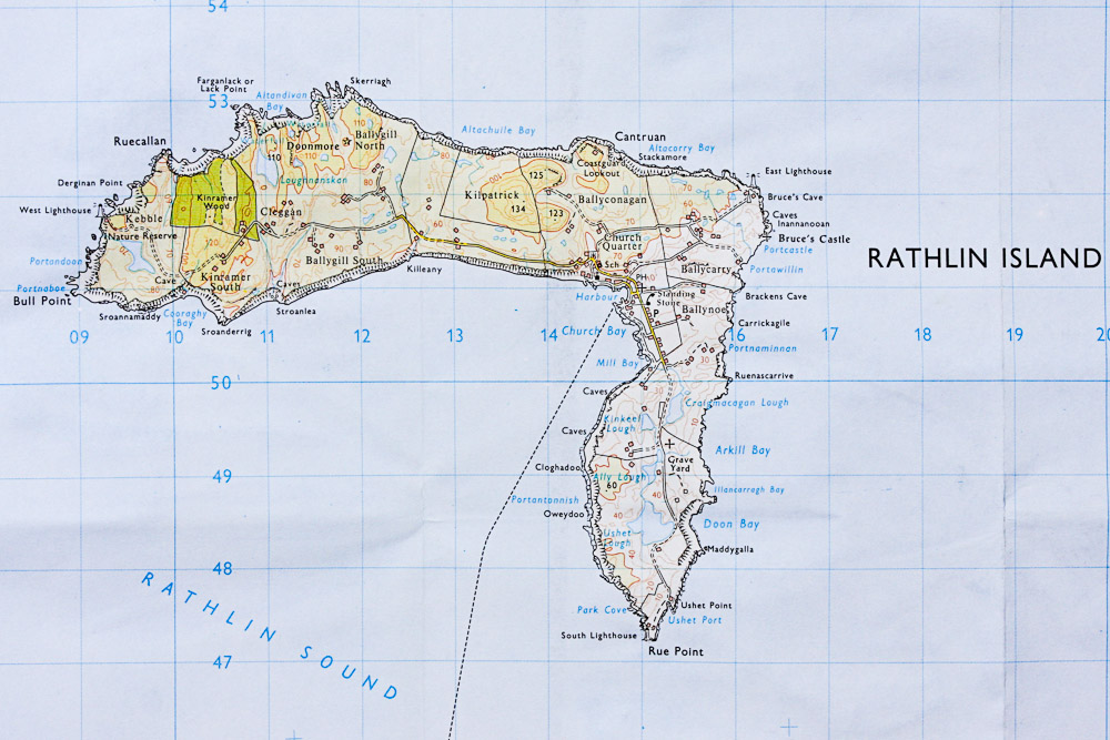
By boat from Rathlin or Ballycastle Harbour. The wreck is found approximately 0.5km SE of Maddygalla Point and is marked by a buoy which can be used for descent and ascent.
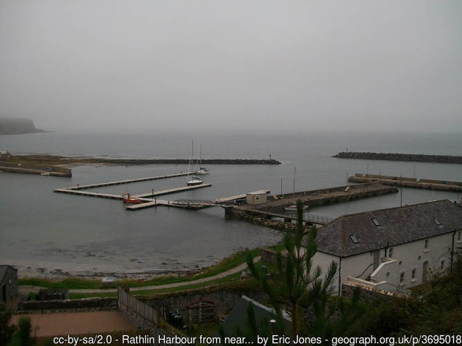
Rathlin Harbour has pontoons for around 40 boats. Water and electricity are available on the pontoon but there is no reliable source of fuel. Public toilets are available in Church Bay between the harbour and the pub, near the playground.
Ballycastle Harbour has a gated slipway (open during office hours) and pontoon berthing. Free car parking is available above the harbour and marina. Free public toilets are available in the visitor information office above the harbour.
Berthing fees apply for both Rathlin and Ballycastle Harbour Office; for use of either, contact the Ballycastle Harbour Office: 02820768525 / 07803505984.
Nearest tank filling is Aquaholics in Ballycastle or Portstewart (ring ahead: 028 7083 2584)
- Very strong currents
- Snagged fishing lines
- Live ammunition may still be in the vicinity of the wreck (according to reports)
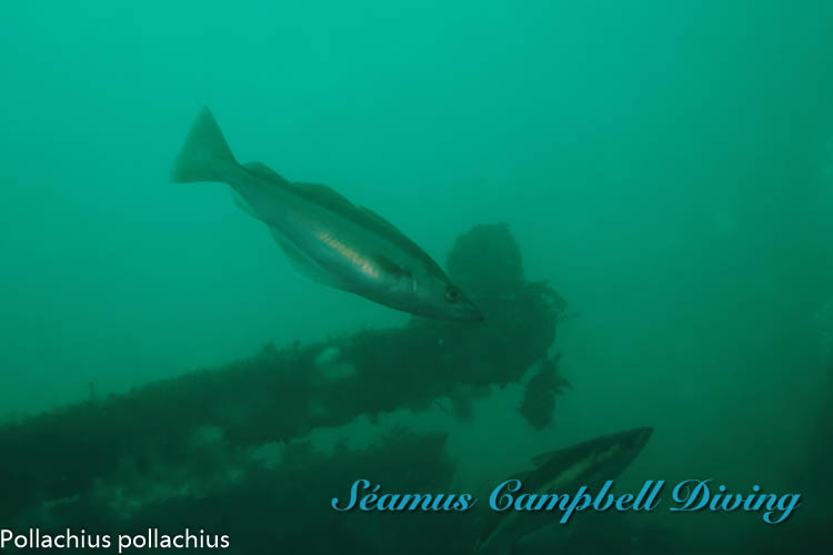
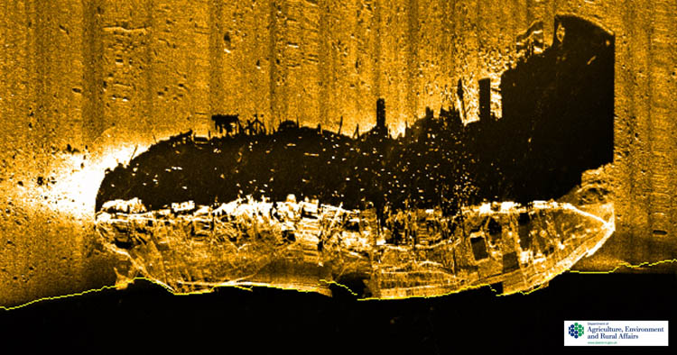
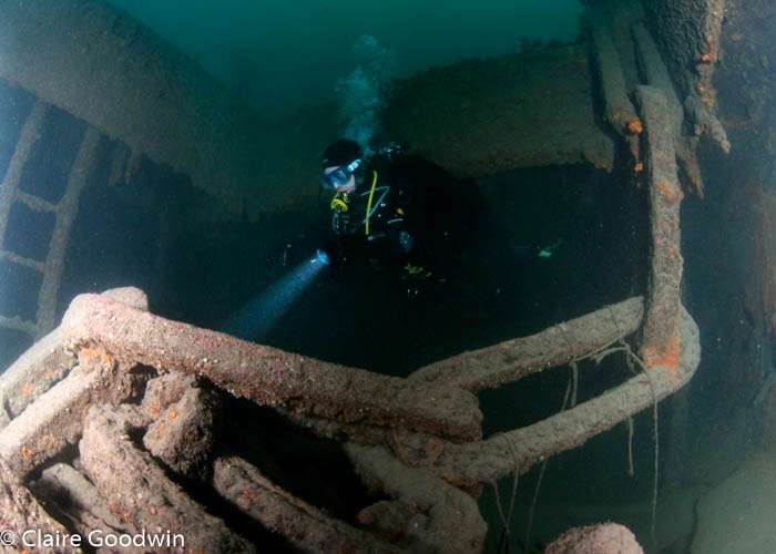
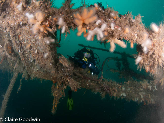
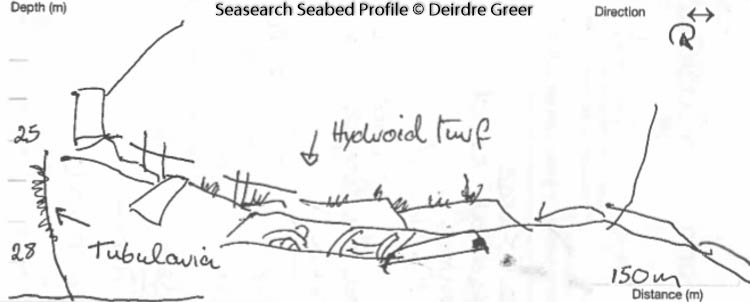
The wreckage lies upright, on a stone/shale seabed and is mostly intact although the stern looks liable to collapse soon. The top of the wreck is at approximately 7 metres, with the base of the wreck at 35metres. The wreck has several recognisible features, including black/white tiles, the triple expansion engine is exposed and the forward hold is covered with a heavy chain which was used to prevent anyone gaining access to the munitions below. The wreck is surrounded by an area of coarse gravel and some small boulders.
Date of loss 21/01/1942. This 1670 ton British Troopship (originally a Passenger Ship) foundered after it strayed off course and ran onto rocks in a gale. Two of the lifeboats carrying a total of 30 persons reached the safety of the shore, but a third struck a rock, and the 29 men on board were lost. The vessel was built in 1898 as the Vulture for G. & J. Burns, Glasgow; from 1929 it was known as Lairdsrock, and in 1937 it was sold to David MacBrayne Ltd., and renamed Lochgarry. It had a length of 265 ft., a beam of 34 ft. and a depth/draught of 16 ft. Its voyage was from Glasgow to Oban, in ballast, to pick up troops bound for the Faroes. In 1976 the wreck lay intact and upright in 32m of water and on a gravel bottom. A gun was still visible on the stern and divers reported finding ammunition around this area. (Sources: Cecil, 1990 The Harsh winds of Rathlin p.55; WA G60; AWD).
AWD (Admiralty Wreck Data); WA (Wilson Archive)
Information derived from Historic Environment Record of Northern Ireland (HERoNI), Department for Communities, Historic Environment Division.
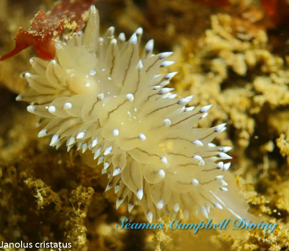
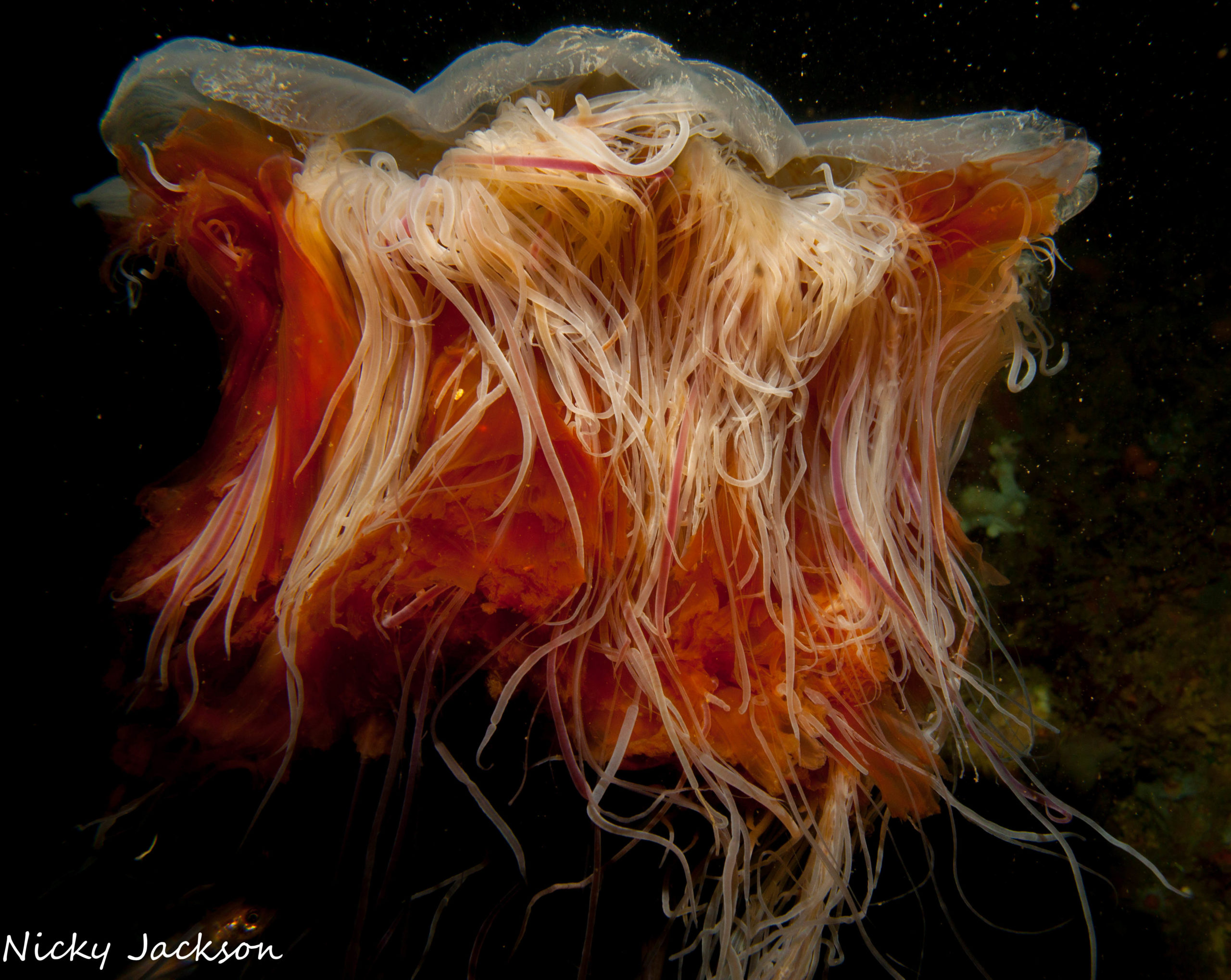
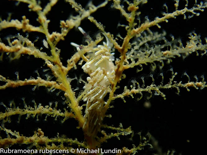
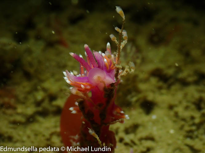
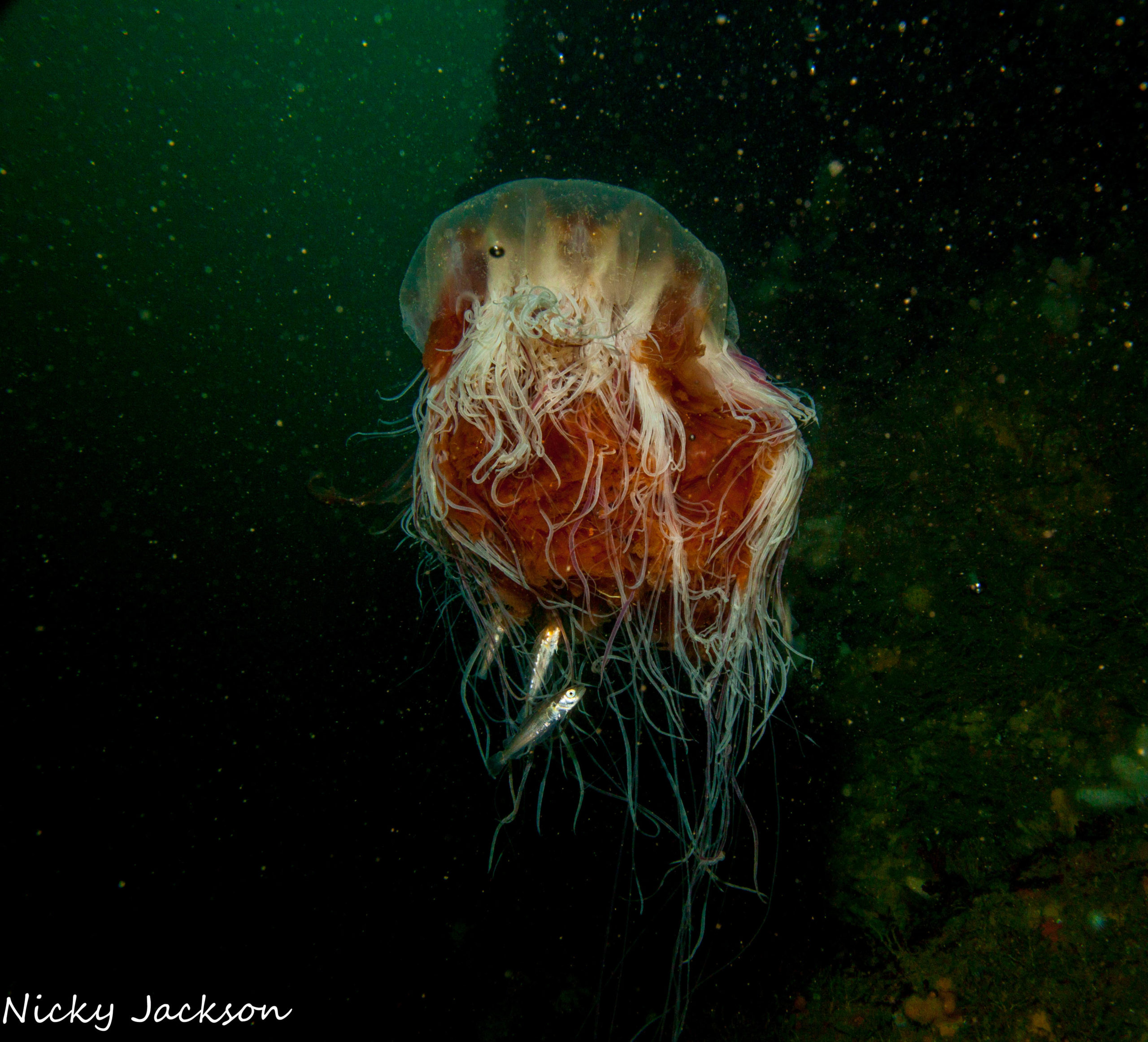
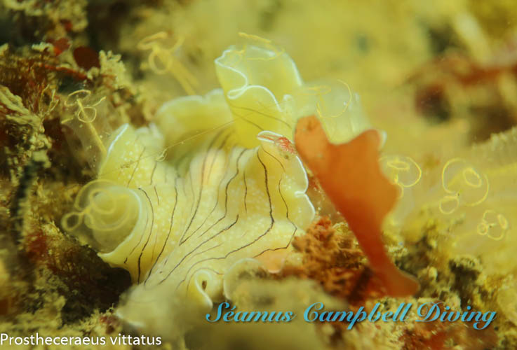
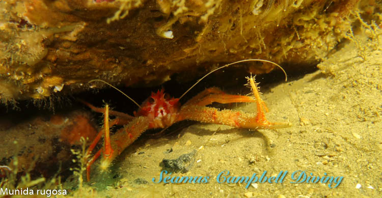
The wreck and the surrounding gravel/boulder habitat are dominated by oaten pipes hydroids Tubularia indivisa, Devonshire cup corals Caryophyllia (Caryophyllia) smithii , dead man’s fingers Alcyonium digitatum, jewel anemones Corynactis viridis and the antenna hydroid Nemertesia ramosa. In 2007, the fan mussel Atrina fragilis was recorded in the boulder area to the south east of the wreck, however, it hasn’t been seen since scallop dredging occurred on the site in 2009. Scallop dredging has now been banned from within the Rathlin Marine Conservation Zone and therefore this species may reappear one day.
View all species records from this site
A link to the dive site location on the NBN Atlas Northern Ireland website, showing all species records from within a 1km boundary of the site centroid. Any new species records from the site submitted to Seasearch, iRecord, CEDaR Online Recording or iNaturalist will appear hereMariner –Lochgarry
Divernet – Lochgarry
Northern Ireland Marine MapViewer
- In an emergency call 999 or 112 and ask for the coastguard.
- Follow VHF radio Channel 16 (156.8 MHz), the international distress frequency. Send a distress alert followed by ‘MAYDAY, MAYDAY, MAYDAY’ and ‘This is [boat name]’.
- Find nearest defibrillator (AED) here.
- Ballycastle/Rathlin Harbour Office No. 028 207 68525 Mobile Number 07803 505084
- When navigating within Ballycastle or Rathlin Harbour, use VHF Channel 80.


Leave a Comment
Dived here recently? Then let other divers know about this site from your experience!