All Dives Dive
Snorkelling Snorkelling

Luke’s Point

Bangor

Average score: 0

Site name: Luke’s Point
Location: Descriptive location referring to nearest landfall i.e. town, village, harbour or island
Bangor
Type: Describes whether this dive site can be dived from the shore, from a boat, or both
Shore
Wreck: Dive sites which include a shipwreck (or part of a shipwreck) are labelled with a ‘Yes’
No
Min. dive depth (m): The approximate minimum depth of the dive given in metres
2
Max. dive depth (m): The approximate maximum depth of the dive given in metres
7

Max. seabed depth (m): The maximum depth of the seabed at the site taken from the intersect between the dive site point and the depth contour on an Admiralty Standard Nautical Chart
8

Diving experience (min level): The recommended minimum level of diving experience for a specific site, described as Novice (<50 dives in temperate/cold waters and minimum certification of PADI Open/Advanced Open Water, BSAC Ocean Diver or CMAS 1 star), Intermediate (50-100 dives in temperate/cold waters and minimum certification of PADI Rescue Dive, BSAC Sports Dive or CMAS 2 star) or Advanced (>250 dives in temperate/cold waters and minimum certification of PADI Divemaster, BSAC Dive Leader or CMAS 3 star
Novice

Optimal wind direction: The general wind direction which causes minimal exposure at the site, corresponding to 8 points of the compass: North (N), North East (NE), East (E, South East (SE), South (S), South West (SW), West, North West (NW)
SE/S/SW

Exposure: The approximate level of exposure to wind and wave action at the site on any given day, described as Sheltered (inshore sites surrounded by a form of shelter on all sides), Moderate (sites which are partially sheltered) or Exposed (sites with little to no shelter)
Moderate

Tidal strength: Anecdotal description of tidal strength at the site
Weak

Marine Protected Area: A Yes or No highlighting whether or not the site occurs within a Marine Protected Area
Yes

Visibility: Anecdotal description of the typical underwater visibility at the site
~5-10 metres in good conditions
Best time to dive: Anecdotal recommendation for the best time to dive the site for optimal underwater conditions. This typically relates to the stage of the tide
Anytime, however entry is easier closer to HW. At LW entry is a bit slippy over cobbles.
Getting There: Directions for getting to the site

Follow Seacliff Road in Bangor towards Jamaica Inn. Car parking is available in the lay-by outside the waste water pumping station. Access the site from the shore beneath the east side of the pumping station.

Facilities: Details of nearest facilities to dive site i.e. public car parking and toilets, slipways etc

Free car parking along Seacliff Road. Public toilets are available near Bangor Marina.

Nearest tank filling is DV Diving, Newtownards.

Hazards: Anecdotal information on possible hazards at the site for divers and snorkellers

  • Minor slip hazards at LW.
  • Recreational boat traffic in the area.
Description: A general description of the physical features of the dive site

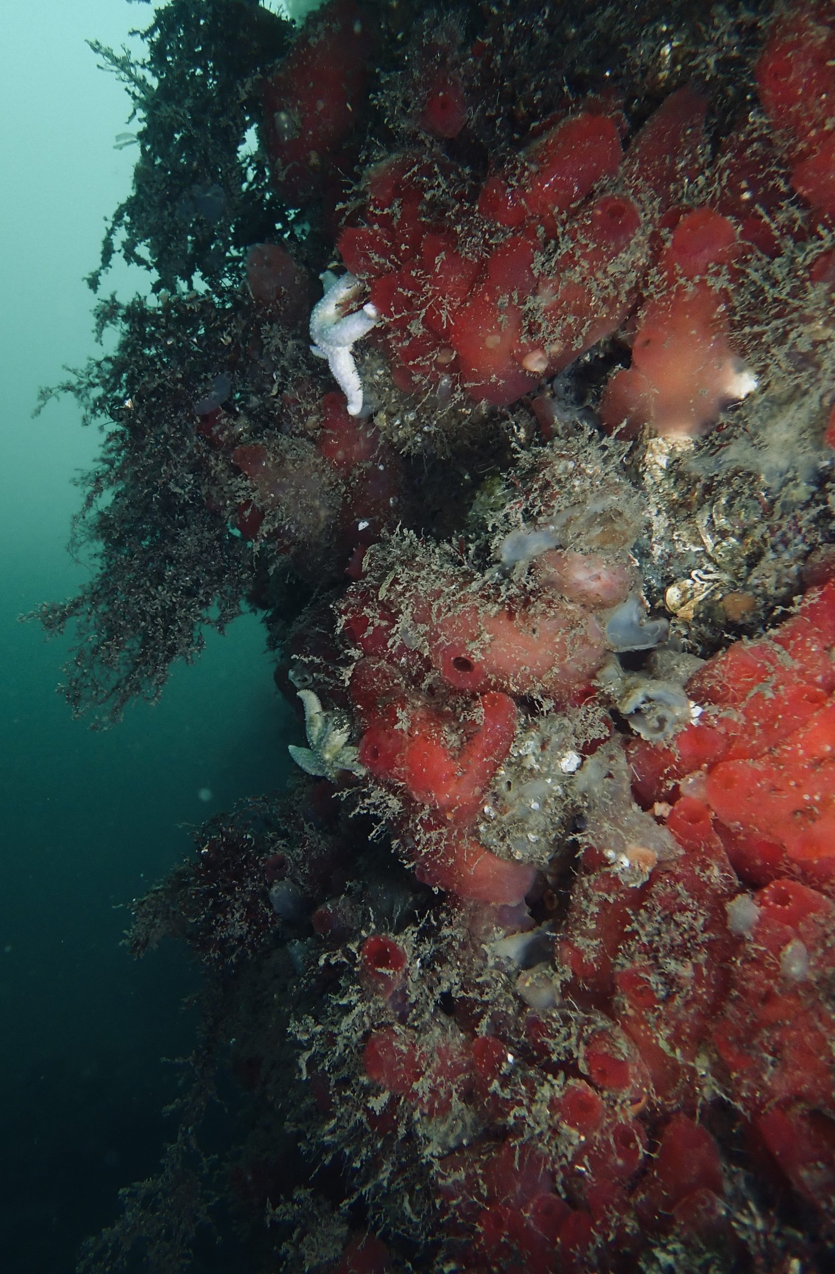
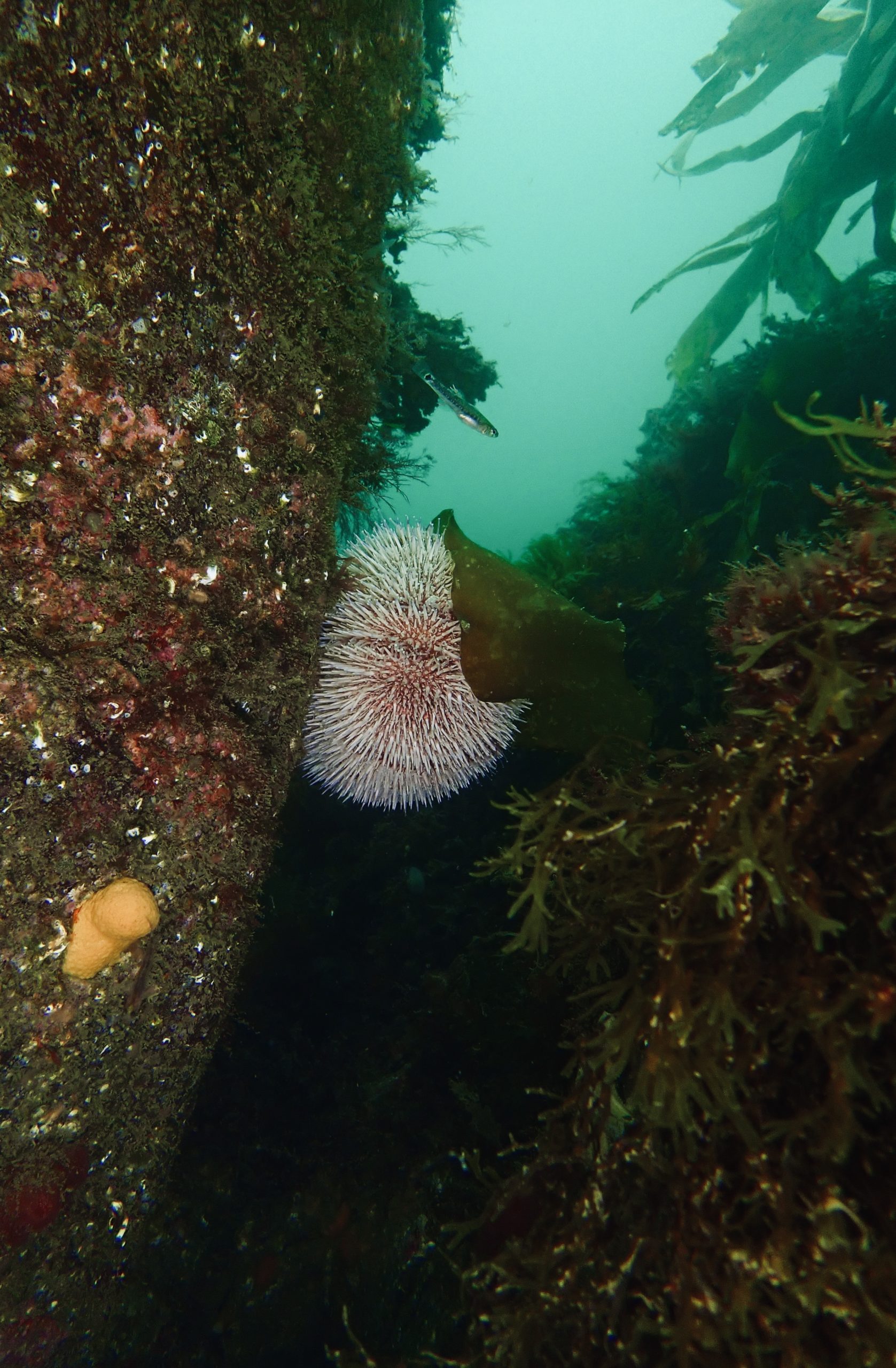
The seabed here is made up of a mixture of bedrock and coarse sand/shells.

Biodiversity: A description of the species composition at the site. Species of interest are highlighted. Follow the links for more information about the species on the NBN Atlas Northern Ireland website

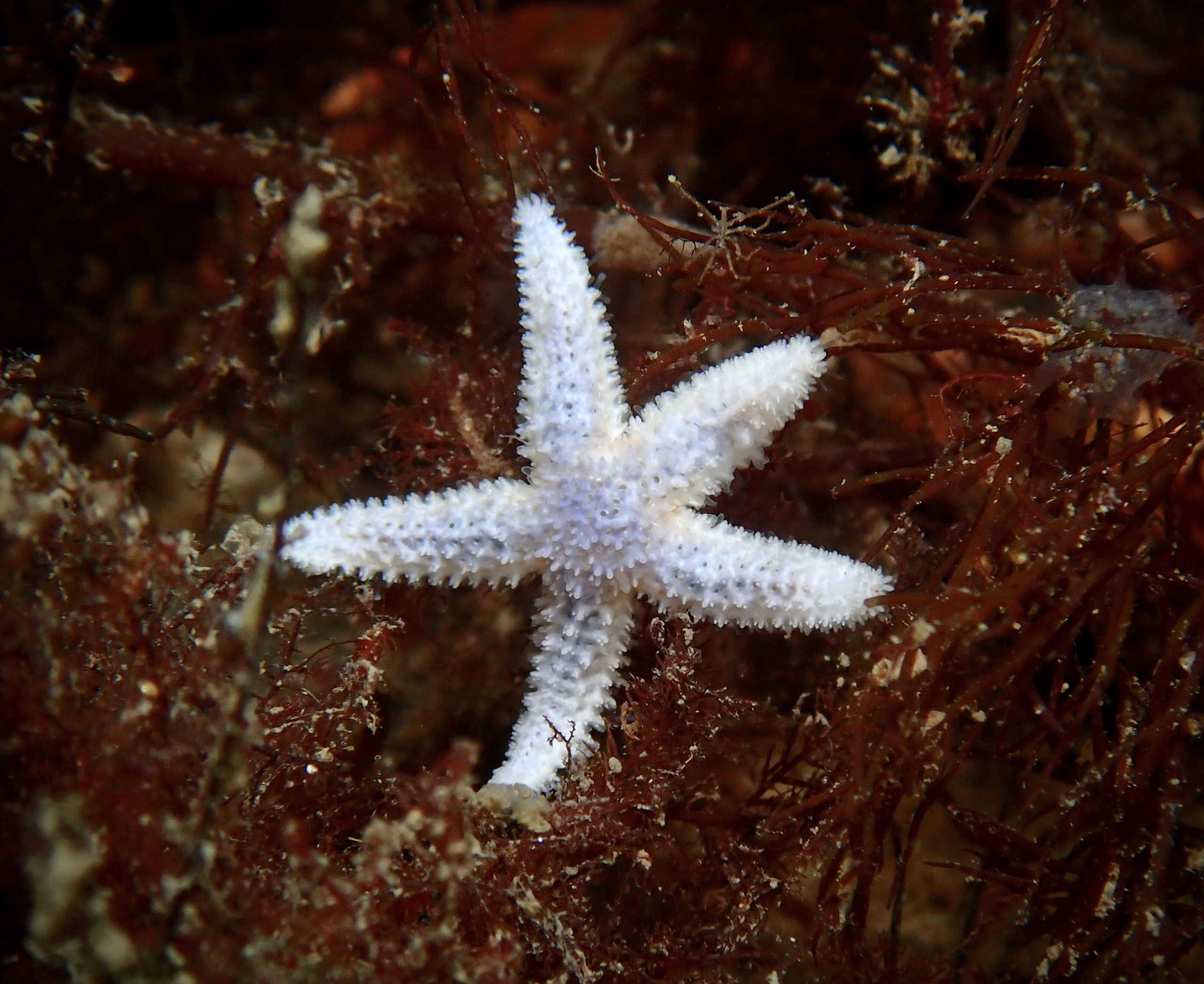
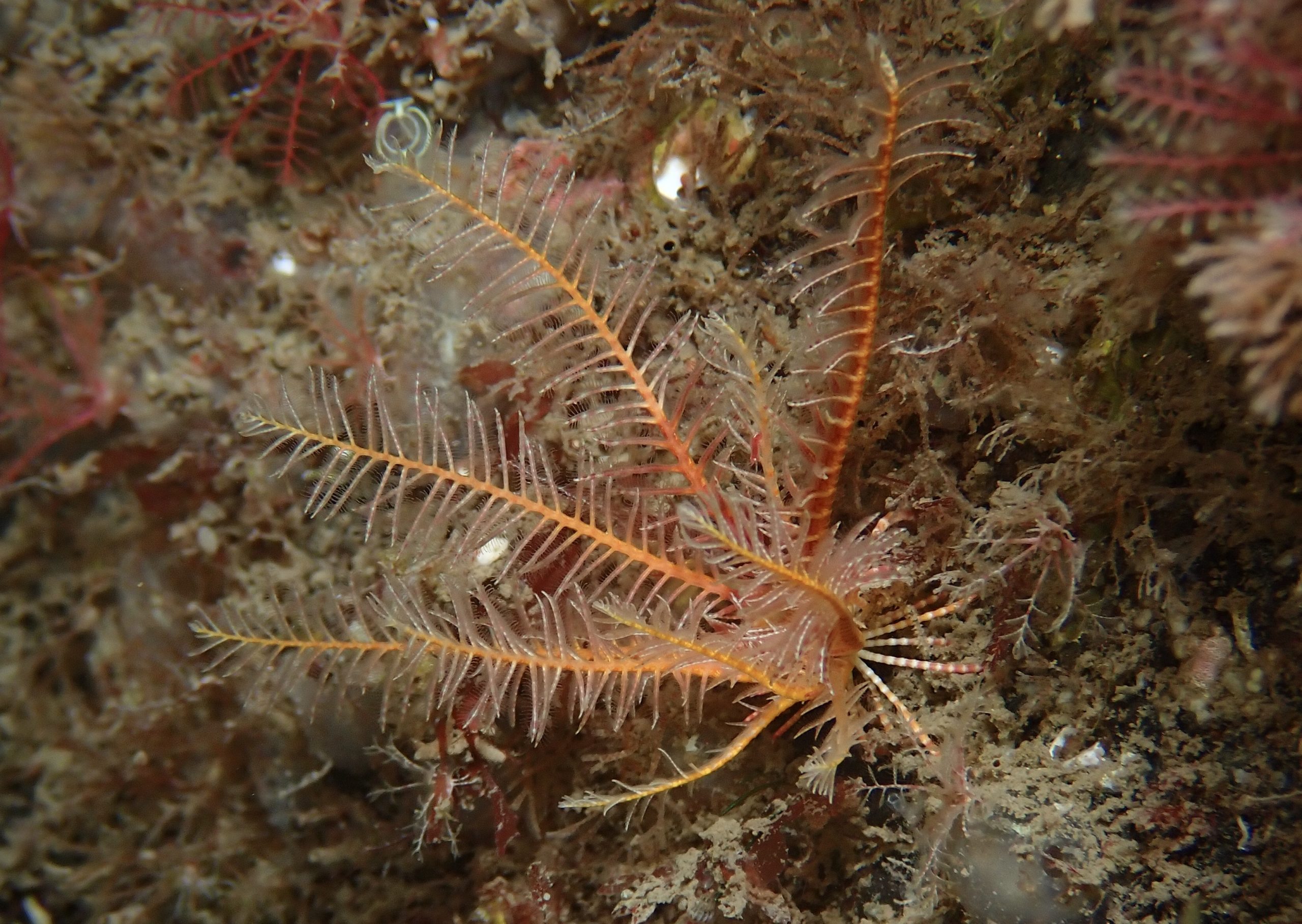
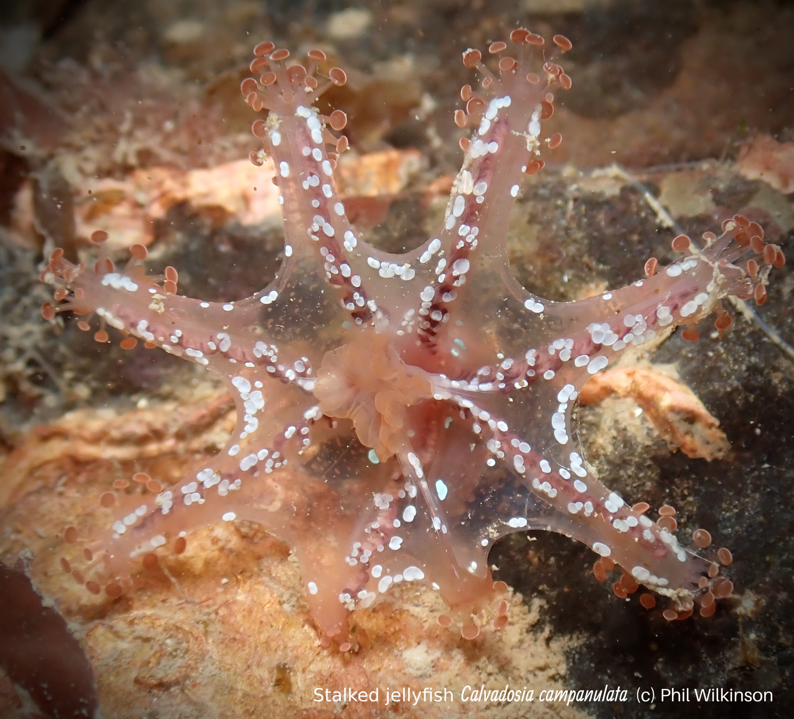
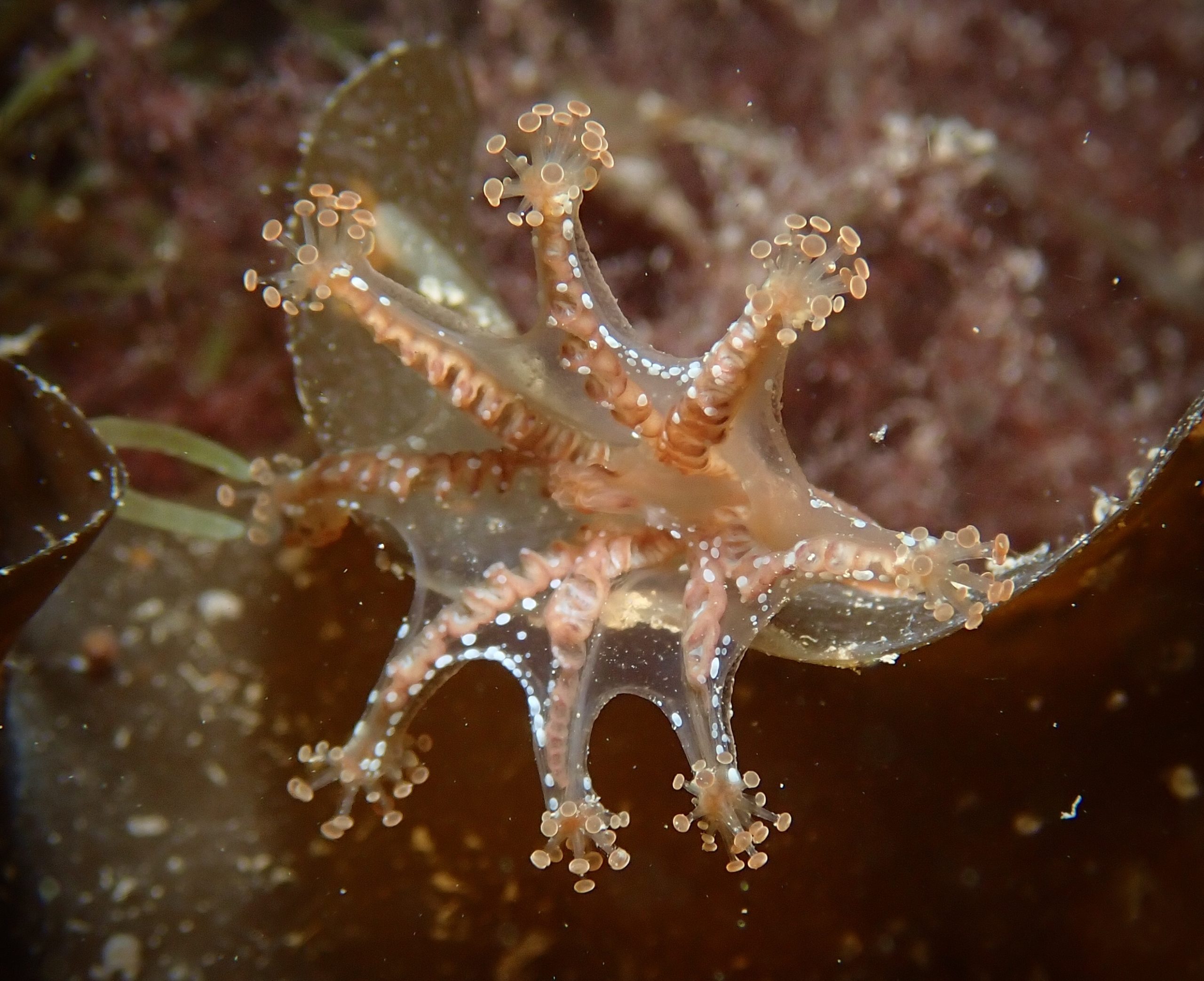
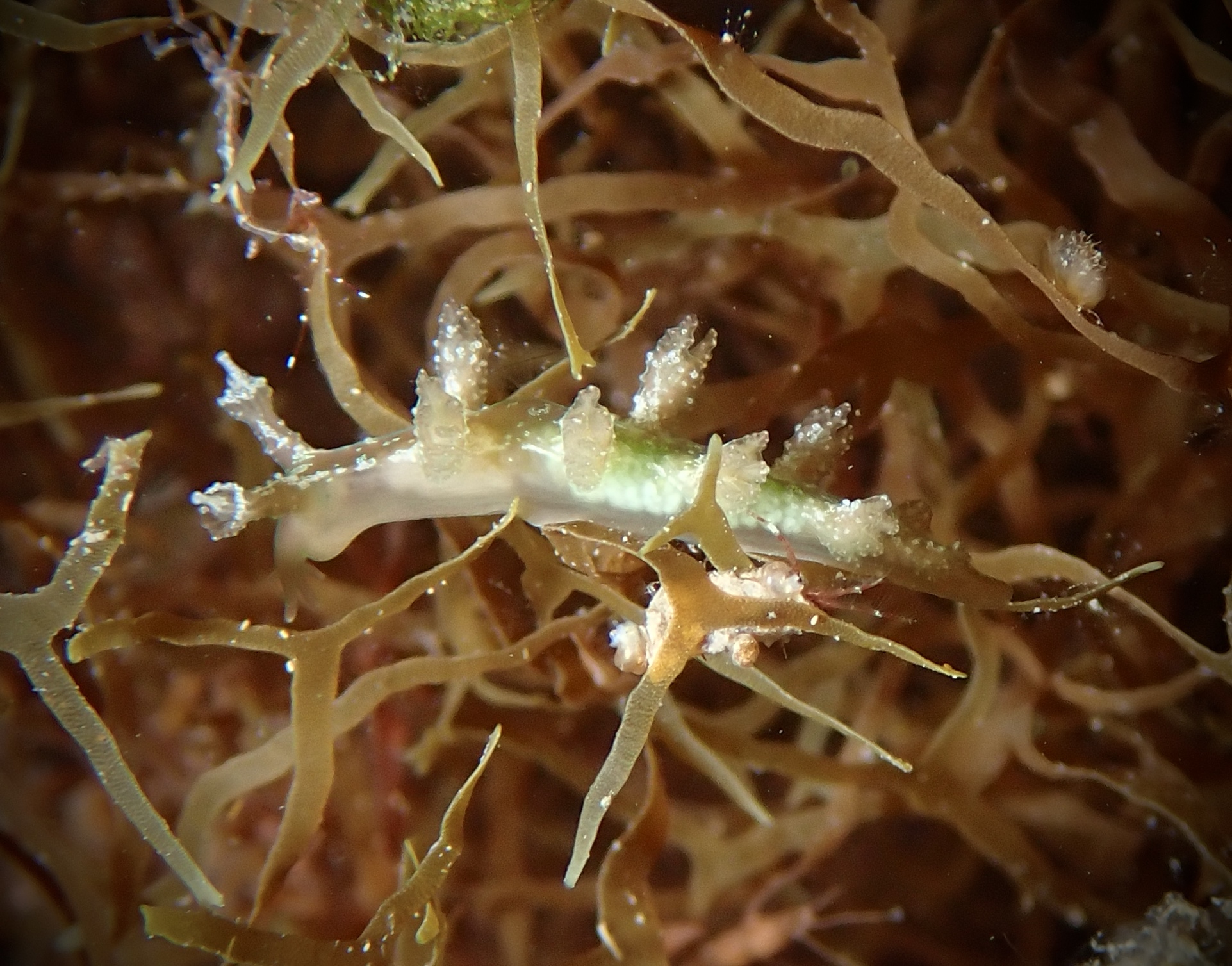
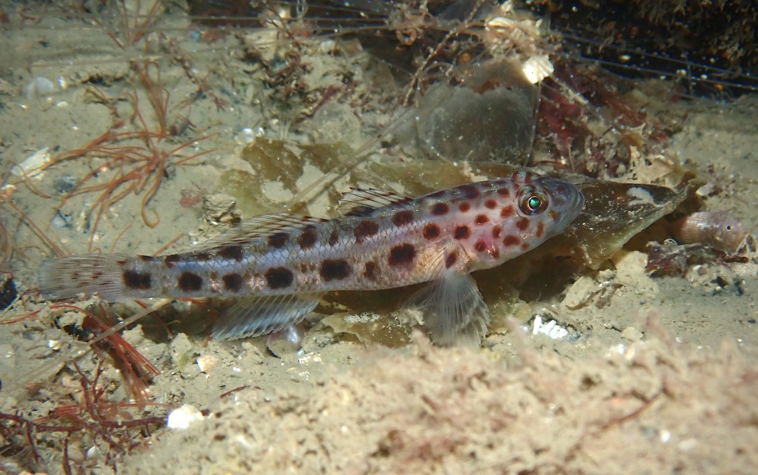
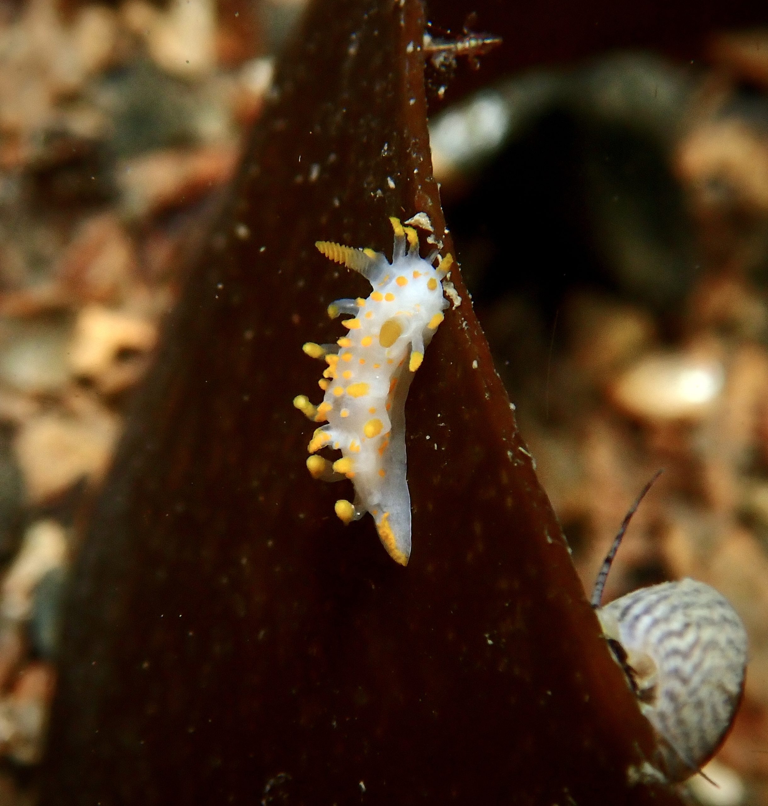
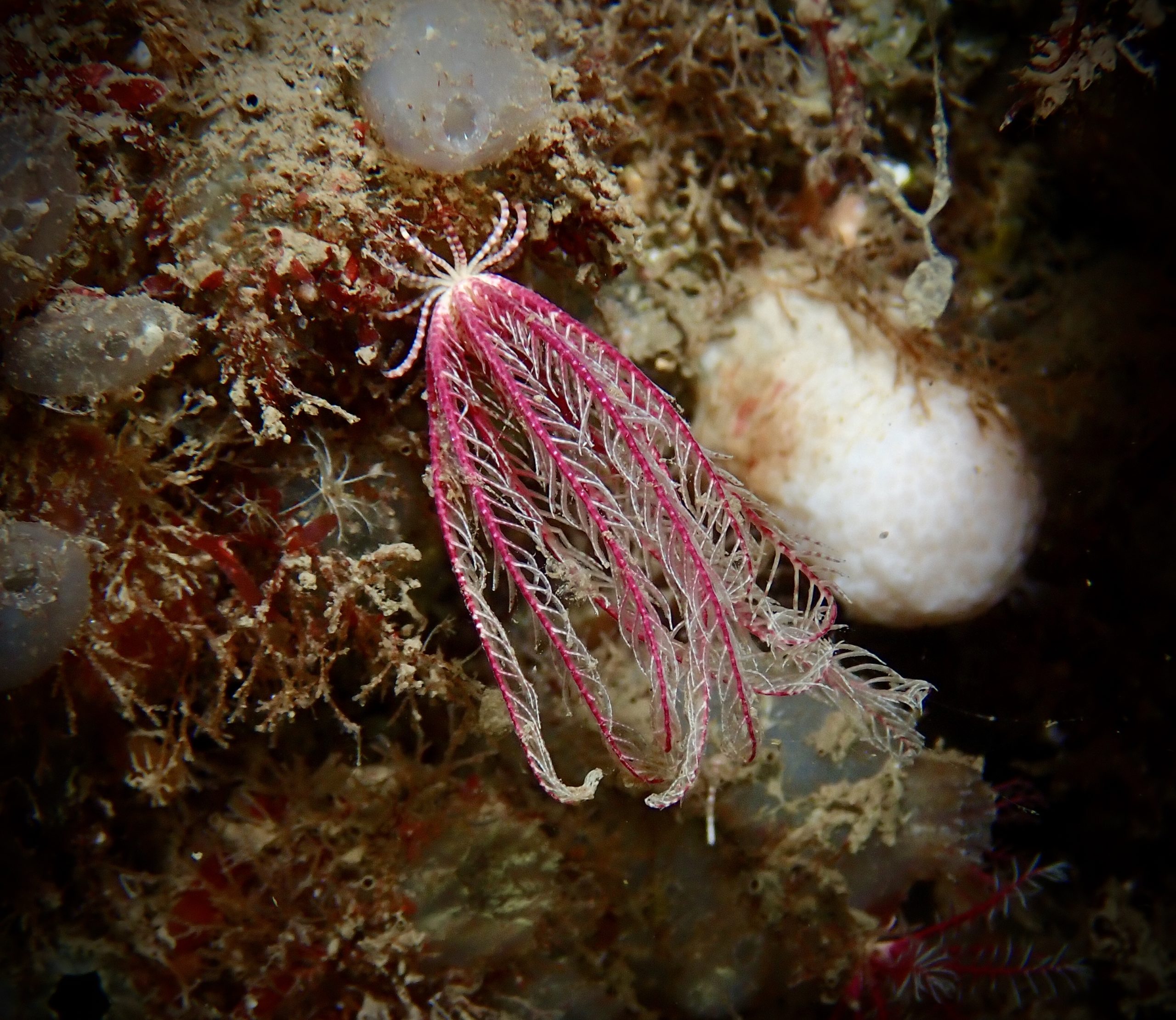
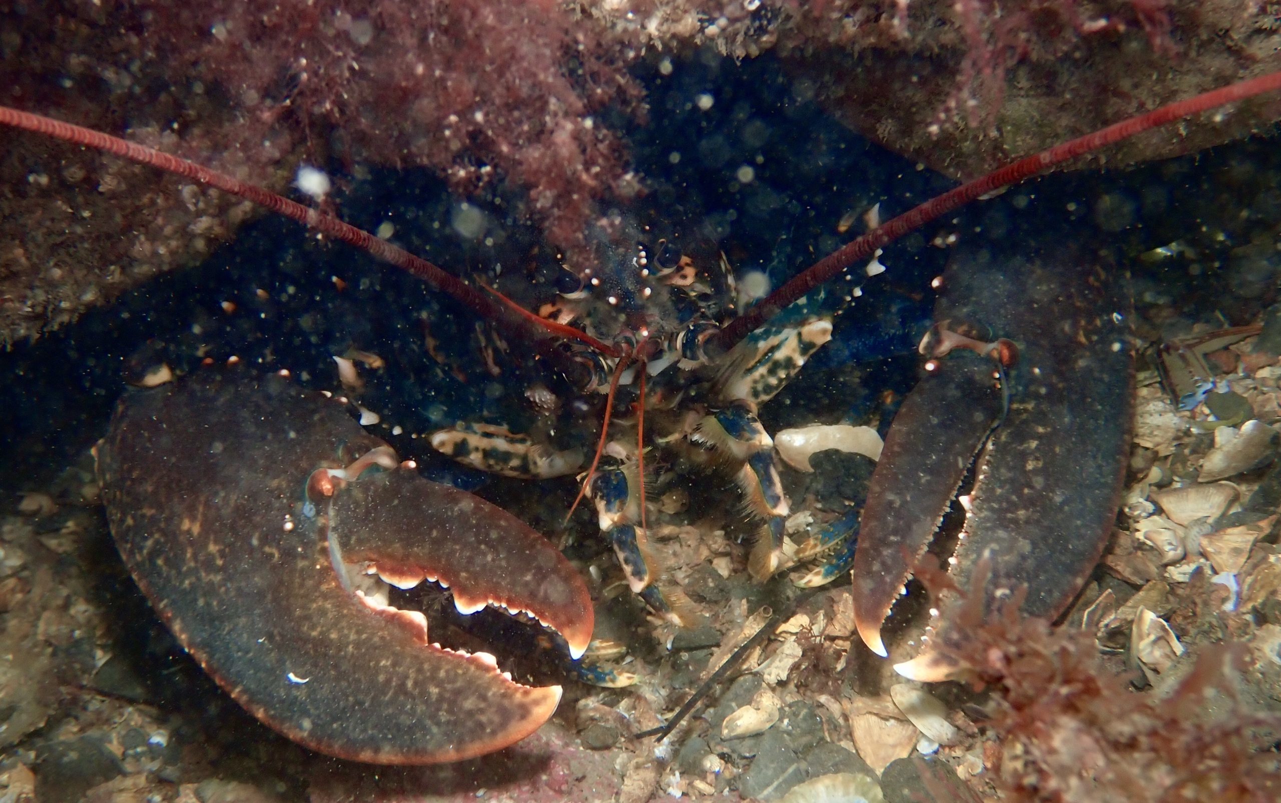
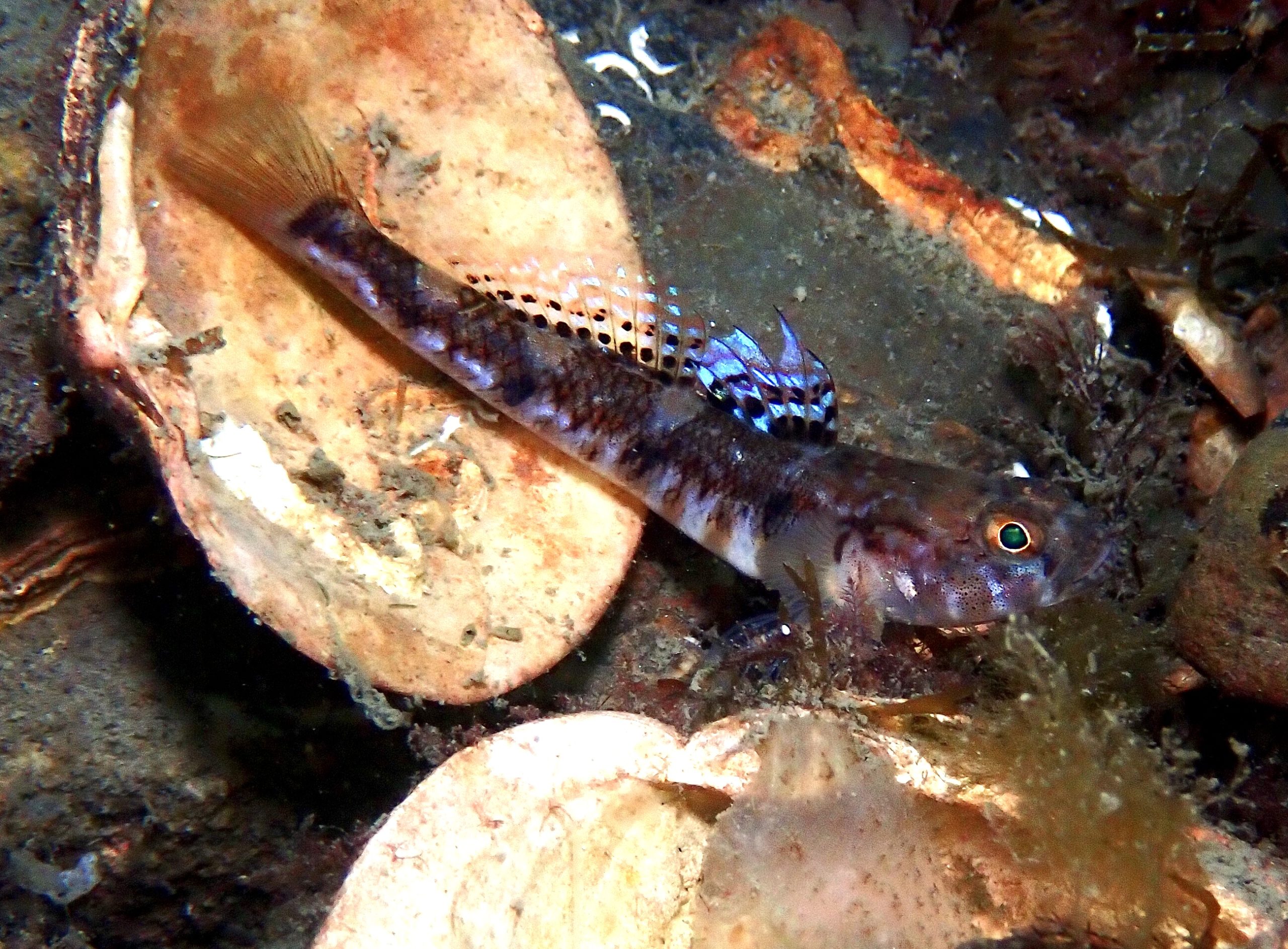
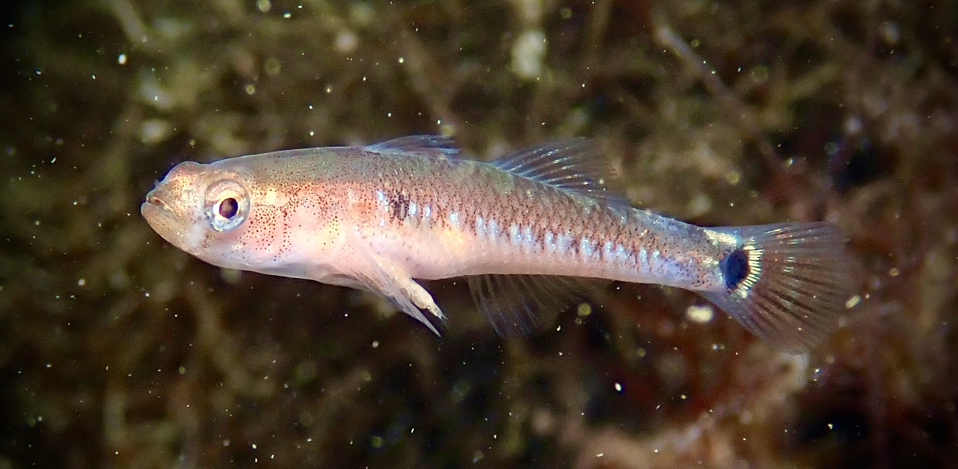
Anemones, sea squirts, urchins and featherstars are all found on the bedrock at this site. Mixed seaweed dominates the course sand where divers can see starfish, crabs and fish including gobies and dragonets. The rare nudibranch Hancockia uncinata was recorded here in August 2020. This was the first record for this species in Northern Ireland! The same diver, Phil Wilkinson then identified the stalked jellyfish Calvadosia campanulata when diving at the site again the following month. This species has only been recorded in Northern Ireland 4 times previously and is listed as a Northern Ireland Priority Species due to its rarity.

View all species records from this site

A link to the dive site location on the NBN Atlas Northern Ireland website, showing all species records from within a 1km boundary of the site centroid. Any new species records from the site submitted to Seasearch, iRecord, CEDaR Online Recording or iNaturalist will appear here
Local Charters: A link to the website for the nearest Dive Centre to the site. A map of all dive centres is provided under ‘Go Diving’

DV Diving

Environmental and Historical Designations: A list of any environmental or historical designations attributed to the site, or overlapping it. Follow the link for more information

Outer Ards ASSI
Outer Ards RAMSAR
East Coast Proposed SPA

More Information: Links to additional information found online for the dive site

Northern Ireland Marine MapViewer

Safety: Safety tips

  • In an emergency call 999 or 112 and ask for the coastguard.
  • Follow VHF radio Channel 16 (156.8 MHz), the international distress frequency. Send a distress alert followed by ‘MAYDAY, MAYDAY, MAYDAY’ and ‘This is [boat name]’.
  • Find nearest defibrillator (AED) here
  • Bangor Harbour Master: 028 9145 3297
  • When navigating within the harbour/marina, use VHF Channel 11
Latitude, Longitude: The approximate XY coordinates for the dive site in Decimel Degrees (DD). These can be converted to DMS or DDM by following the link below
54.670253, -5.657108

Leave a Comment

Dived here recently? Then let other divers know about this site from your experience!

2 thoughts on “Luke’s Point

Leave a Reply

Your email address will not be published. Required fields are marked *

This site uses Akismet to reduce spam. Learn how your comment data is processed.

  1. Phil Wilkinson says:

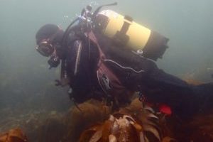
    Quickly becoming my favourite dive site! Another great dive last night. Lots of critters including ling and my buddy spotted a John Dory.

  2. Phil Wilkinson says:

    Another great dive here on Sunday 6th September. 5m+ vis and lots to see ?

Join our Mailing List