Wreck Wreck

M.V. Normanby Hall

Belfast Lough

Average score: 0

Site name: M.V. Normanby Hall
Location: Descriptive location referring to nearest landfall i.e. town, village, harbour or island
Belfast Lough
Type: Describes whether this dive site can be dived from the shore, from a boat, or both
Boat
Wreck: Dive sites which include a shipwreck (or part of a shipwreck) are labelled with a ‘Yes’
Yes
Min. dive depth (m): The approximate minimum depth of the dive given in metres
6
Max. dive depth (m): The approximate maximum depth of the dive given in metres
12

Max. seabed depth (m): The maximum depth of the seabed at the site taken from the intersect between the dive site point and the depth contour on an Admiralty Standard Nautical Chart
12

Diving experience (min level): The recommended minimum level of diving experience for a specific site, described as Novice (<50 dives in temperate/cold waters and minimum certification of PADI Open/Advanced Open Water, BSAC Ocean Diver or CMAS 1 star), Intermediate (50-100 dives in temperate/cold waters and minimum certification of PADI Rescue Dive, BSAC Sports Dive or CMAS 2 star) or Advanced (>250 dives in temperate/cold waters and minimum certification of PADI Divemaster, BSAC Dive Leader or CMAS 3 star
Intermediate

Optimal wind direction: The general wind direction which causes minimal exposure at the site, corresponding to 8 points of the compass: North (N), North East (NE), East (E, South East (SE), South (S), South West (SW), West, North West (NW)
W/NW/N

Exposure: The approximate level of exposure to wind and wave action at the site on any given day, described as Sheltered (inshore sites surrounded by a form of shelter on all sides), Moderate (sites which are partially sheltered) or Exposed (sites with little to no shelter)
Exposed

Tidal strength: Anecdotal description of tidal strength at the site
Moderate

Marine Protected Area: A Yes or No highlighting whether or not the site occurs within a Marine Protected Area
Yes

Visibility: Anecdotal description of the typical underwater visibility at the site
Typically ~3-8 metres. However a silty seabed, when disturbed can reduce vis for long periods to <1 metre.
Best time to dive: Anecdotal recommendation for the best time to dive the site for optimal underwater conditions. This typically relates to the stage of the tide
1 hour before HW Belfast
Getting there: Directions for getting to the site

By boat from Bangor, Groomsport or Whitehead. The wreck is located ~1km SW off the end of the Cloghan Point Fuel Terminal.

Facilities: Details of nearest facilities to dive site i.e. public car parking and toilets, slipways etc

Free car parking and toilet facilities are available at Whitehead car park, above the Whiteharbour slipway. Whiteharbour is privately owned. For access call the Harbour Master: 028 9338 2549.

Groomsport has two slipway launching points and access to public toilets on Harbour road. Car parking is available adjacent to the harbour.

Free car parking is available above Bangor Marina and public toilets are available at South Pier. The slipway to the north of the car park is primarily a means of launching Bangor’s Atlantic 85 lifeboat and use is restricted to season ticket holders and Bangor Marina/harbour users. For more information, visit: http://www.quaymarinas.com/cookie-preferences-page/

Nearest tank filling is DV Diving, Mount Stewart, Newtownards.

Hazards: Anecdotal information on possible hazards at the site for divers and snorkellers

  • The site is less than 200 metres from the Cairnryan-Belfast ferry route
  • Visibility can be very poor if the silty seabed is disturbed.
Description: A general description of the physical features of the dive site

The wreckage is broken up and scattered over a silty and muddy seabed.

History: The history of the wreck provided by the Senior Marine Archaeologist from the Department for Communities Historic Environment Division (only included for wreck sites)

Date of loss 08/10/1065. See Irish Wrecks Online

Biodiversity: A description of the species composition at the site. Species of interest are highlighted. Follow the links for more information about the species on the NBN Atlas Northern Ireland website

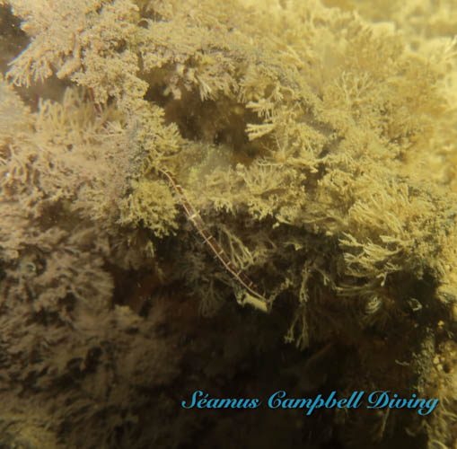
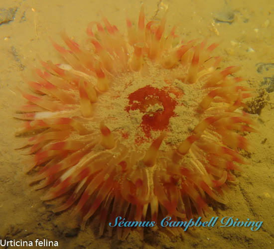
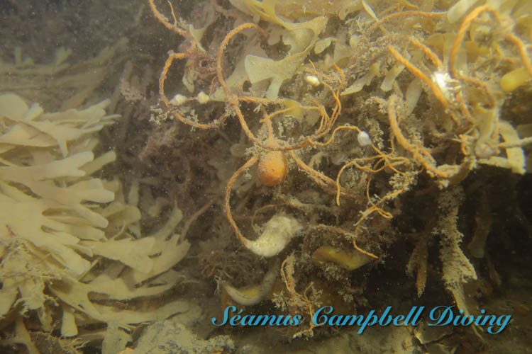
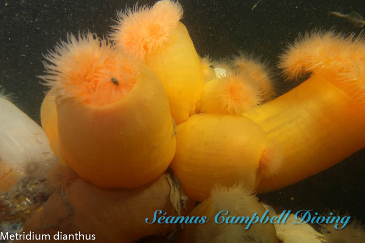
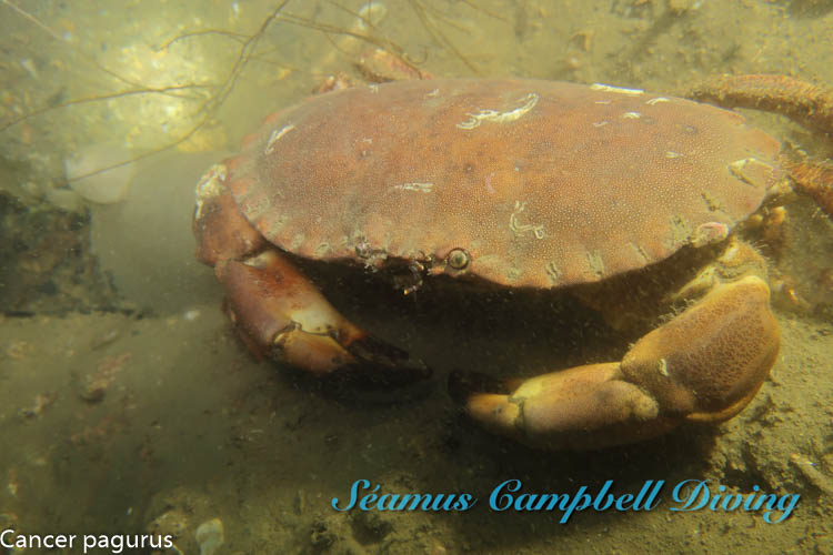
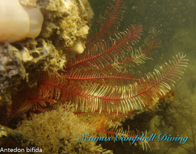
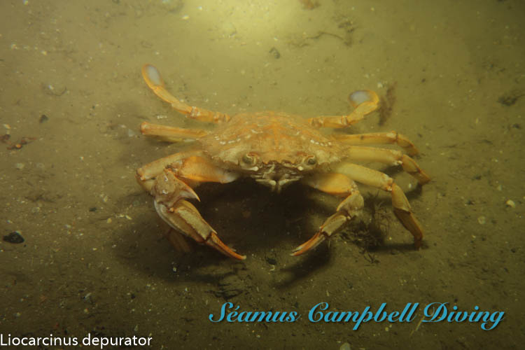
The wreckage is covered in abundant plumose anemones Metridium diaphanus. Other species in and around the wreckage include the sponge Dysidea fragilis, the hydroid Nemertesia antennina, feather stars Antedon bifida and small shoals of various fish species. The surrounding muddy seabed has many holes and burrows.

View all species records from this site

A link to the dive site location on the NBN Atlas Northern Ireland website, showing all species records from within a 1km boundary of the site centroid. Any new species records from the site submitted to Seasearch, iRecord, CEDaR Online Recording or iNaturalist will appear here
Local charters: A link to the website for the nearest Dive Centre to the site. A map of all dive centres is provided under ‘Go Diving’

DV Diving

Environmental and Historical Designations: A list of any environmental or historical designations attributed to the site, or overlapping it. Follow the link for more information

East Coast Proposed Marine SPA

More information: Links to additional information found online for the dive site

Irish Wrecks Online – M.V. Normanby Hall

Diving.ie – County Antrim Wrecks

Northern Ireland Marine MapViewer

Safety: Safety tips

  • In an emergency call 999 or 112 and ask for the coastguard.
  • Follow VHF radio Channel 16 (156.8 MHz), the international distress frequency. Send a distress alert followed by ‘MAYDAY, MAYDAY, MAYDAY’ and ‘This is [boat name]’.
  • Find nearest defibrillator (AED) here.
  • Bangor Harbour Master: 028 9145 3297. When navigating within the harbour/marina, use VHF Channel 11
  • Groomsport Harbour Master: 028 9188 2377
  • Whiterock (Whiteharbour) Harbour Master: 028 933 82549
Latitude, Longitude: The approximate XY coordinates for the dive site in Decimel Degrees (DD). These can be converted to DMS or DDM by following the link below
54.724615, -5.725785

Leave a Comment

Dived here recently? Then let other divers know about this site from your experience!

Leave a Reply

Your email address will not be published. Required fields are marked *

This site uses Akismet to reduce spam. Learn how your comment data is processed.

Join our Mailing List