Wreck Wreck

M.Y. Alastor

Strangford Lough

Average score: 5

Site name: M.Y. Alastor
Location: Descriptive location referring to nearest landfall i.e. town, village, harbour or island
Strangford Lough
Type: Describes whether this dive site can be dived from the shore, from a boat, or both
Shore/Boat
Wreck: Dive sites which include a shipwreck (or part of a shipwreck) are labelled with a ‘Yes’
Yes
Min. dive depth (m): The approximate minimum depth of the dive given in metres
7
Max. dive depth (m): The approximate maximum depth of the dive given in metres
23

Max. seabed depth (m): The maximum depth of the seabed at the site taken from the intersect between the dive site point and the depth contour on an Admiralty Standard Nautical Chart
23

Diving experience (min level): The recommended minimum level of diving experience for a specific site, described as Novice (<50 dives in temperate/cold waters and minimum certification of PADI Open/Advanced Open Water, BSAC Ocean Diver or CMAS 1 star), Intermediate (50-100 dives in temperate/cold waters and minimum certification of PADI Rescue Dive, BSAC Sports Dive or CMAS 2 star) or Advanced (>250 dives in temperate/cold waters and minimum certification of PADI Divemaster, BSAC Dive Leader or CMAS 3 star
Advanced

Optimal wind direction: The general wind direction which causes minimal exposure at the site, corresponding to 8 points of the compass: North (N), North East (NE), East (E, South East (SE), South (S), South West (SW), West, North West (NW)
SW/W/NW

Exposure: The approximate level of exposure to wind and wave action at the site on any given day, described as Sheltered (inshore sites surrounded by a form of shelter on all sides), Moderate (sites which are partially sheltered) or Exposed (sites with little to no shelter)
Sheltered

Tidal strength: Anecdotal description of tidal strength at the site
Strong

Marine Protected Area: A Yes or No highlighting whether or not the site occurs within a Marine Protected Area
Yes

Visibility: Anecdotal description of the typical underwater visibility at the site
Poor. Divers are recommended to keep off the seabed to avoid kicking up silt. Ranges from 2-6 metres.
Best time to dive: Anecdotal recommendation for the best time to dive the site for optimal underwater conditions. This typically relates to the stage of the tide
Best time is 5th hour of flood or ebb. It’s generally OK to dive here anytime apart from the first 2 hours of ebb or 2nd hour of flood.
Getting there: Directions for getting to the site

For a shore dive, there is a line that leads you out to the wreck from Ringhaddy Quay. Firstly you need to find a pipe approximately 3m out and 3m right from right hand edge of pier when looking at the shore. Follow this pipe to approx 8/10m to find a yellow cable going to the left of the pipe which then changes into a black cable that leads you to the wreck.

For a boat dive, a marker buoy is attached to a small bollard at the stern at 18m. For more detail, see links provided in ‘More Information’ below.

Facilities: Details of nearest facilities to dive site i.e. public car parking and toilets, slipways etc

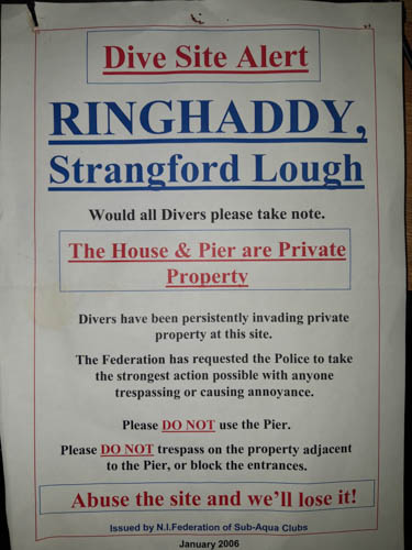
Parking is very limited along the access road, therefore be careful to leave plenty of space for residents and other road users. The Ringhaddy Cruising Club is for club members only. Do not use the private jetty nearby!

Hazards: Anecdotal information on possible hazards at the site for divers and snorkellers

  • Pleasure boat traffic.
  • Litter: regular reports of tyres, bottles, and plastics in and around the wreck.
Description: A general description of the physical features of the dive site

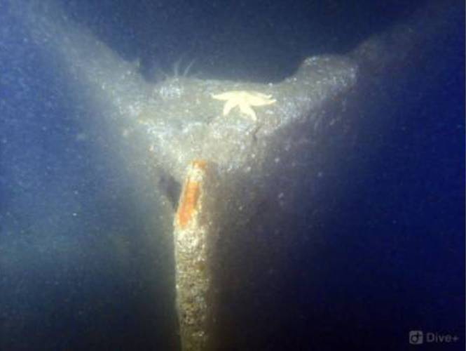
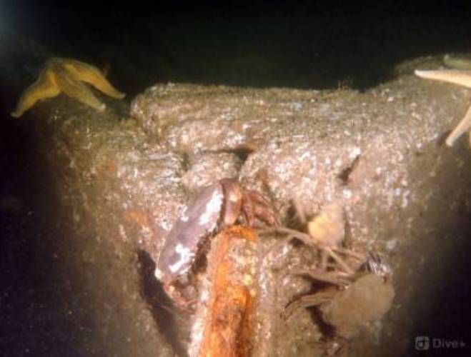
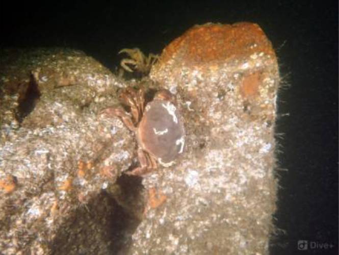
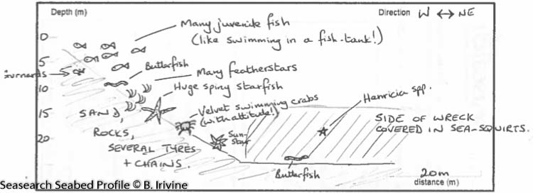
A muddy, gravelly, sandy slope with cobbles that leads down to the wreck at a chart depth of 23 metres. The wreck is sitting upright and almost entirely intact with an upright funnel. Wooden decks are decayed and wheelhouse is collapsed. This is a very silty site, so divers are recommended to keep off the seabed. Instead of swimming out to the wreck, you will find a nice shallower dive along the cable around 10 metres, with plenty of life.

History: The history of the wreck provided by the Senior Marine Archaeologist from the Department for Communities Historic Environment Division (only included for wreck sites)

Date of loss 11/03/1946. A luxury motor yacht M.Y. Alastor, ex M.Y. Vita. A report produced by QUB Sub-Aqua Club (see Brabetz, Callaghan and Snijder 2004) has proven that the wreck is not that of the M.Y. Alisdair, but that of the Vita, a luxury diesel yacht that Camper & Nicholsons built for the millionaire and America’s Cup challenger Sir Thomas Octave Murdoch Sopwith in 1926. In July 1939, the Alastor was acquired by the Ministry of War Transport. The Admiralty kept the Alastor until 1946, when she was considered redundant and sold to the Greek government. Alastor was relocated to Ringhaddy Sound, where she was to be repainted in preparation for her new role in Greece. She caught fire and sank at her mooring 11/03/1946. (Brabetz, Callaghan and Snijder 2004).

Information derived from Historic Environment Record of Northern Ireland (HERoNI), Department for Communities, Historic Environment Division.


Biodiversity: A description of the species composition at the site. Species of interest are highlighted. Follow the links for more information about the species on the NBN Atlas Northern Ireland website

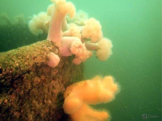
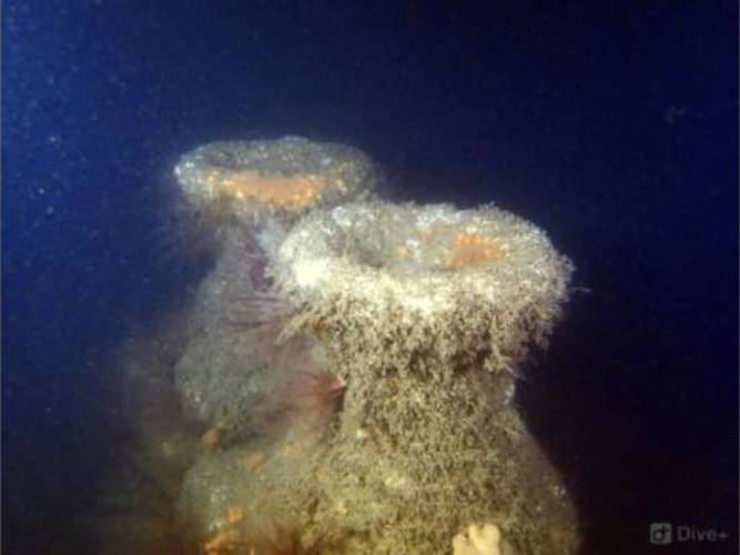
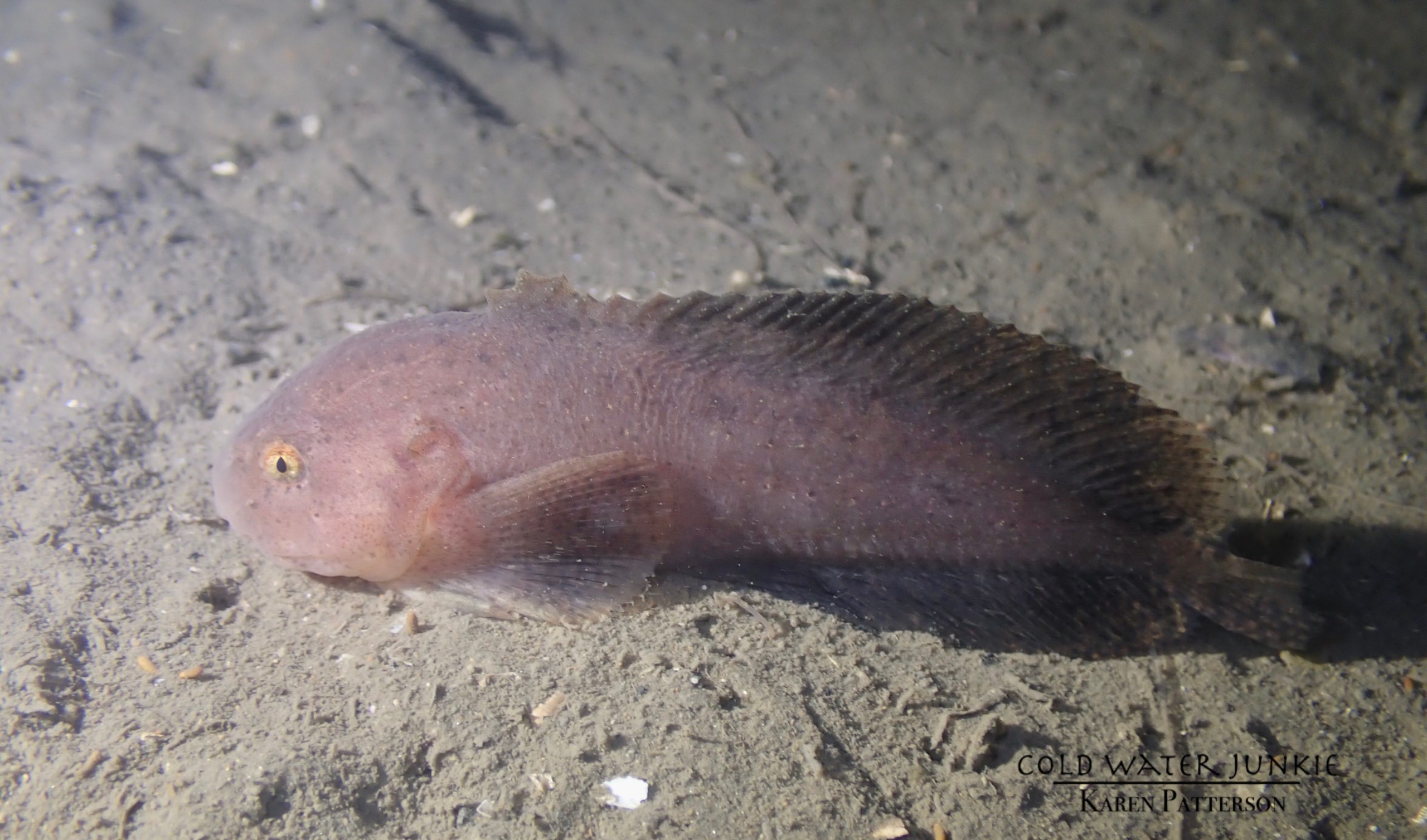
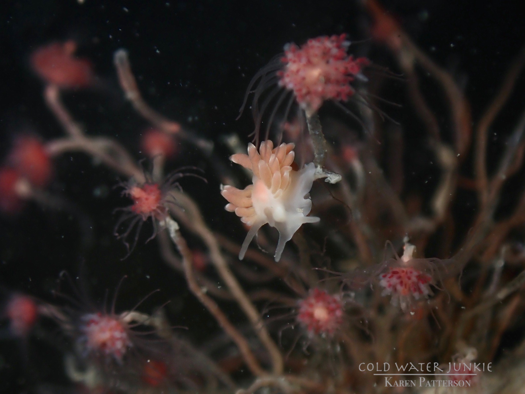
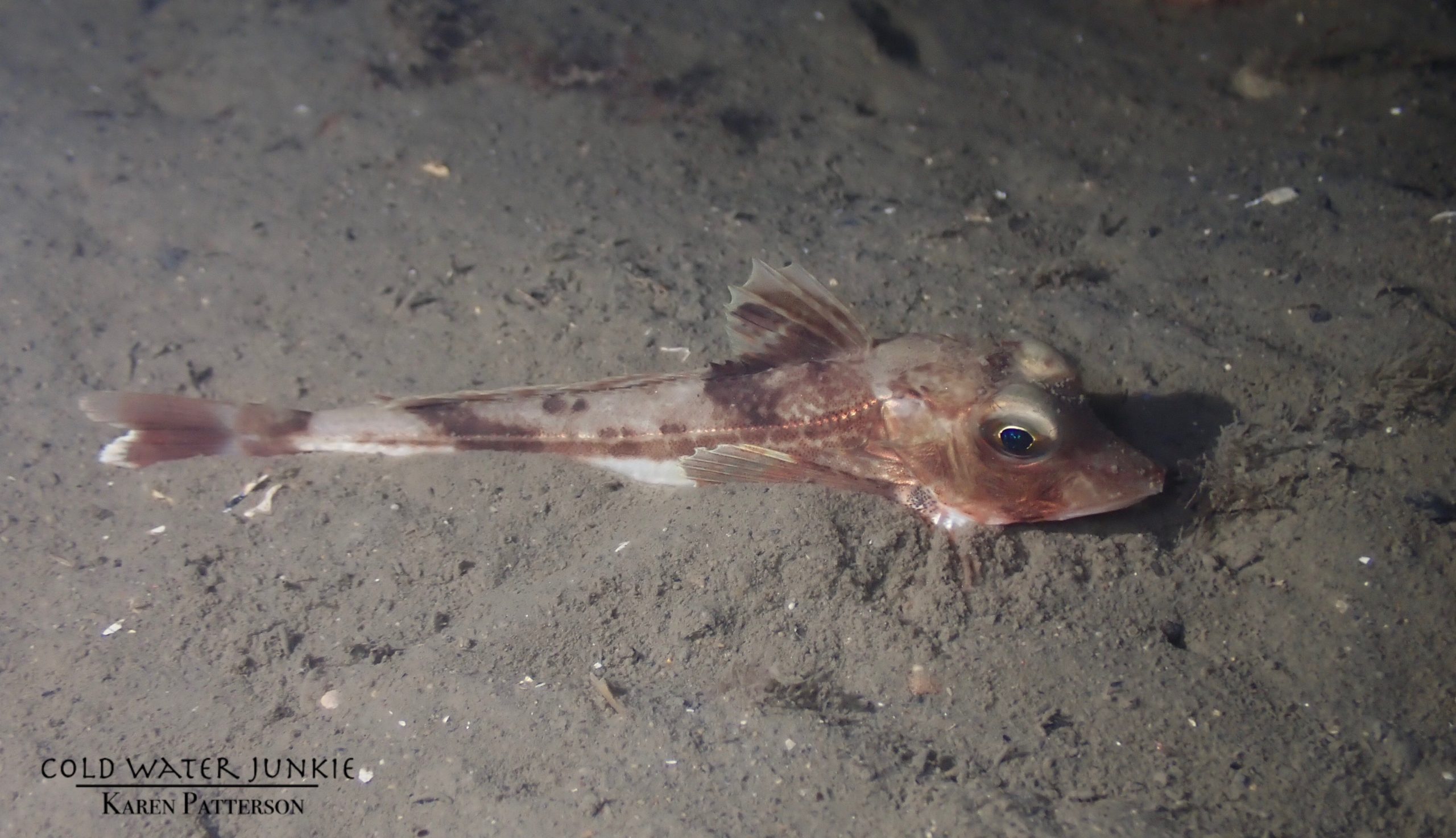
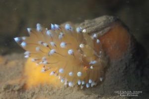
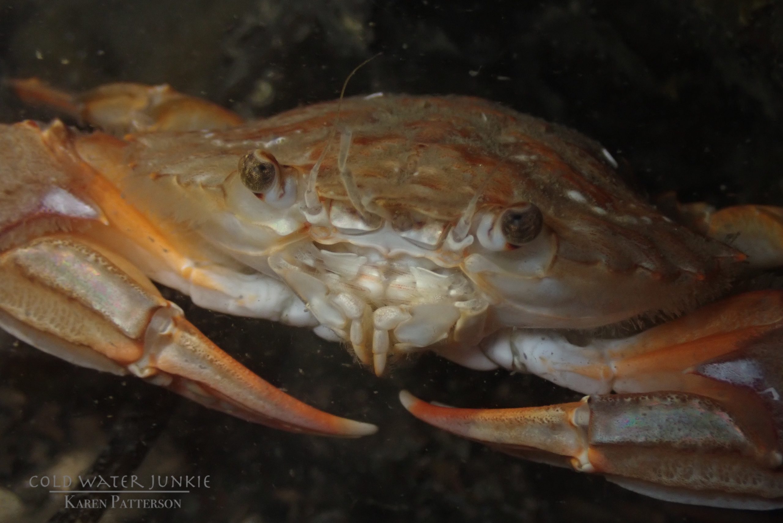
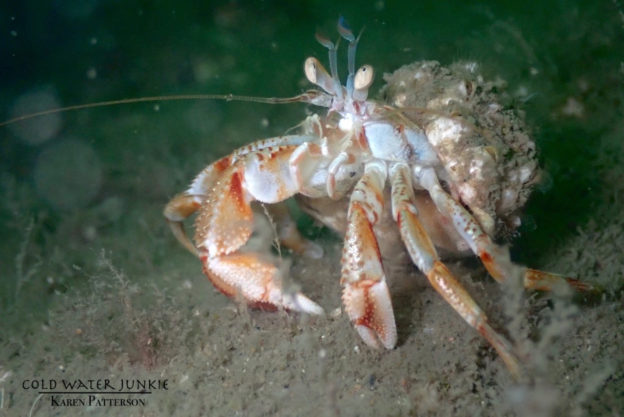
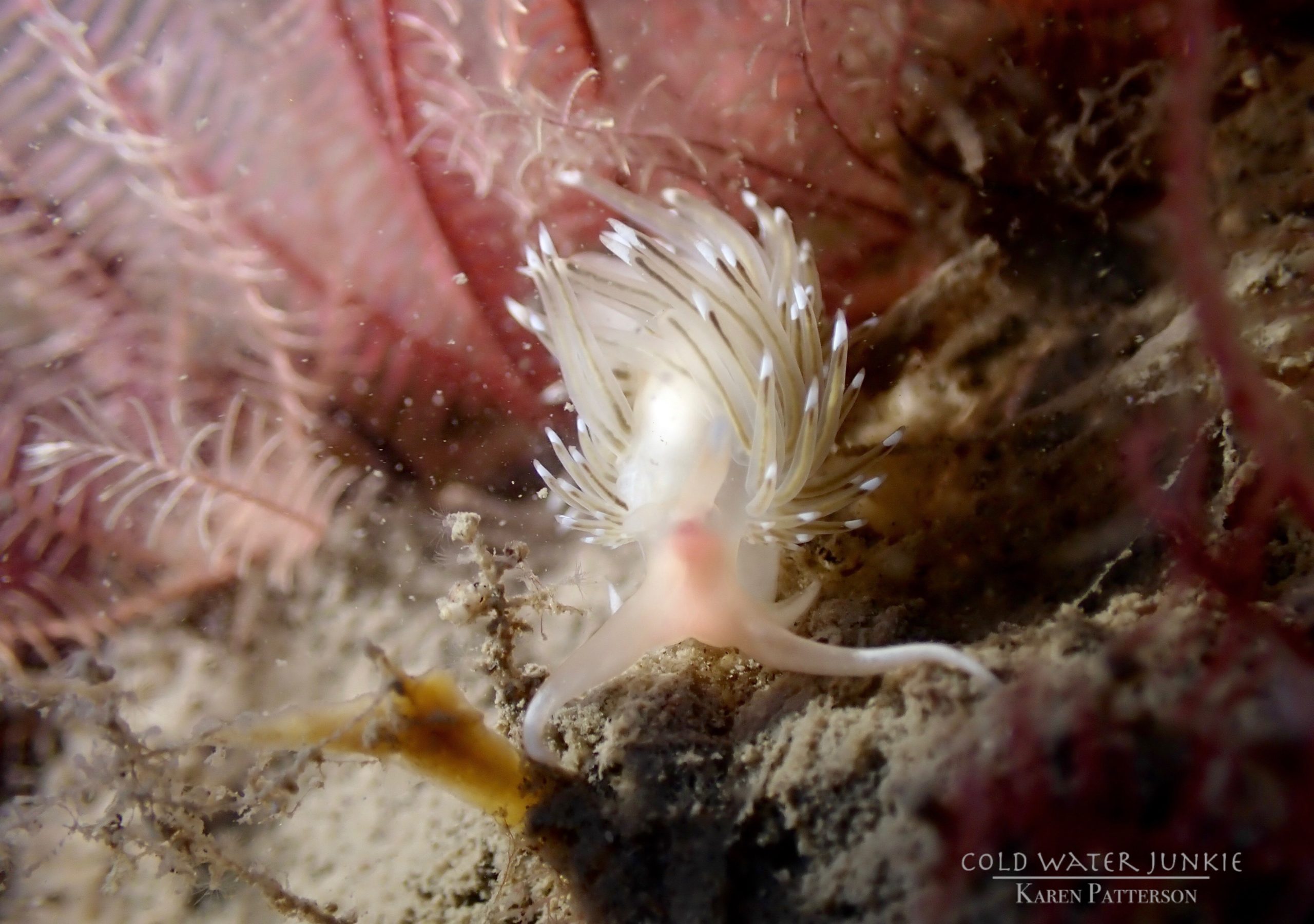
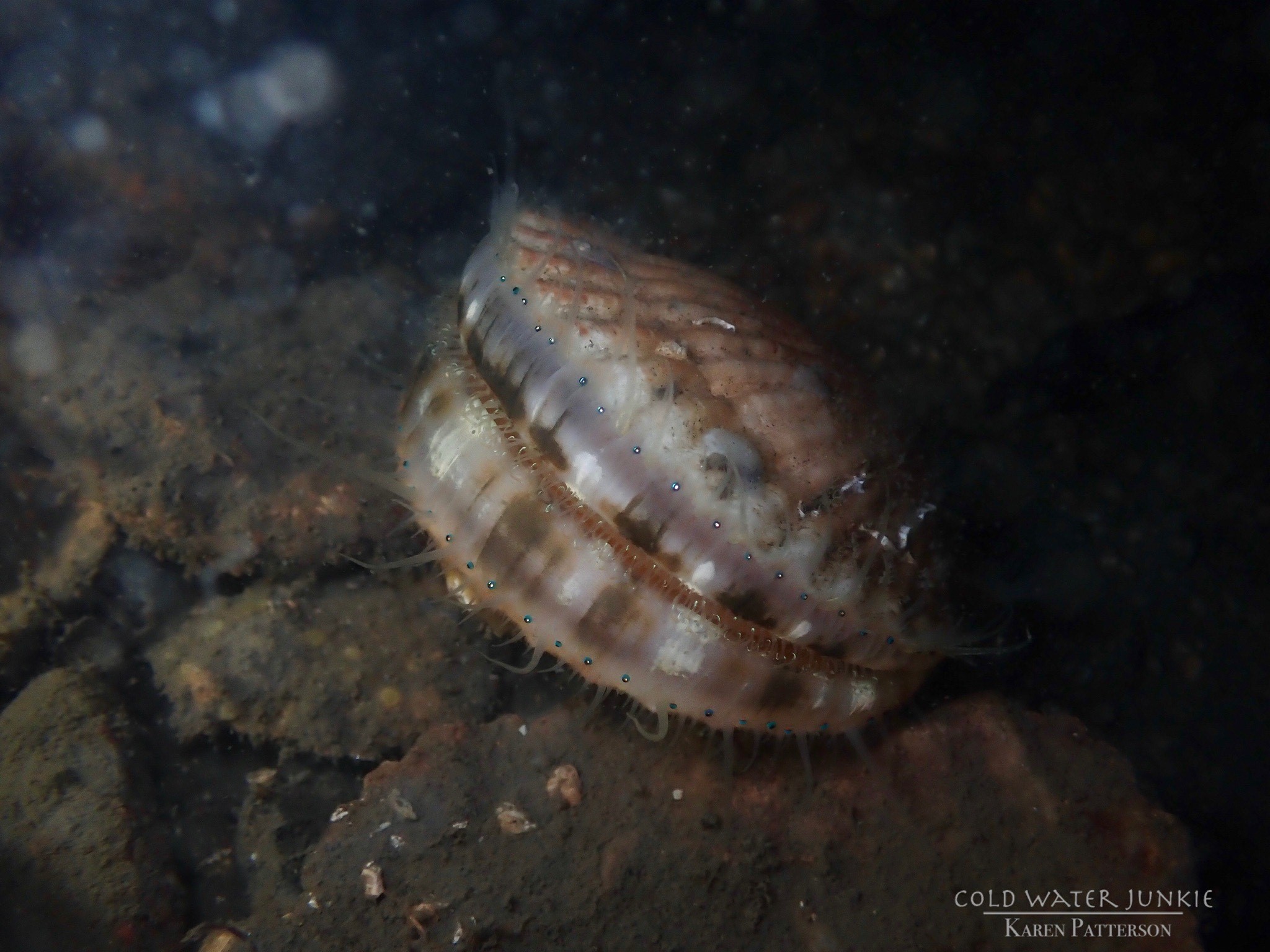
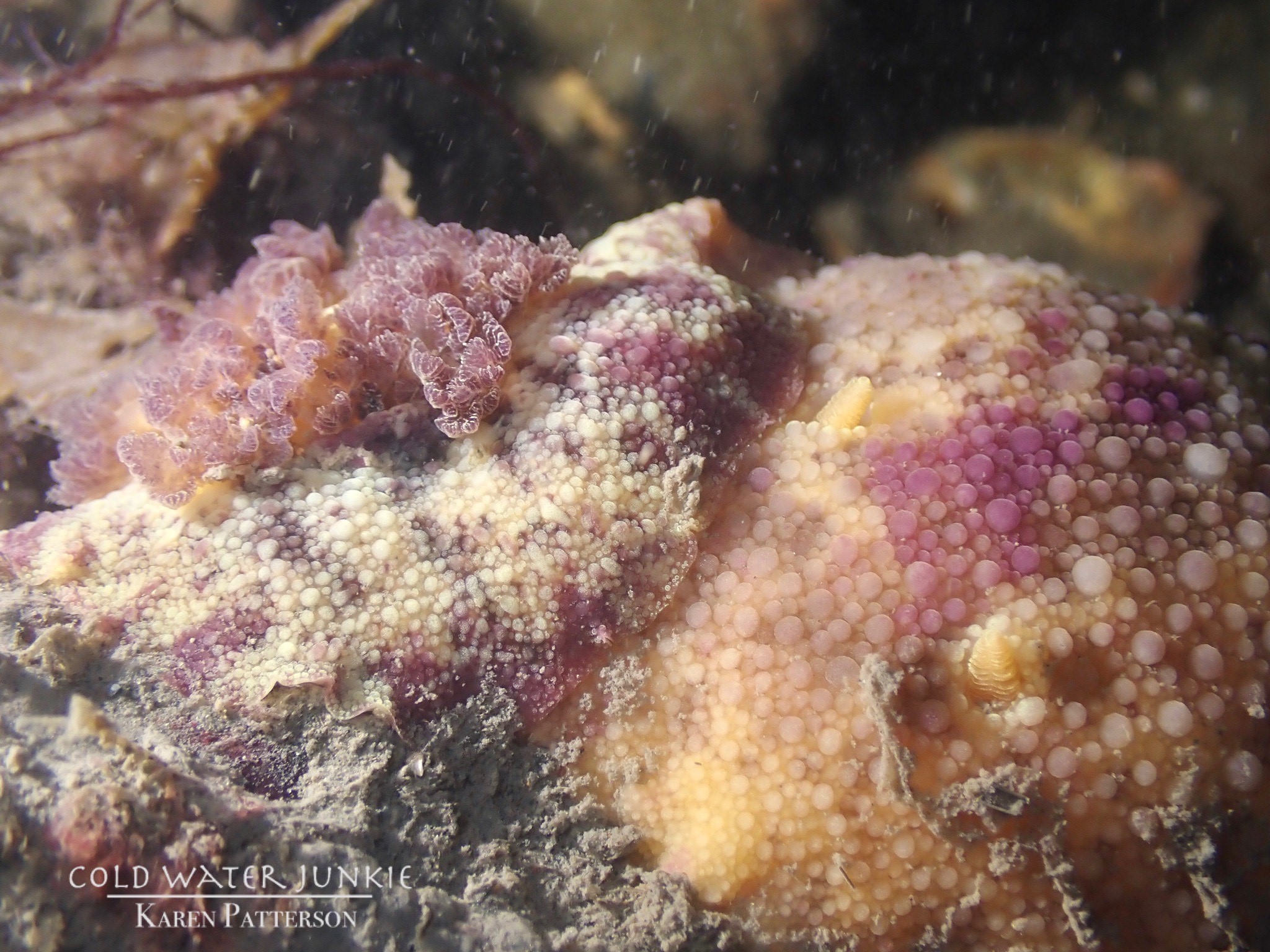
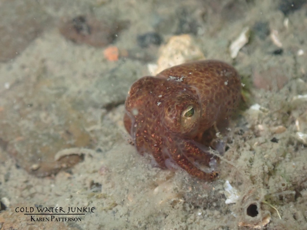
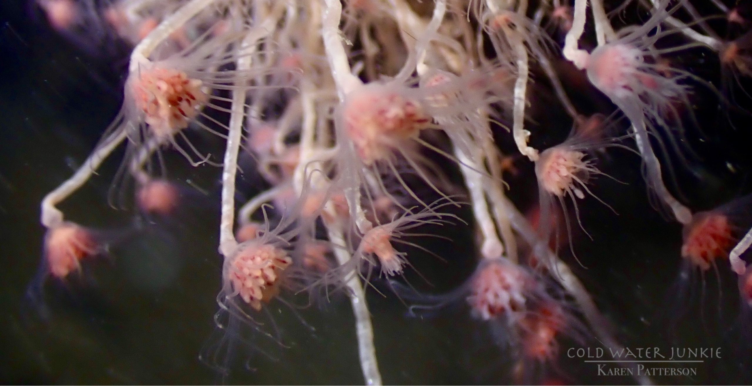
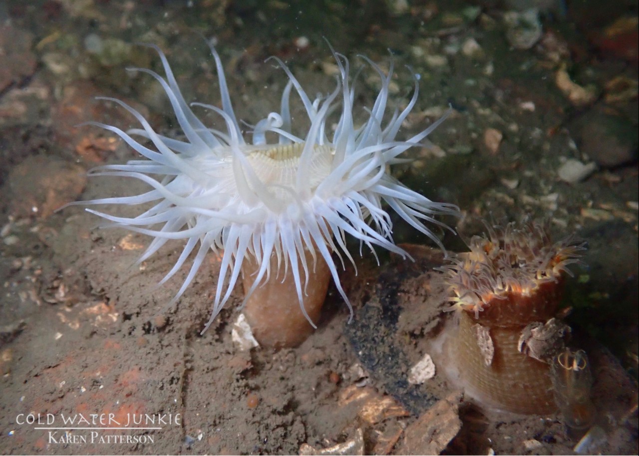
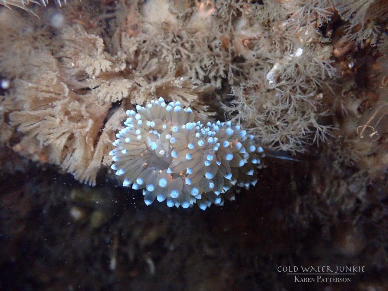
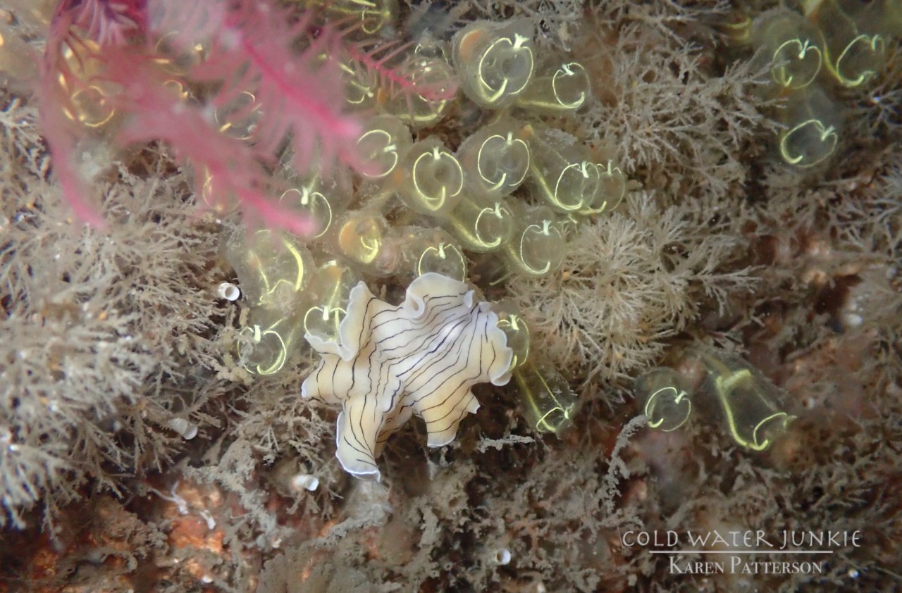
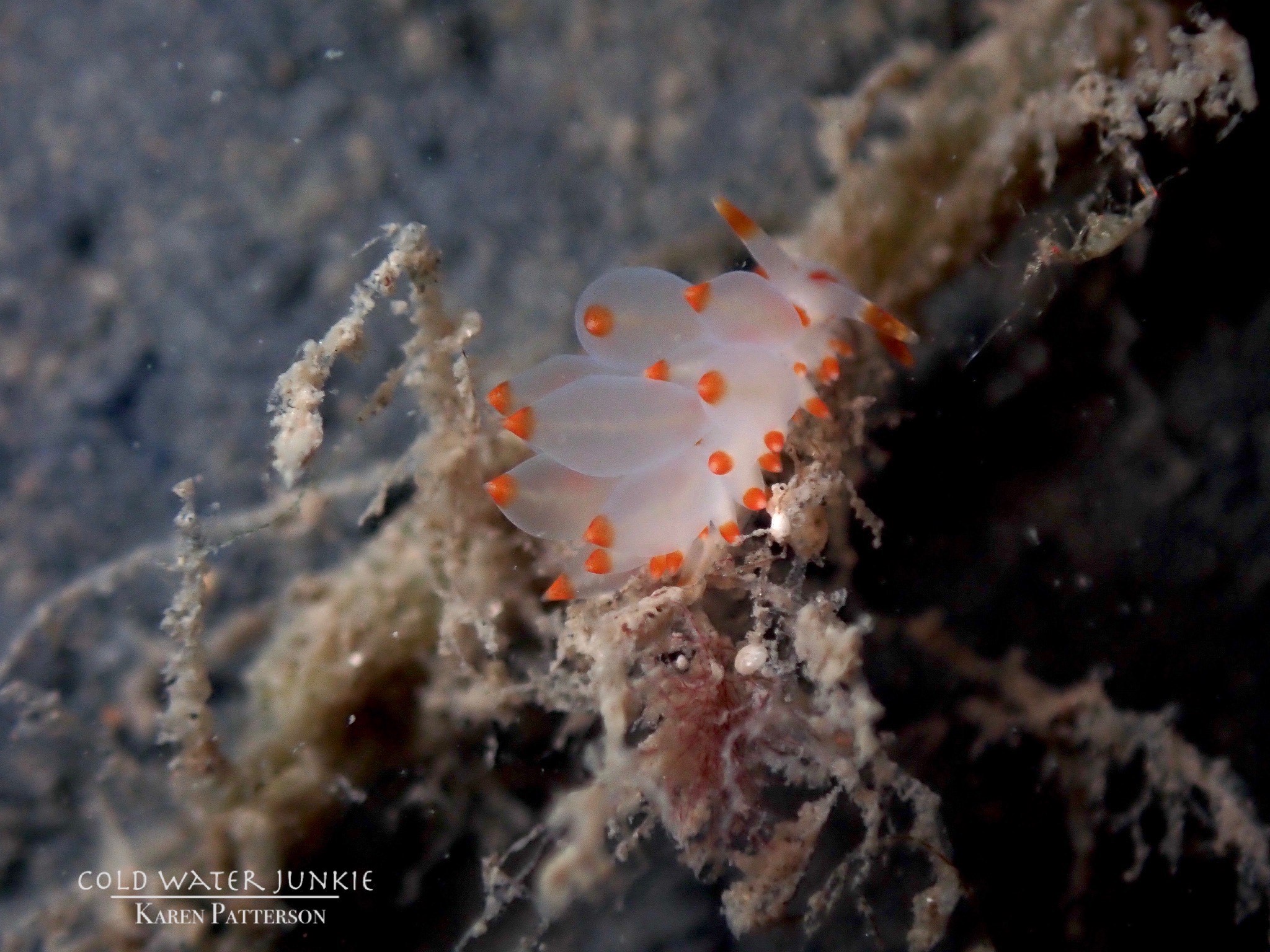
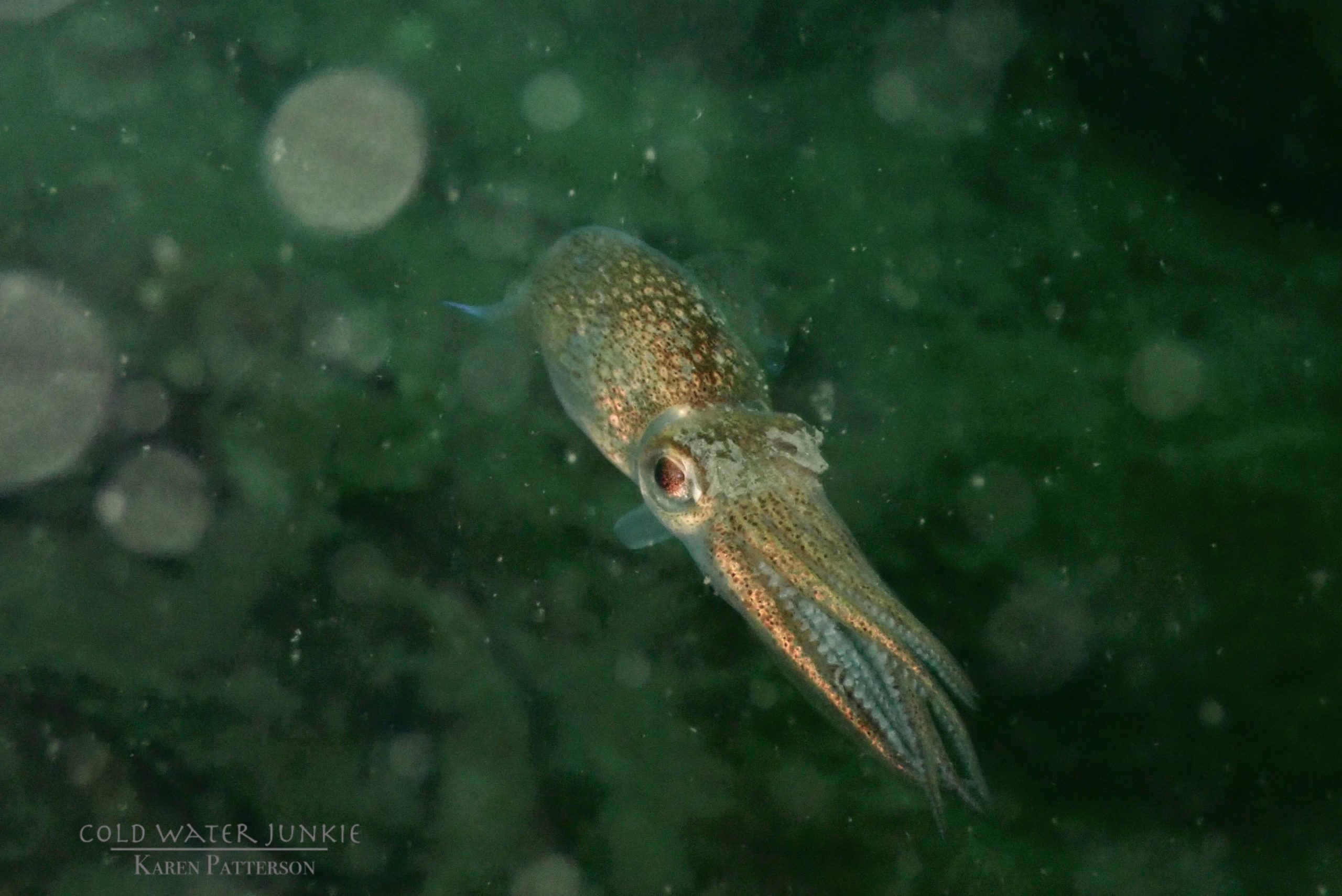
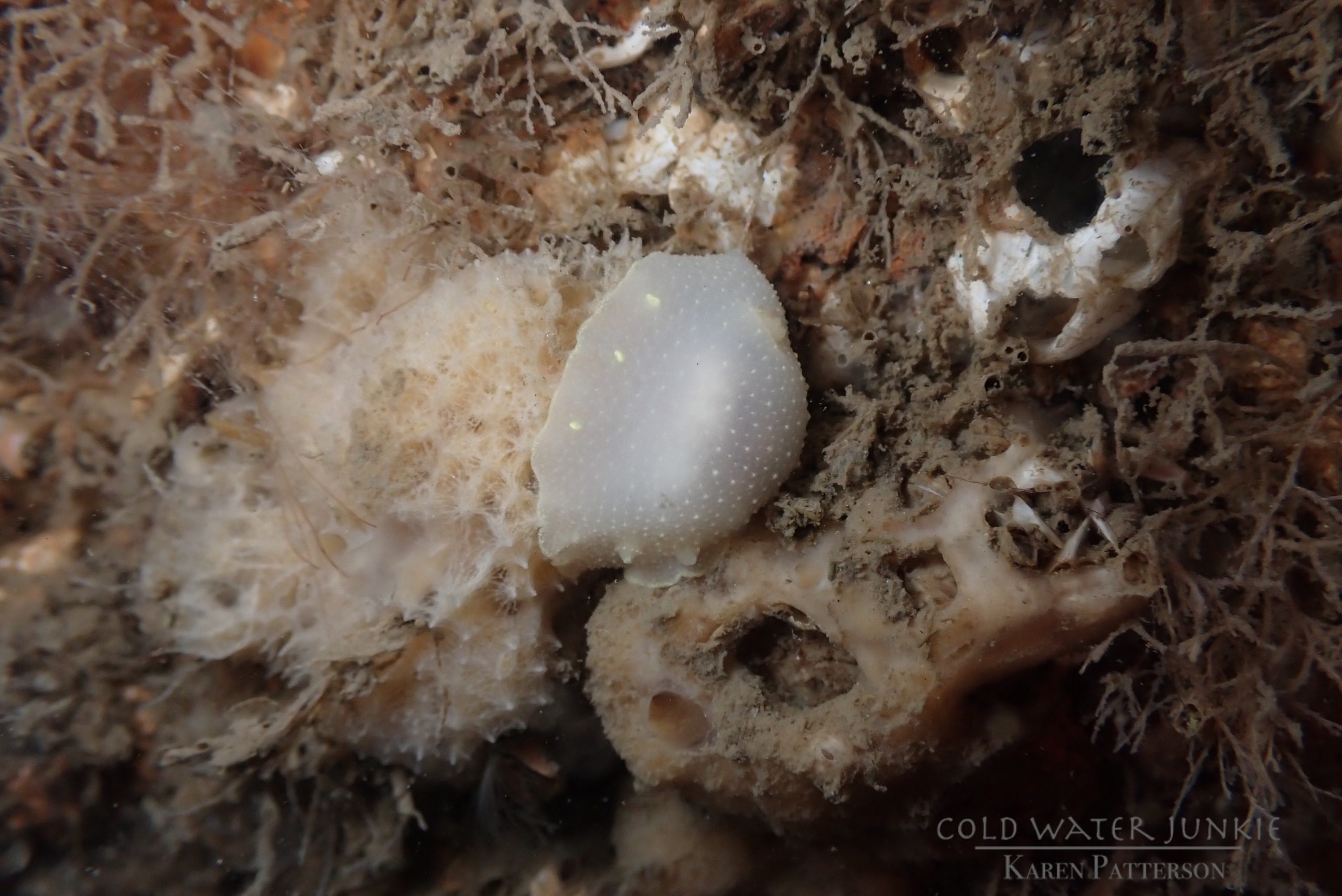
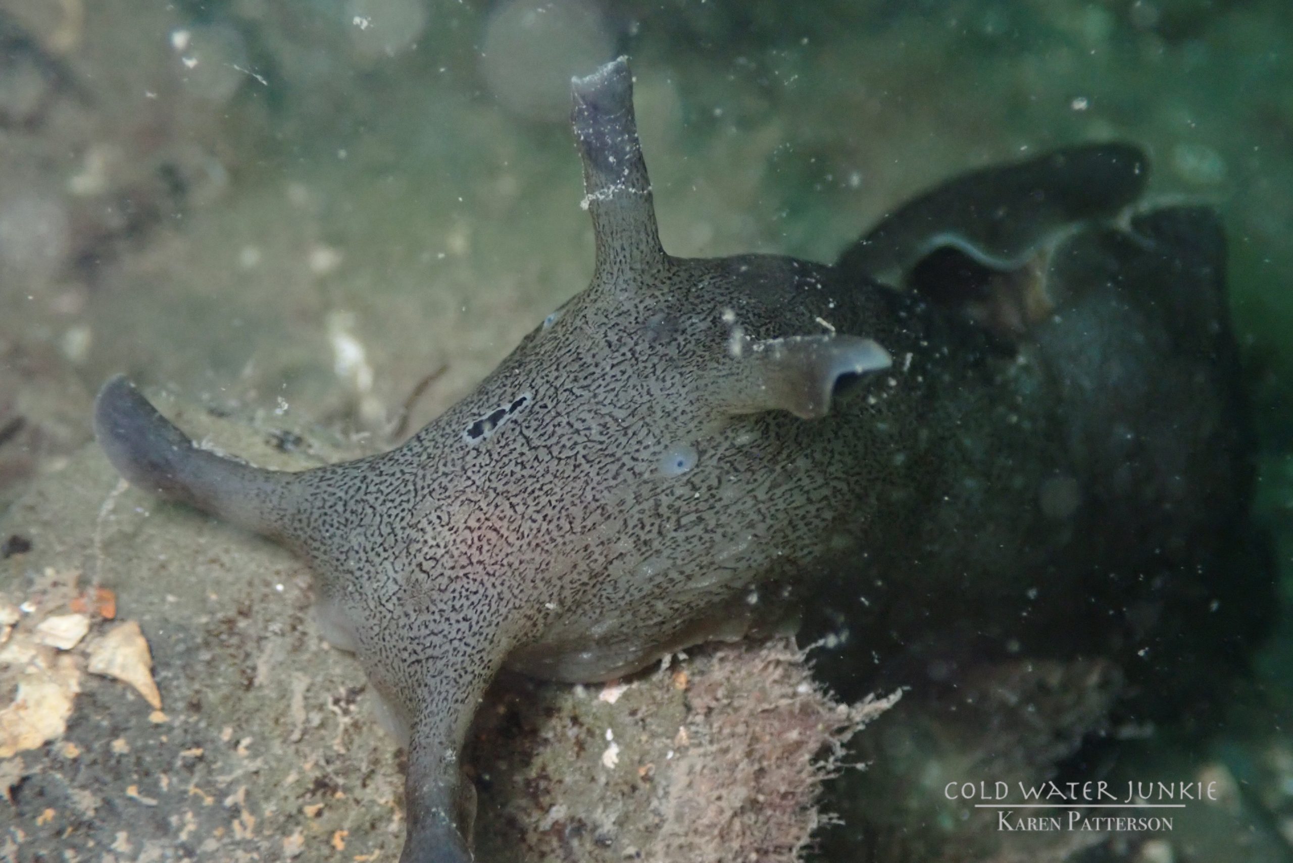
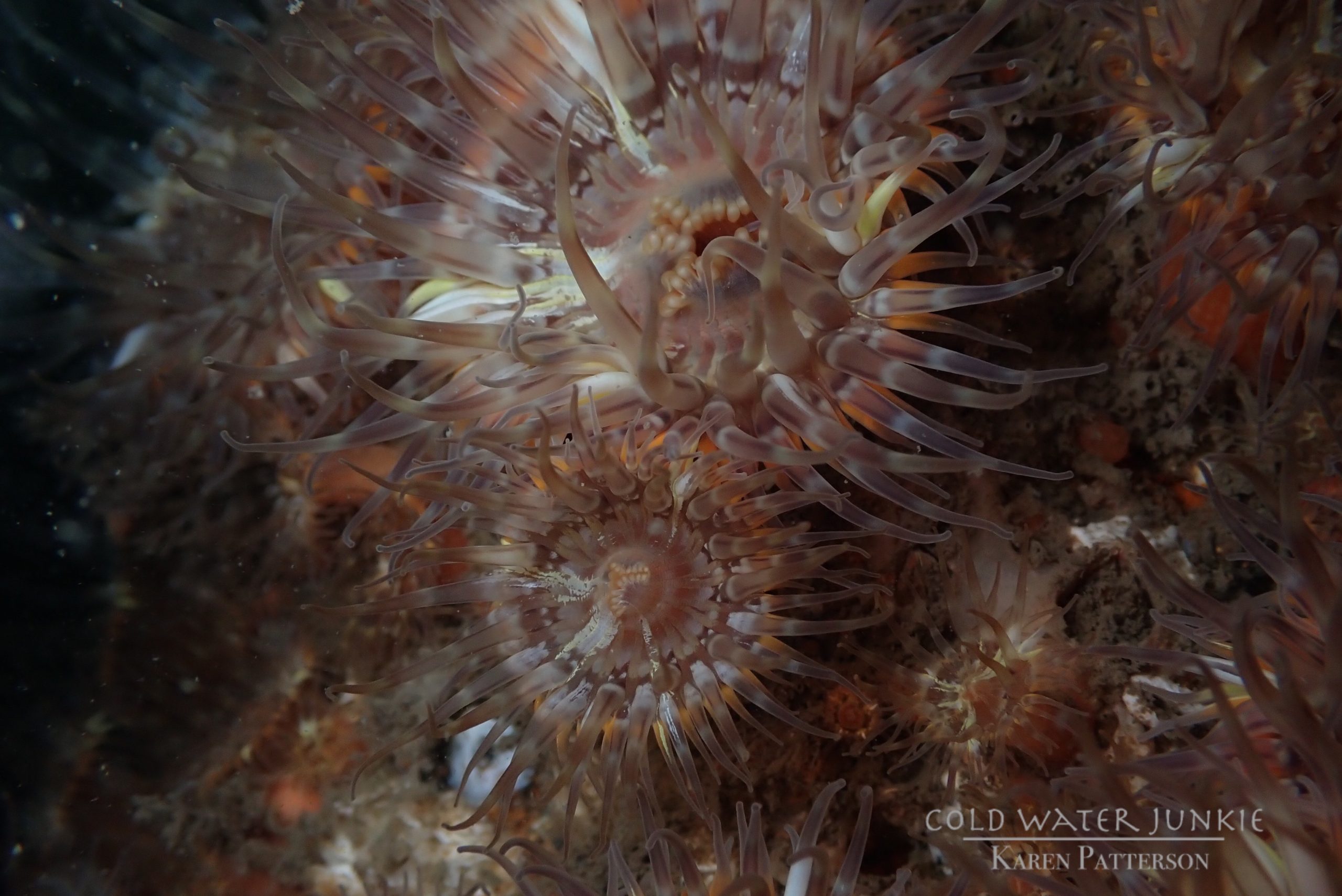
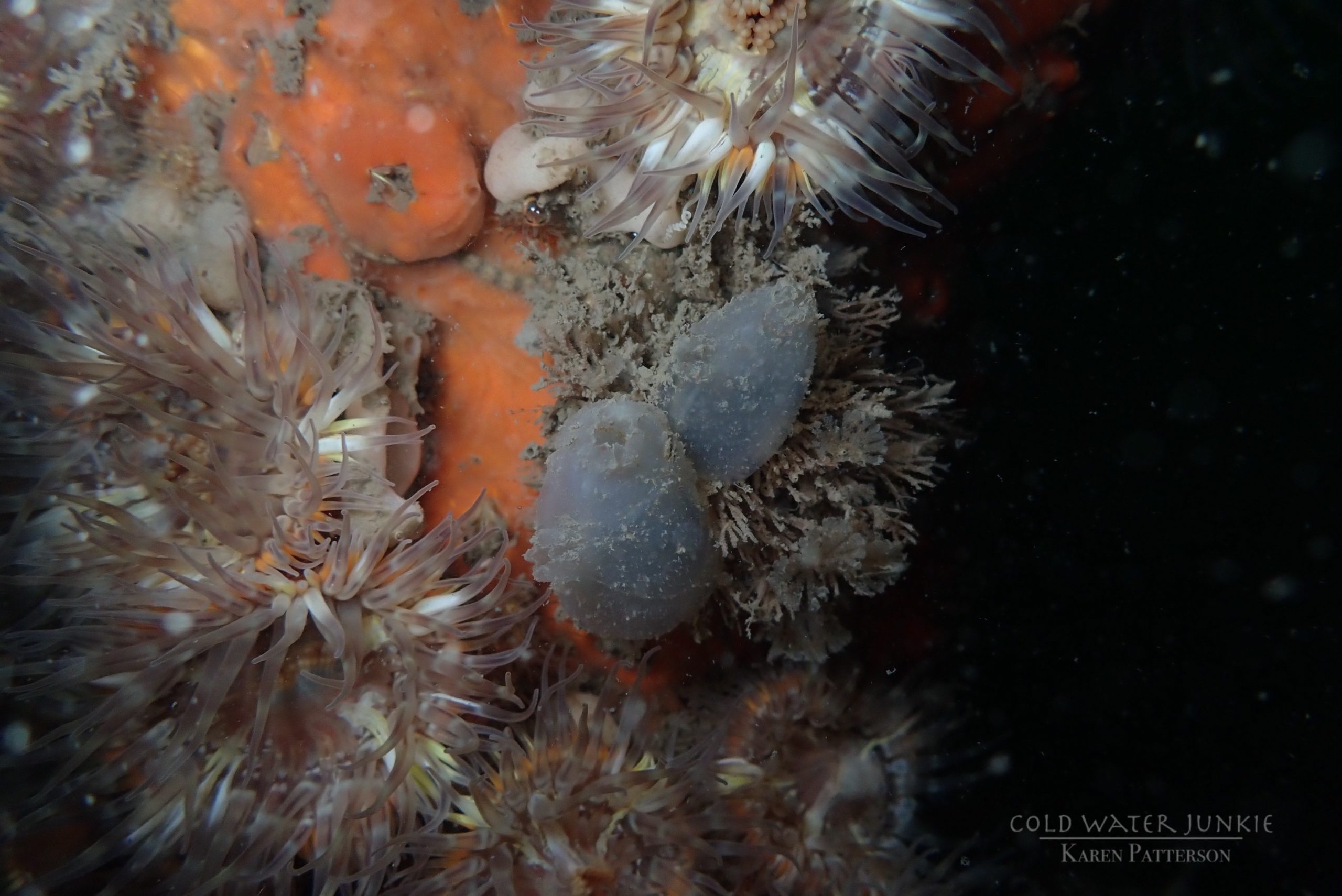
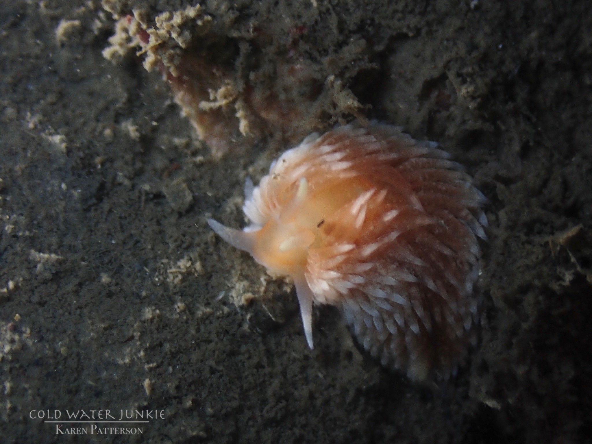
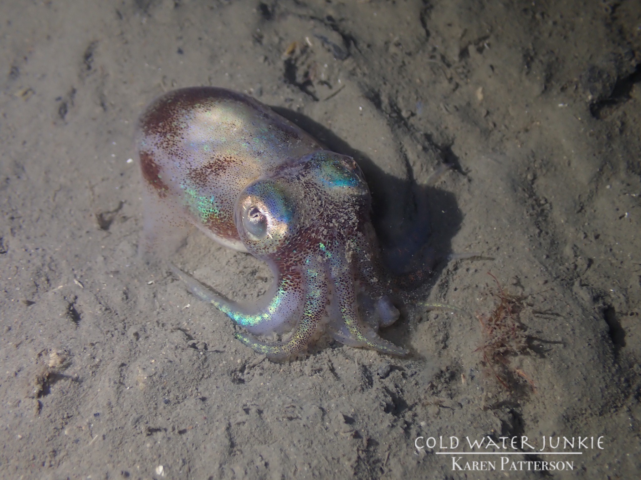
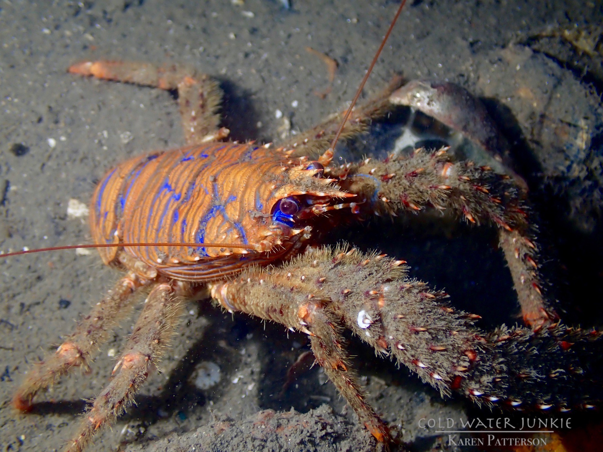
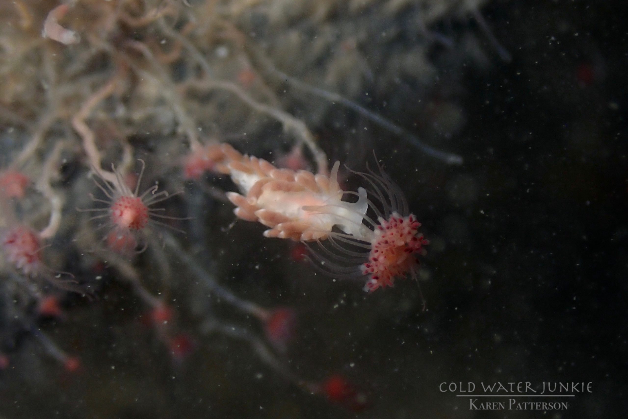
The wreck is covered in sea squirts and dead men’s fingers. Following the cable leading out to the wreck divers have recorded a variety of nudibranchs, sea snails Liparis sp. (a small clinging fish), tube anemones Cerianthus lloydii, rugose squat lobsters Munida rugosa and Atlantic bobtail squid Sepiola atlantica. The invasive Compass sea squirt Asterocarpa humilis has recently been recorded from Ringhaddy.

View all species records from this site

A link to the dive site location on the NBN Atlas Northern Ireland website, showing all species records from within a 1km boundary of the site centroid. Any new species records from the site submitted to Seasearch, iRecord, CEDaR Online Recording or iNaturalist will appear here
Local charters: A link to the website for the nearest Dive Centre to the site. A map of all dive centres is provided under ‘Go Diving’

D.V. Diving

Environmental and Historical Designations: A list of any environmental or historical designations attributed to the site, or overlapping it. Follow the link for more information

Strangford Lough MCZ
Strangford Lough SAC
Strangford Lough SPA
Strangford Lough RAMSAR

Safety: Safety tips

  • In an emergency call 999 or 112 and ask for the coastguard.
  • Follow VHF radio Channel 16 (156.8 MHz), the international distress frequency. Send a distress alert followed by ‘MAYDAY, MAYDAY, MAYDAY’ and ‘This is [boat name]’.
  • Find nearest defibrillator (AED) here.
  • Portaferry Harbour Master: 028 9188 2377
  • When navigating within the harbour/marina, use VHF Channel 80
Latitude, Longitude: The approximate XY coordinates for the dive site in Decimel Degrees (DD). These can be converted to DMS or DDM by following the link below
54.45155, -5.629383

Watch more videos from MY Alastor

Leave a Comment

Dived here recently? Then let other divers know about this site from your experience!

Leave a Reply

Your email address will not be published. Required fields are marked *

This site uses Akismet to reduce spam. Learn how your comment data is processed.

Join our Mailing List