All Dives Dive

Orlock Point

Groomsport

Average score: 0

Site name: Orlock Point
Location: Descriptive location referring to nearest landfall i.e. town, village, harbour or island
Groomsport
Type: Describes whether this dive site can be dived from the shore, from a boat, or both
Shore/Boat
Wreck: Dive sites which include a shipwreck (or part of a shipwreck) are labelled with a ‘Yes’
No
Min. dive depth (m): The approximate minimum depth of the dive given in metres
3
Max. dive depth (m): The approximate maximum depth of the dive given in metres
7

Max. seabed depth (m): The maximum depth of the seabed at the site taken from the intersect between the dive site point and the depth contour on an Admiralty Standard Nautical Chart
9

Diving experience (min level): The recommended minimum level of diving experience for a specific site, described as Novice (<50 dives in temperate/cold waters and minimum certification of PADI Open/Advanced Open Water, BSAC Ocean Diver or CMAS 1 star), Intermediate (50-100 dives in temperate/cold waters and minimum certification of PADI Rescue Dive, BSAC Sports Dive or CMAS 2 star) or Advanced (>250 dives in temperate/cold waters and minimum certification of PADI Divemaster, BSAC Dive Leader or CMAS 3 star
Novice

Optimal wind direction: The general wind direction which causes minimal exposure at the site, corresponding to 8 points of the compass: North (N), North East (NE), East (E, South East (SE), South (S), South West (SW), West, North West (NW)
S/SW/W/NW

Exposure: The approximate level of exposure to wind and wave action at the site on any given day, described as Sheltered (inshore sites surrounded by a form of shelter on all sides), Moderate (sites which are partially sheltered) or Exposed (sites with little to no shelter)
Moderate

Tidal strength: Anecdotal description of tidal strength at the site
Weak close to shore but can have some surge

Marine Protected Area: A Yes or No highlighting whether or not the site occurs within a Marine Protected Area
Yes

Visibility: Anecdotal description of the typical underwater visibility at the site
Dependant on wind direction & rainfall.
Best time to dive: Anecdotal recommendation for the best time to dive the site for optimal underwater conditions. This typically relates to the stage of the tide
For a shore dive, 1 hour before HW Belfast
Getting There: Directions for getting to the site

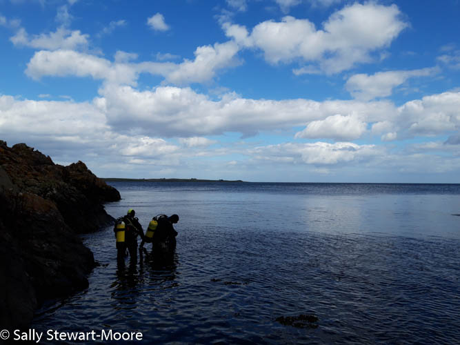
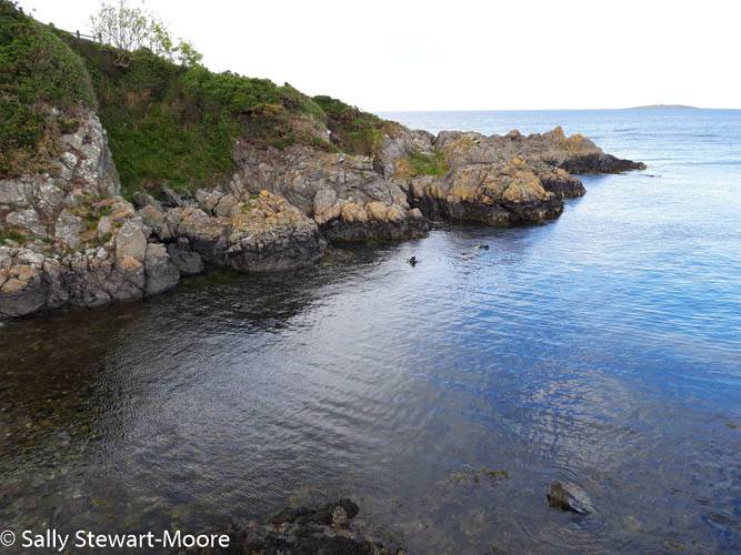
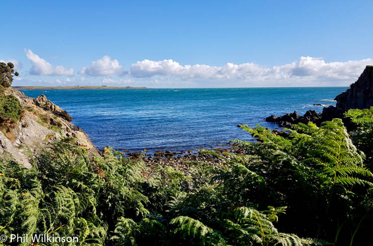
Turn off the A2 Warren Road Head for National Trust Orlock Point. Exact parking location is 54.668970, -5.573830 (Google maps). Follow the footpath for ~200 metres to reach the entry point. Note that the footpath is uneven and narrow. The entry point is a small stony beach, on the north side of a high rocky outcrop. Enter the water here (easiest at high water) and follow the rocky wall out to the point. Drop down here and swim around the corner, following the wall in a northerly direction.

Facilities: Details of nearest facilities to dive site i.e. public car parking and toilets, slipways etc

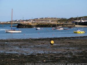
The nearest public toilets are near Main Street, Groomsport.

Nearest tank filling: DV Diving, Newtownards.

Hazards: Anecdotal information on possible hazards at the site for divers and snorkellers

  • Entry and exit over slippery boulders can be quite difficult causing a slip and trip hazard.
  • There can be strong currents further from the shoreline.
  • Due to possible surge, there is a slight risk of being pushed against the rocks.
Description: A general description of the physical features of the dive site

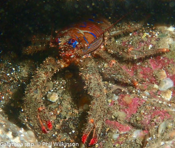
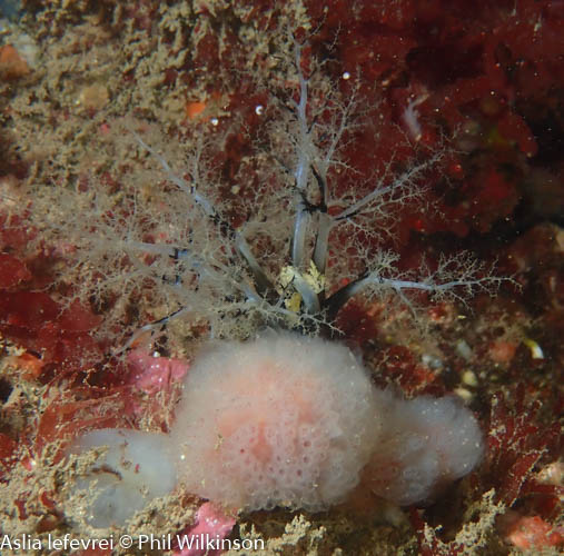
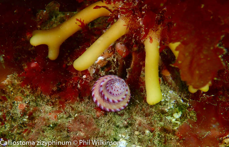
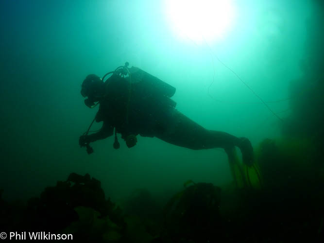
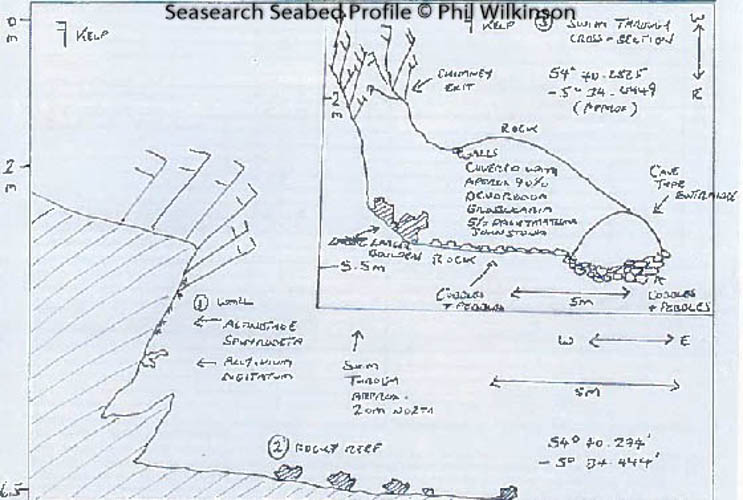
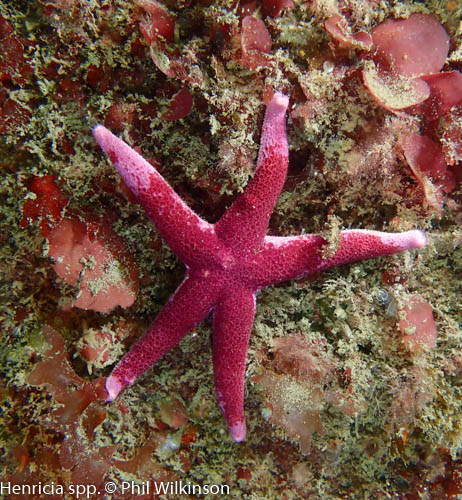
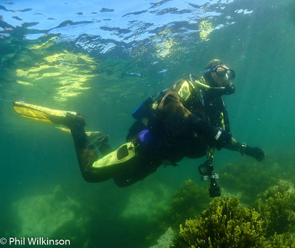
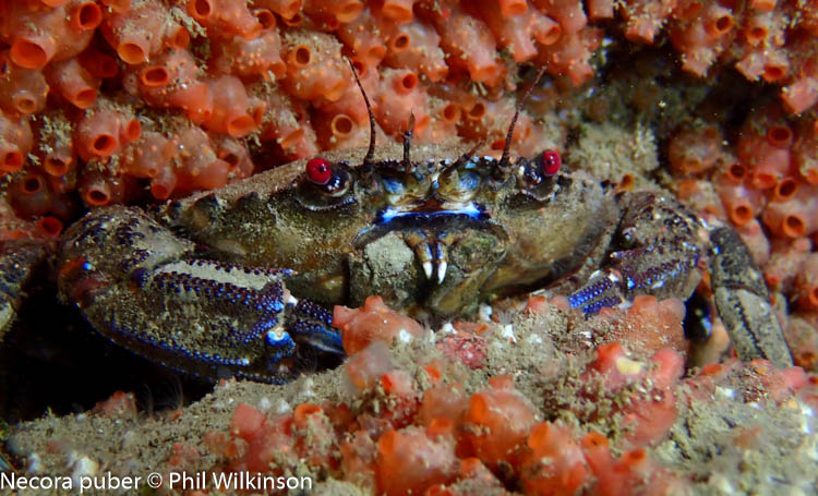
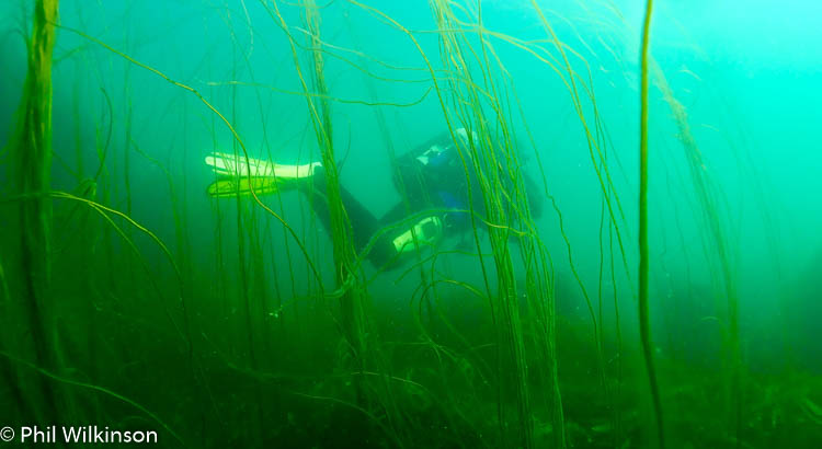
A really interesting and diverse shore dive. Finning out east to ‘the point’ there are boulders, rock, sand and mixed seaweed. Heading north from the entry point (at 54.671221, -05.574086) there is a lovely wall at a slightly acute angle towards the seabed. At the top of this wall is kelp. Further down there are numerous sea squirts, soft corals, anemones and crustaceans such as velvet swimming crabs. Finning north, there are further points of interest with smaller walls and a seabed that is generally sandy with large and smaller pebbles. At ~54.671540. -05.574155 there is a swim through. This can be difficult to find even in good visibility. Look out for a sandy seabed with large and smaller pebbles and sea spaghetti dipping into a dark cave entrance. The entrance is ~1m across and ~1m high. The main ‘chamber’ of the swim through is ~1.5 wide and 1.8m high. The swim through walls and ceiling are covered in highly abundant baked bean sea squirts, giving the main chamber a reddish glow under torch light. There are also crustaceans such as spiny squat lobsters and velvet swimming crabs. The swim through is ~5m in length at a linear depth of ~6m. At the end of the swim through there are silty boulders and a chimney (vertical) exit to ~2m of fairly open kelp. The swim through has quite a silty seabed with smaller pebbles and sand. If you are the first diver there, it is fantastic, however the visibility quickly deteriorates due to finning and disturbance of the silt. The remainder of the dive is normally heading south to the point and then east to a slippery exit over the boulders at 54.670990, -05.575001 (from my experience, a good time to remember to keep your mask on and reg in, until you’re on dry land!)

Biodiversity: A description of the species composition at the site. Species of interest are highlighted. Follow the links for more information about the species on the NBN Atlas Northern Ireland website

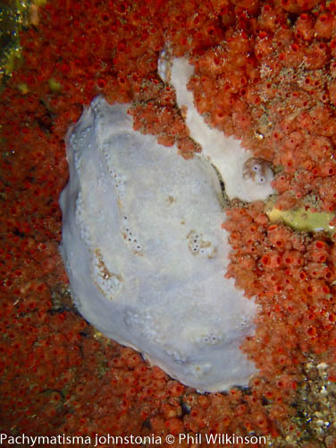
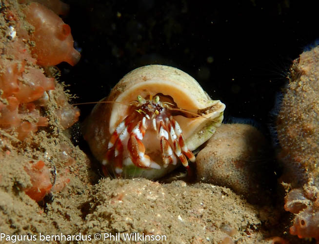
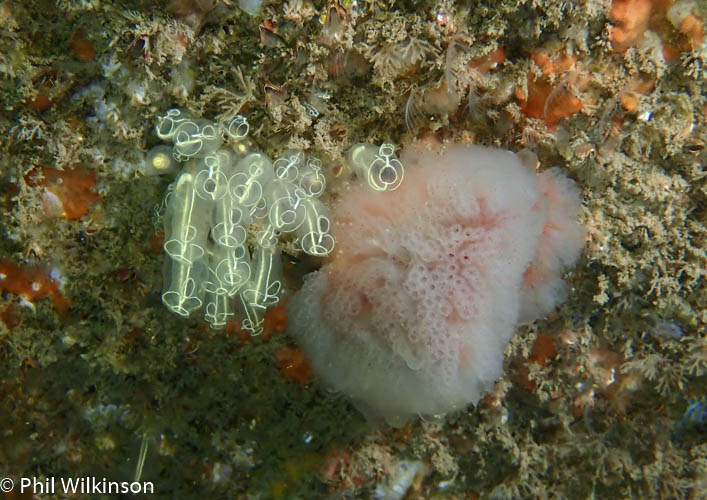
At the walls and swim through there are soft corals, numerous crustaceans, wrasse, anemones (including the white striped anemone Actinothoe sphyrodeta) and large, dense colonies of the baked bean sea squirt Dendrodoa grossularia. A white variety of elephant’s hide sponge Pachymatisma johnstonia is found on the cave walls.

View all species records from this site

A link to the dive site location on the NBN Atlas Northern Ireland website, showing all species records from within a 1km boundary of the site centroid. Any new species records from the site submitted to Seasearch, iRecord, CEDaR Online Recording or iNaturalist will appear here
Local Charters: A link to the website for the nearest Dive Centre to the site. A map of all dive centres is provided under ‘Go Diving’

DV Diving

Environmental and Historical Designations: A list of any environmental or historical designations attributed to the site, or overlapping it. Follow the link for more information

Outer Ards SPA

Outer Ards RAMSAR

More Information: Links to additional information found online for the dive site

Northern Ireland Marine MapViewer

Safety: Safety tips

  • In an emergency call 999 or 112 and ask for the coastguard.
  • Follow VHF radio Channel 16 (156.8 MHz), the international distress frequency.
  • Find nearest defibrillator (AED) here
  • Groomsport/Donaghadee Harbour Master: 028 9188 2377
Latitude, Longitude: The approximate XY coordinates for the dive site in Decimel Degrees (DD). These can be converted to DMS or DDM by following the link below
54.670966, -5.575059

Leave a Comment

Dived here recently? Then let other divers know about this site from your experience!

Leave a Reply

Your email address will not be published. Required fields are marked *

This site uses Akismet to reduce spam. Learn how your comment data is processed.

Join our Mailing List