All Dives Dive

Ramore Head

Portrush

Average score: 0

Site name: Ramore Head
Location: Descriptive location referring to nearest landfall i.e. town, village, harbour or island
Portrush
Type: Describes whether this dive site can be dived from the shore, from a boat, or both
Boat
Wreck: Dive sites which include a shipwreck (or part of a shipwreck) are labelled with a ‘Yes’
No
Min. dive depth (m): The approximate minimum depth of the dive given in metres
2
Max. dive depth (m): The approximate maximum depth of the dive given in metres
23

Max. seabed depth (m): The maximum depth of the seabed at the site taken from the intersect between the dive site point and the depth contour on an Admiralty Standard Nautical Chart
23

Diving experience (min level): The recommended minimum level of diving experience for a specific site, described as Novice (<50 dives in temperate/cold waters and minimum certification of PADI Open/Advanced Open Water, BSAC Ocean Diver or CMAS 1 star), Intermediate (50-100 dives in temperate/cold waters and minimum certification of PADI Rescue Dive, BSAC Sports Dive or CMAS 2 star) or Advanced (>250 dives in temperate/cold waters and minimum certification of PADI Divemaster, BSAC Dive Leader or CMAS 3 star
Novice

Optimal wind direction: The general wind direction which causes minimal exposure at the site, corresponding to 8 points of the compass: North (N), North East (NE), East (E, South East (SE), South (S), South West (SW), West, North West (NW)
E/SE/S/SW

Exposure: The approximate level of exposure to wind and wave action at the site on any given day, described as Sheltered (inshore sites surrounded by a form of shelter on all sides), Moderate (sites which are partially sheltered) or Exposed (sites with little to no shelter)
Exposed

Tidal strength: Anecdotal description of tidal strength at the site
Moderate

Marine Protected Area: A Yes or No highlighting whether or not the site occurs within a Marine Protected Area
Yes

Visibility: Anecdotal description of the typical underwater visibility at the site
Visibility ranges from 5-10 metres
Best time to dive: Anecdotal recommendation for the best time to dive the site for optimal underwater conditions. This typically relates to the stage of the tide
Slack (Portrush)
Getting There: Directions for getting to the site

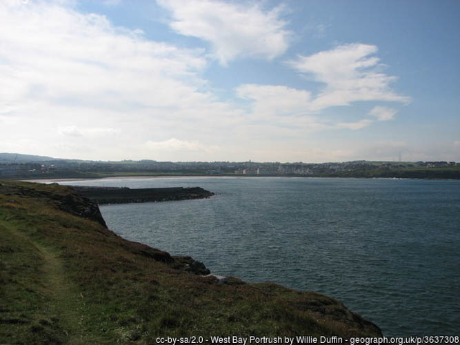
By boat from Portrush Harbour, the site is approximately 700m north of the harbour wall, following the coastline.

Facilities: Details of nearest facilities to dive site i.e. public car parking and toilets, slipways etc

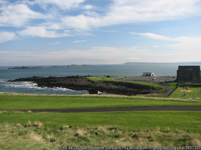
Portrush Harbour offers free car parking above the harbour, public toilets in the harbour office and a slipway on the North Pier. There is a barrier to the harbour which is staffed during office hours, 7 days a week from April – September. Fees apply; for use contact Portrush Harbour Office: 02870822307 / 0788981860.

Nearest tank filling is Aquaholics in Portstewart (028 7083 2584)

Hazards: Anecdotal information on possible hazards at the site for divers and snorkellers

  • Boat traffic in/out of Portrush Harbour, including Portrush 7 Class Lifeboat
  • Numerous lines from lobster pots, snagged fishing lines, plastic and metal rubbish.
Description: A general description of the physical features of the dive site

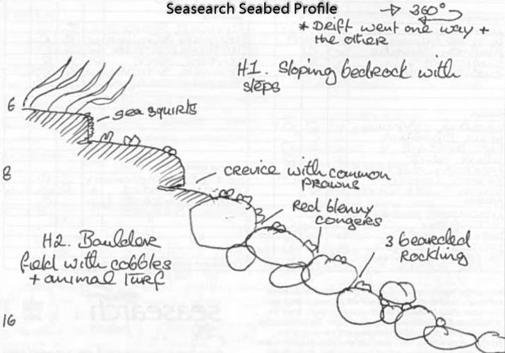
Boulder slope which levels off at 22 metres, with sand and gravel at the base and further isolated boulders.

Biodiversity: A description of the species composition at the site. Species of interest are highlighted. Follow the links for more information about the species on the NBN Atlas Northern Ireland website

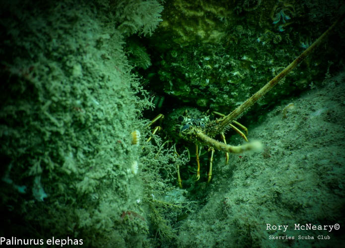
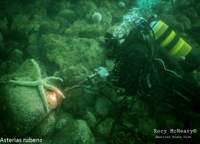
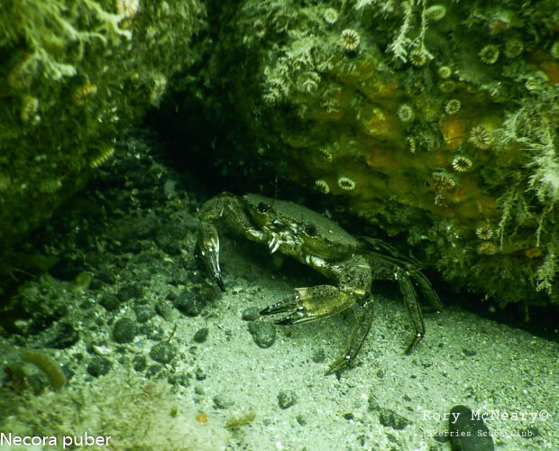
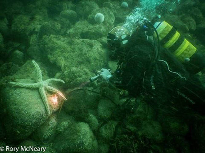
Seabed community dominated by kelp and mixed red algae and a diversity of fish including wrasse and the reticulated dragonet Callionymus reticulatus. The rare nudibranch (sea slug) Crimora papillata has been recorded at the site previously, as well as the crawfish / spiny lobster Palinurus elephas, a Northern Ireland Priority Species which based on increasing records from divers in the area, is either showing signs of recovery or range expansion.

View all species records from this site

A link to the dive site location on the NBN Atlas Northern Ireland website, showing all species records from within a 1km boundary of the site centroid. Any new species records from the site submitted to Seasearch, iRecord, CEDaR Online Recording or iNaturalist will appear here
Local Charters: A link to the website for the nearest Dive Centre to the site. A map of all dive centres is provided under ‘Go Diving’

Aquaholics

Environmental and Historical Designations: A list of any environmental or historical designations attributed to the site, or overlapping it. Follow the link for more information

Skerries and Causeway SAC

More Information: Links to additional information found online for the dive site

Aquaholics

Northern Ireland Marine MapViewer

Safety: Safety tips

  • In an emergency call 999 or 112 and ask for the coastguard.
  • Follow VHF radio Channel 16 (156.8 MHz), the international distress frequency. Send a distress alert followed by ‘MAYDAY, MAYDAY, MAYDAY’ and ‘This is [boat name]’.
  • Find nearest defibrillator (AED) here.
  • Portrush Harbour Office: 02870822307. When navigating within the harbour/marina, use VHF Channel 12.
Latitude, Longitude: The approximate XY coordinates for the dive site in Decimel Degrees (DD). These can be converted to DMS or DDM by following the link below
55.210033, -6.66275

Leave a Comment

Dived here recently? Then let other divers know about this site from your experience!

Leave a Reply

Your email address will not be published. Required fields are marked *

This site uses Akismet to reduce spam. Learn how your comment data is processed.

Join our Mailing List