All Dives Dive

Red Bay Shore

Cushendall

Average score: 0

Site name: Red Bay Shore
Location: Descriptive location referring to nearest landfall i.e. town, village, harbour or island
Cushendall
Type: Describes whether this dive site can be dived from the shore, from a boat, or both
Shore
Wreck: Dive sites which include a shipwreck (or part of a shipwreck) are labelled with a ‘Yes’
No
Min. dive depth (m): The approximate minimum depth of the dive given in metres
Max. dive depth (m): The approximate maximum depth of the dive given in metres
7

Max. seabed depth (m): The maximum depth of the seabed at the site taken from the intersect between the dive site point and the depth contour on an Admiralty Standard Nautical Chart
9

Diving experience (min level): The recommended minimum level of diving experience for a specific site, described as Novice (<50 dives in temperate/cold waters and minimum certification of PADI Open/Advanced Open Water, BSAC Ocean Diver or CMAS 1 star), Intermediate (50-100 dives in temperate/cold waters and minimum certification of PADI Rescue Dive, BSAC Sports Dive or CMAS 2 star) or Advanced (>250 dives in temperate/cold waters and minimum certification of PADI Divemaster, BSAC Dive Leader or CMAS 3 star
Novice

Optimal wind direction: The general wind direction which causes minimal exposure at the site, corresponding to 8 points of the compass: North (N), North East (NE), East (E, South East (SE), South (S), South West (SW), West, North West (NW)
SE/W/SW/W

Exposure: The approximate level of exposure to wind and wave action at the site on any given day, described as Sheltered (inshore sites surrounded by a form of shelter on all sides), Moderate (sites which are partially sheltered) or Exposed (sites with little to no shelter)
Moderate

Tidal strength: Anecdotal description of tidal strength at the site

Marine Protected Area: A Yes or No highlighting whether or not the site occurs within a Marine Protected Area
No

Visibility: Anecdotal description of the typical underwater visibility at the site
Best time to dive: Anecdotal recommendation for the best time to dive the site for optimal underwater conditions. This typically relates to the stage of the tide
Slack HW Cushendall (for ease of entry)
Getting There: Directions for getting to the site

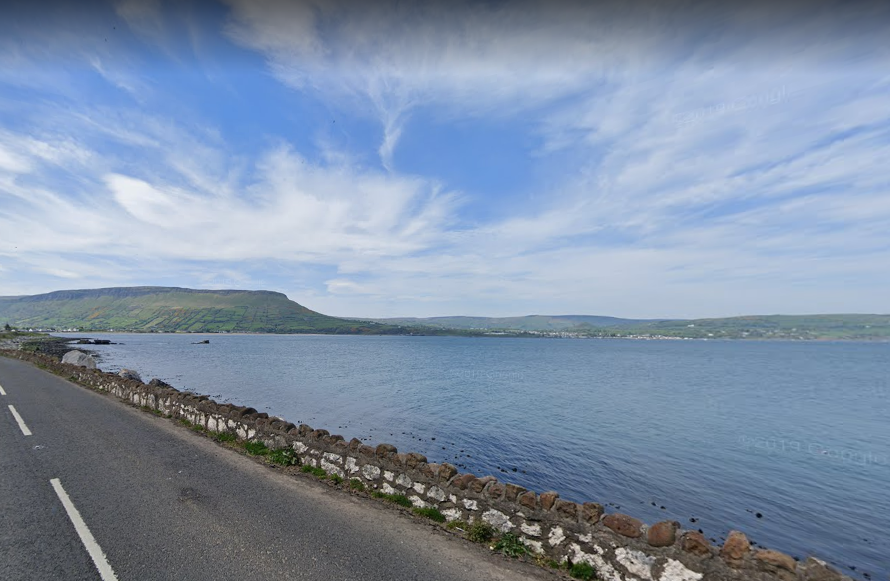
Park on the verge at 55.056695, -6.025248 on Garron Road (south side of Red Bay). Be sure not to obstruct the road. Additional parking space is available at the Garron Road car park approx. 500m west of the site. Use the old concrete steps to access the shore. From here, swim out for  ~5 metres over boulders and drop down onto the sandy seabed. Dive towards the Old Pier to the West, or towards Garron Point to the east.

Facilities: Details of nearest facilities to dive site i.e. public car parking and toilets, slipways etc

Free car parking at Garron Road car park (or on the layby above the site). The nearest public toilets are available at Cushendall caravan park / Cushendall Sailing and Boating Club.

Nearest tank filling is Aquaholics in Portstewart or Ballycastle (call ahead: 028 7083 2584)

Hazards: Anecdotal information on possible hazards at the site for divers and snorkellers

  • Traffic when crossing road to access point.
  • Difficult entry/exist at low tide (high water recommended)
Description: A general description of the physical features of the dive site

A nice shore dive with a kelpy boulder wall (originally a shore defence) on the shore side, and a sandy seabed on the sea side.

Biodiversity: A description of the species composition at the site. Species of interest are highlighted. Follow the links for more information about the species on the NBN Atlas Northern Ireland website

Kelp dominates the boulder wall.

View all species records from this site

A link to the dive site location on the NBN Atlas Northern Ireland website, showing all species records from within a 1km boundary of the site centroid. Any new species records from the site submitted to Seasearch, iRecord, CEDaR Online Recording or iNaturalist will appear here
Local Charters: A link to the website for the nearest Dive Centre to the site. A map of all dive centres is provided under ‘Go Diving’

Aquaholics

Environmental and Historical Designations: A list of any environmental or historical designations attributed to the site, or overlapping it. Follow the link for more information

More Information: Links to additional information found online for the dive site

Northern Ireland Marine MapViewer

Safety: Safety tips

  • In an emergency call 999 or 112 and ask for the coastguard.
  • Follow VHF radio Channel 16 (156.8 MHz), the international distress frequency.
  • Find nearest defibrillator (AED) here
Latitude, Longitude: The approximate XY coordinates for the dive site in Decimel Degrees (DD). These can be converted to DMS or DDM by following the link below
55.057006, -6.025485

Leave a Comment

Dived here recently? Then let other divers know about this site from your experience!

Leave a Reply

Your email address will not be published. Required fields are marked *

This site uses Akismet to reduce spam. Learn how your comment data is processed.

Join our Mailing List