Wreck Wreck

S.S. Albia

The Maidens

Average score: 0

Site name: S.S. Albia
Location: Descriptive location referring to nearest landfall i.e. town, village, harbour or island
The Maidens
Type: Describes whether this dive site can be dived from the shore, from a boat, or both
Boat
Wreck: Dive sites which include a shipwreck (or part of a shipwreck) are labelled with a ‘Yes’
Yes
Min. dive depth (m): The approximate minimum depth of the dive given in metres
5
Max. dive depth (m): The approximate maximum depth of the dive given in metres
28

Max. seabed depth (m): The maximum depth of the seabed at the site taken from the intersect between the dive site point and the depth contour on an Admiralty Standard Nautical Chart
30

Diving experience (min level): The recommended minimum level of diving experience for a specific site, described as Novice (<50 dives in temperate/cold waters and minimum certification of PADI Open/Advanced Open Water, BSAC Ocean Diver or CMAS 1 star), Intermediate (50-100 dives in temperate/cold waters and minimum certification of PADI Rescue Dive, BSAC Sports Dive or CMAS 2 star) or Advanced (>250 dives in temperate/cold waters and minimum certification of PADI Divemaster, BSAC Dive Leader or CMAS 3 star
Intermediate

Optimal wind direction: The general wind direction which causes minimal exposure at the site, corresponding to 8 points of the compass: North (N), North East (NE), East (E, South East (SE), South (S), South West (SW), West, North West (NW)
SW/W

Exposure: The approximate level of exposure to wind and wave action at the site on any given day, described as Sheltered (inshore sites surrounded by a form of shelter on all sides), Moderate (sites which are partially sheltered) or Exposed (sites with little to no shelter)
Exposed

Tidal strength: Anecdotal description of tidal strength at the site

Marine Protected Area: A Yes or No highlighting whether or not the site occurs within a Marine Protected Area
Yes

Visibility: Anecdotal description of the typical underwater visibility at the site
~5-10m
Best time to dive: Anecdotal recommendation for the best time to dive the site for optimal underwater conditions. This typically relates to the stage of the tide
Belfast LW Slack. Avoid ebb tides to ensure better visibility. Tide times here are approx 10minutes earlier than Belfast
Getting there: Directions for getting to the site

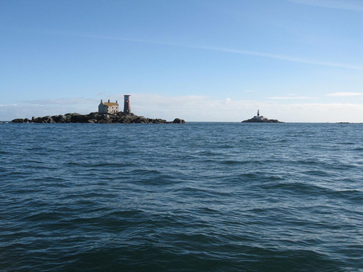
By boat from Portmuck or Ballylumford Harbour. The wreck is south of Allens Rock, to the north of the Maidens.

Facilities: Details of nearest facilities to dive site i.e. public car parking and toilets, slipways etc

Portmuck Harbour provides free car parking, a slipway and public toilets. The pier is 25 metres long, 6.5 metres wide and in good condition.

Free parking, a slipway, public toilets and outdoor changing facilities are available at Ballylumford Harbour as well (access to slipway restricted to Islandmagee Boat Club members; email: info@islandmageeboatclub.co.uk).

Nearest tank filling is DV Diving, Mount Stewart, Newtownards.

Hazards: Anecdotal information on possible hazards at the site for divers and snorkellers

Description: A general description of the physical features of the dive site

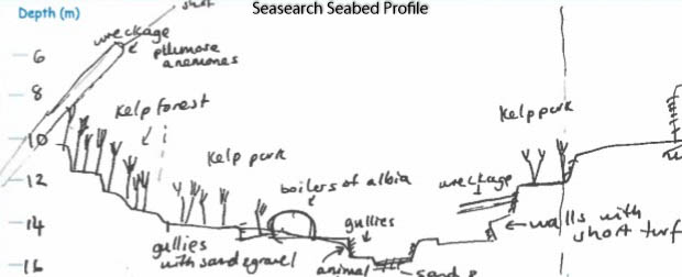
The wreck lies mostly scattered and upright with the bow pointing toward the south side of Allen Rock. The midships and bow are broken up, however the stern, propeller and rudder remain intact. The surrounding bedrock is uneven, with gullies, fissures and vertical faces. The bedrock slopes down to 28 metres at the base, where there is a coarse mixed sediment seabed.

History: The history of the wreck provided by the Senior Marine Archaeologist from the Department for Communities Historic Environment Division (only included for wreck sites)

Date of loss 28/09/1929. A Spanish steel steamship en route from Euelva to Londonderry with a cargo of copper, ore. Built Newcastle in 1890. LBD 79.24 x 11.15 x 5.08. Larn & Larn (2002).

Information derived from Historic Environment Record of Northern Ireland (HERoNI), Department for Communities, Historic Environment Division.

Biodiversity: A description of the species composition at the site. Species of interest are highlighted. Follow the links for more information about the species on the NBN Atlas Northern Ireland website

The wreck is covered in red and brown algae, anemones and dead men’s fingers Alcyonium digitatum. Bryozoans, sponges and hydroids dominate the rock face.

View all species records from this site

A link to the dive site location on the NBN Atlas Northern Ireland website, showing all species records from within a 1km boundary of the site centroid. Any new species records from the site submitted to Seasearch, iRecord, CEDaR Online Recording or iNaturalist will appear here
Local charters: A link to the website for the nearest Dive Centre to the site. A map of all dive centres is provided under ‘Go Diving’

Aquaholics

Environmental and Historical Designations: A list of any environmental or historical designations attributed to the site, or overlapping it. Follow the link for more information

The Maidens SAC

More information: Links to additional information found online for the dive site

Irish Wrecks Online – S.S. Albia

Northern Ireland Marine MapViewer

Safety: Safety tips

  • In an emergency call 999 or 112 and ask for the coastguard.
  • Follow VHF radio Channel 16 (156.8 MHz), the international distress frequency. Send a distress alert followed by ‘MAYDAY, MAYDAY, MAYDAY’ and ‘This is [boat name]’.
  • Find nearest defibrillator (AED) here.
  • Portmuck/Ballylumford Harbour: 028 9336 6666
Latitude, Longitude: The approximate XY coordinates for the dive site in Decimel Degrees (DD). These can be converted to DMS or DDM by following the link below
54.949887, -5.741622

Leave a Comment

Dived here recently? Then let other divers know about this site from your experience!

Leave a Reply

Your email address will not be published. Required fields are marked *

This site uses Akismet to reduce spam. Learn how your comment data is processed.

Join our Mailing List