Location:Descriptive location referring to nearest landfall i.e. town, village, harbour or island
Belfast Lough
Type:Describes whether this dive site can be dived from the shore, from a boat, or both
Boat
Wreck:Dive sites which include a shipwreck (or part of a shipwreck) are labelled with a ‘Yes’
Yes
Min. dive depth (m):The approximate minimum depth of the dive given in metres
16
Max. dive depth (m):The approximate maximum depth of the dive given in metres
25
Max. seabed depth (m):The maximum depth of the seabed at the site taken from the intersect between the dive site point and the depth contour on an Admiralty Standard Nautical Chart
28
Diving experience (min level):The recommended minimum level of diving experience for a specific site, described as Novice (<50 dives in temperate/cold waters and minimum certification of PADI Open/Advanced Open Water, BSAC Ocean Diver or CMAS 1 star), Intermediate (50-100 dives in temperate/cold waters and minimum certification of PADI Rescue Dive, BSAC Sports Dive or CMAS 2 star) or Advanced (>250 dives in temperate/cold waters and minimum certification of PADI Divemaster, BSAC Dive Leader or CMAS 3 star
Advanced
Optimal wind direction:The general wind direction which causes minimal exposure at the site, corresponding to 8 points of the compass: North (N), North East (NE), East (E, South East (SE), South (S), South West (SW), West, North West (NW)
SW/W/NW
Exposure:The approximate level of exposure to wind and wave action at the site on any given day, described as Sheltered (inshore sites surrounded by a form of shelter on all sides), Moderate (sites which are partially sheltered) or Exposed (sites with little to no shelter)
Exposed
Tidal strength:Anecdotal description of tidal strength at the site
Strong
Marine Protected Area:A Yes or No highlighting whether or not the site occurs within a Marine Protected Area
Yes
Visibility:Anecdotal description of the typical underwater visibility at the site
On average the visibility ranges from 8-10 metres but can be as high as 15 metres.
Best time to dive:Anecdotal recommendation for the best time to dive the site for optimal underwater conditions. This typically relates to the stage of the tide
Dive 1/1.5 hours before HW Belfast
Getting there:Directions for getting to the site
By boat from Whitehead, Carrickfergus or Bangor. The site lies ~ 0.5km off Blackhead Lighthouse
Facilities:Details of nearest facilities to dive site i.e. public car parking and toilets, slipways etc
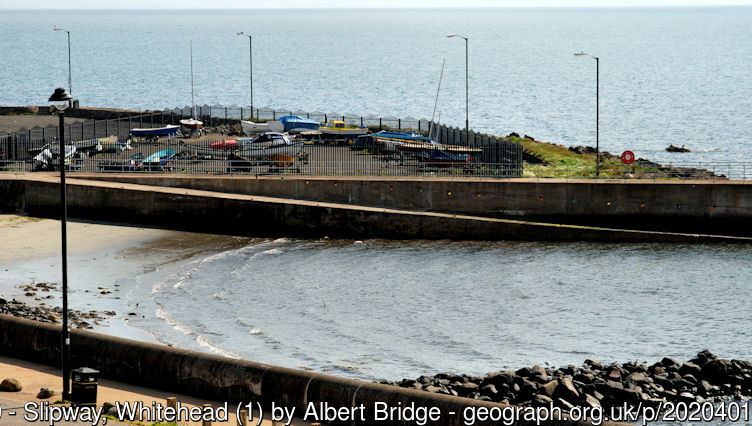
Whitehead, Carrickfergus and Bangor all offer free car parking, public toilets and slipway facilities.
Nearest tank filling is DV Diving, Newtownards.
Hazards:Anecdotal information on possible hazards at the site for divers and snorkellers
Strong tidal currents
Description:A general description of the physical features of the dive site
The wreck lies largely intact on its starboard side at a depth of 25 metres. The surrounding seabed is flat, consisting of sand and gravel.
History:The history of the wreck provided by the Senior Marine Archaeologist from the Department for Communities Historic Environment Division (only included for wreck sites)
Date of loss 28/12/1917. This 4050 g.t. British Merchant vessel, armed for defensive purposes, was sunk by a mine laid by UC75. The crew were saved. The vessel was built in 1906 and owned by Messrs Elders & Fyffes Ltd. The bronze prop was removed about 1960-70.
Information derived from Historic Environment Record of Northern Ireland (HERoNI), Department for Communities, Historic Environment Division.
Biodiversity:A description of the species composition at the site. Species of interest are highlighted. Follow the links for more information about the species on the NBN Atlas Northern Ireland website
The wreck is dominated by dead men’s fingers Alcyonium digitatum and anemones. It is teeming with various fish species including wrasse.
A link to the dive site location on the NBN Atlas Northern Ireland website, showing all species records from within a 1km boundary of the site centroid. Any new species records from the site submitted to Seasearch, iRecord, CEDaR Online Recording or iNaturalist will appear here
Local charters:A link to the website for the nearest Dive Centre to the site. A map of all dive centres is provided under ‘Go Diving’
Environmental and Historical Designations:A list of any environmental or historical designations attributed to the site, or overlapping it. Follow the link for more information
In an emergency call 999 or 112 and ask for the coastguard.
Follow VHF radio Channel 16 (156.8 MHz), the international distress frequency. Send a distress alert followed by ‘MAYDAY, MAYDAY, MAYDAY’ and ‘This is [boat name]’.
When navigating within the harbour/marina, use VHF Channel M/80/M2.
Whitehead Harbour Office: 07470 392553
Latitude, Longitude:The approximate XY coordinates for the dive site in Decimel Degrees (DD). These can be converted to DMS or DDM by following the link below


Leave a Comment
Dived here recently? Then let other divers know about this site from your experience!