Wreck Wreck

S.S. State of Louisiana (bow section)

Larne

Average score: 0

Site name: S.S. State of Louisiana (bow section)
Location: Descriptive location referring to nearest landfall i.e. town, village, harbour or island
Larne
Type: Describes whether this dive site can be dived from the shore, from a boat, or both
Boat
Wreck: Dive sites which include a shipwreck (or part of a shipwreck) are labelled with a ‘Yes’
Yes
Min. dive depth (m): The approximate minimum depth of the dive given in metres
18
Max. dive depth (m): The approximate maximum depth of the dive given in metres
25

Max. seabed depth (m): The maximum depth of the seabed at the site taken from the intersect between the dive site point and the depth contour on an Admiralty Standard Nautical Chart
31

Diving experience (min level): The recommended minimum level of diving experience for a specific site, described as Novice (<50 dives in temperate/cold waters and minimum certification of PADI Open/Advanced Open Water, BSAC Ocean Diver or CMAS 1 star), Intermediate (50-100 dives in temperate/cold waters and minimum certification of PADI Rescue Dive, BSAC Sports Dive or CMAS 2 star) or Advanced (>250 dives in temperate/cold waters and minimum certification of PADI Divemaster, BSAC Dive Leader or CMAS 3 star
Intermediate

Optimal wind direction: The general wind direction which causes minimal exposure at the site, corresponding to 8 points of the compass: North (N), North East (NE), East (E, South East (SE), South (S), South West (SW), West, North West (NW)
SW/W/NW

Exposure: The approximate level of exposure to wind and wave action at the site on any given day, described as Sheltered (inshore sites surrounded by a form of shelter on all sides), Moderate (sites which are partially sheltered) or Exposed (sites with little to no shelter)
Exposed

Tidal strength: Anecdotal description of tidal strength at the site
Moderate

Marine Protected Area: A Yes or No highlighting whether or not the site occurs within a Marine Protected Area
Yes

Visibility: Anecdotal description of the typical underwater visibility at the site
5-10 metres
Best time to dive: Anecdotal recommendation for the best time to dive the site for optimal underwater conditions. This typically relates to the stage of the tide
This site can only be dived at slack water, 30-60 minutes before HW or LW Belfast. There are buoys attached to the bow and funnels of the wreck which will appear at slack water. The window for slack water at the site is just under one hour.
Getting there: Directions for getting to the site

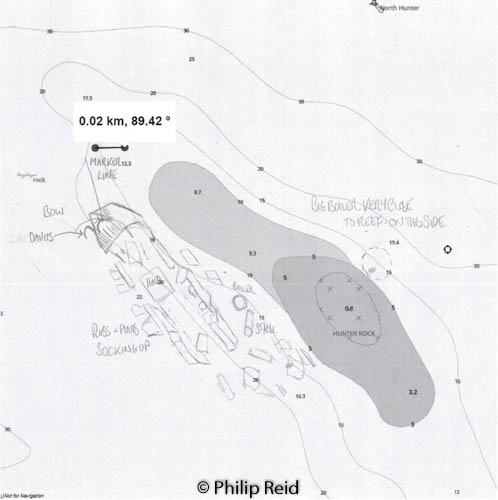
By boat from Portmuck or Ballylumford Harbour, head towards Hunter’s Rock, look out for yellow marker buoys attached to the bow of the wreck (these will only appear at slack water). Enter the water at the shallowest point of the Hunters Rock pinnacle and follow the slope down either side (depending on whether you are diving the bow or stern end).

Facilities: Details of nearest facilities to dive site i.e. public car parking and toilets, slipways etc

Portmuck Harbour provides free car parking, a slipway and public toilets. The pier is 25 metres long, 6.5 metres wide and in good condition.

Free parking, a slipway, public toilets and outdoor changing facilities are available at Ballylumford Harbour as well (access to slipway restricted to Islandmagee Boat Club members; email: info@islandmageeboatclub.co.uk).

Nearest tank filling is DV Diving, Mount Stewart, Newtownards.

Hazards: Anecdotal information on possible hazards at the site for divers and snorkellers

  • Buoys attached to the bow of the wreck and several lobster pots usually in the vicinity.
  • Port of Larne can be busy, contact harbour master on VHF 11 to get permission to exit/enter port.
  • Be aware of ferry traffic (site is located very close to the Larne to Cairnryan ferry lane) and commercial fishing boats.
Description: A general description of the physical features of the dive site

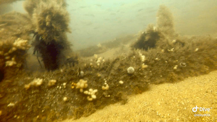
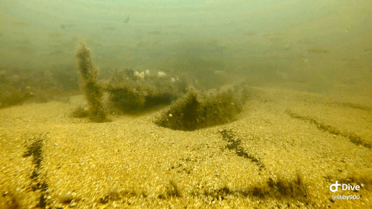
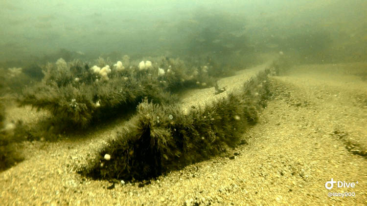
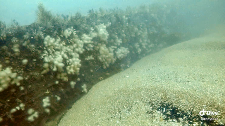
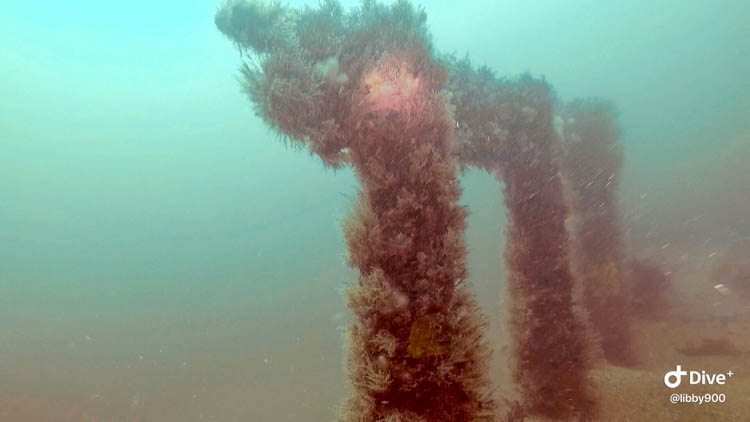
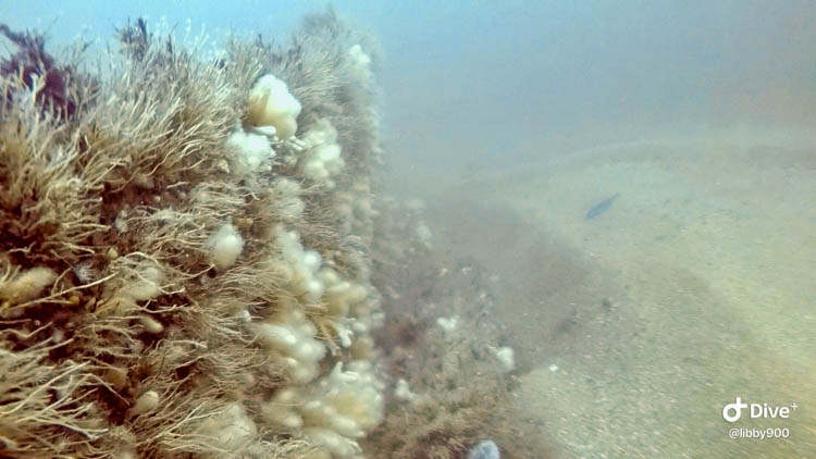
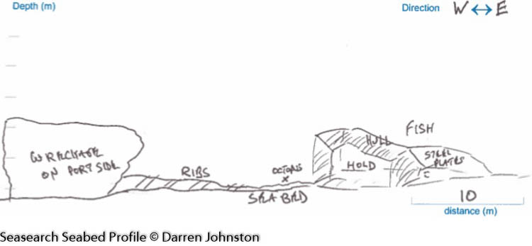
A great dive located off Hunters Rock. The wreck lies on her port side and is broken into three sections either side of Hunters Rock, with the bow side to the SW (see seperate site page for State of Louisiana Stern end which lies to the NE of Hunters Rock). The wreck is starting to deteriorate although the ribs and boilers are still very easily distinguished. The surrounding seabed is comprised of sand and pebbles. Both parts of the wreck can be explored in one dive but given the short tidal window, it is recommended to split this into two seperate dives to allow more time on each part of the wreck. The stern is a better dive, with plenty to see, as opposed to the bow which is quite small, once you have seen it, you can return to midships and make ascent.

History: The history of the wreck provided by the Senior Marine Archaeologist from the Department for Communities Historic Environment Division (only included for wreck sites)

Date of loss 24/12/1878. This 1,216 n.t. British Steamship of Glasgow stranded and was a total loss. The captain, W. McGowan, 49 crew members and 17 passengers were all saved. The vessel was built in 1873, and was owned by The State Steamship Co. Ltd., Glasgow. Its voyage was from Glasgow to New York carrying a general cargo. The officers were exonerated at the Inquiry.

(Sources: CSP 1880 Vol. 66, p.131 and p.168; WA F117). CSP (Commons Sessional Papers); WA (Wilson Archive)

Information derived from Historic Environment Record of Northern Ireland (HERoNI), Department for Communities, Historic Environment Division.

Biodiversity: A description of the species composition at the site. Species of interest are highlighted. Follow the links for more information about the species on the NBN Atlas Northern Ireland website

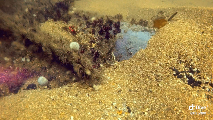
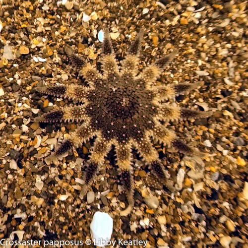
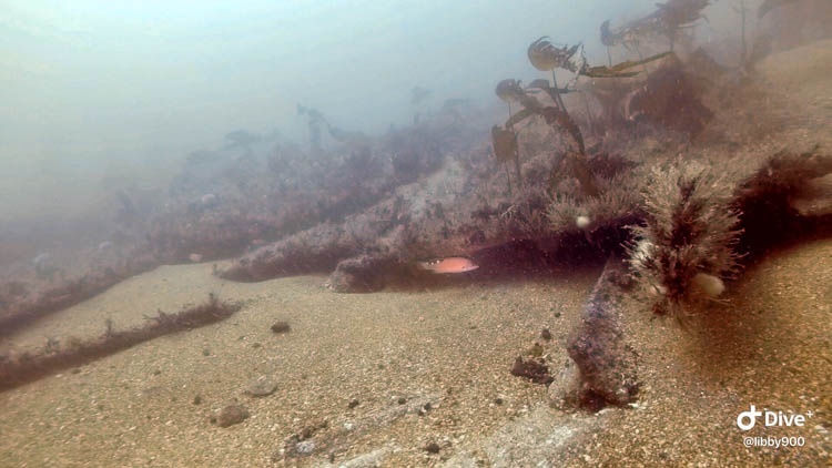
The wreck is covered in sponges, with mobile fauna including sunstars, sea urchins and crabs. The site is home to lots of wrasse, mainly Cuckoo and Ballan.

View all species records from this site

A link to the dive site location on the NBN Atlas Northern Ireland website, showing all species records from within a 1km boundary of the site centroid. Any new species records from the site submitted to Seasearch, iRecord, CEDaR Online Recording or iNaturalist will appear here
Local charters: A link to the website for the nearest Dive Centre to the site. A map of all dive centres is provided under ‘Go Diving’

DV Diving
North Irish Diver

Environmental and Historical Designations: A list of any environmental or historical designations attributed to the site, or overlapping it. Follow the link for more information

The Maidens SAC

Safety: Safety tips

  • In an emergency call 999 or 112 and ask for the coastguard.
  • Follow VHF radio Channel 16 (156.8 MHz), the international distress frequency. Send a distress alert followed by ‘MAYDAY, MAYDAY, MAYDAY’ and ‘This is [boat name]’.
  • Find nearest defibrillator (AED) here.
  • Portmuck/Ballylumford Harbour: 028 9336 6666
Latitude, Longitude: The approximate XY coordinates for the dive site in Decimel Degrees (DD). These can be converted to DMS or DDM by following the link below
54.88185, -5.751967

Leave a Comment

Dived here recently? Then let other divers know about this site from your experience!

Leave a Reply

Your email address will not be published. Required fields are marked *

This site uses Akismet to reduce spam. Learn how your comment data is processed.

Join our Mailing List