All Dives Dive

The Drop Off, Ballyhenry

Strangford Lough

Average score: 0

Site name: The Drop Off, Ballyhenry
Location: Descriptive location referring to nearest landfall i.e. town, village, harbour or island
Strangford Lough
Type: Describes whether this dive site can be dived from the shore, from a boat, or both
Boat
Wreck: Dive sites which include a shipwreck (or part of a shipwreck) are labelled with a ‘Yes’
No
Min. dive depth (m): The approximate minimum depth of the dive given in metres
16
Max. dive depth (m): The approximate maximum depth of the dive given in metres
30

Max. seabed depth (m): The maximum depth of the seabed at the site taken from the intersect between the dive site point and the depth contour on an Admiralty Standard Nautical Chart
35

Diving experience (min level): The recommended minimum level of diving experience for a specific site, described as Novice (<50 dives in temperate/cold waters and minimum certification of PADI Open/Advanced Open Water, BSAC Ocean Diver or CMAS 1 star), Intermediate (50-100 dives in temperate/cold waters and minimum certification of PADI Rescue Dive, BSAC Sports Dive or CMAS 2 star) or Advanced (>250 dives in temperate/cold waters and minimum certification of PADI Divemaster, BSAC Dive Leader or CMAS 3 star
Advanced

Optimal wind direction: The general wind direction which causes minimal exposure at the site, corresponding to 8 points of the compass: North (N), North East (NE), East (E, South East (SE), South (S), South West (SW), West, North West (NW)
NE/E

Exposure: The approximate level of exposure to wind and wave action at the site on any given day, described as Sheltered (inshore sites surrounded by a form of shelter on all sides), Moderate (sites which are partially sheltered) or Exposed (sites with little to no shelter)
Moderate

Tidal strength: Anecdotal description of tidal strength at the site
Strong

Marine Protected Area: A Yes or No highlighting whether or not the site occurs within a Marine Protected Area
Yes

Visibility: Anecdotal description of the typical underwater visibility at the site
Best time to dive: Anecdotal recommendation for the best time to dive the site for optimal underwater conditions. This typically relates to the stage of the tide
Slack HW or LW Strangford
Getting There: Directions for getting to the site

By boat from Strangford, Portaferry or Killyleagh. The site is approximately 100 metres SW of Ballyhenry Island.

Facilities: Details of nearest facilities to dive site i.e. public car parking and toilets, slipways etc

In Strangford, free parking is available above the marina and a slipway is available at the quays. Public toilets are available at the ferry terminal.

In Portaferry free car parking is available on Meeting House Street beside the arts centre, 300 metres from the harbour slipway. Public toilets are available in the town, close to Castle Park.

Killyleagh offers boat launching facilities at the town’s Yacht Club, which also has a car park and toilets.

Nearest tank filling is DV Diving, Mount Stewart, Newtownards.

Hazards: Anecdotal information on possible hazards at the site for divers and snorkellers

Description: A general description of the physical features of the dive site

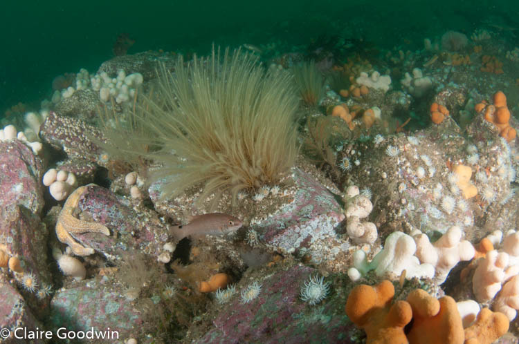
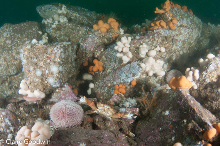
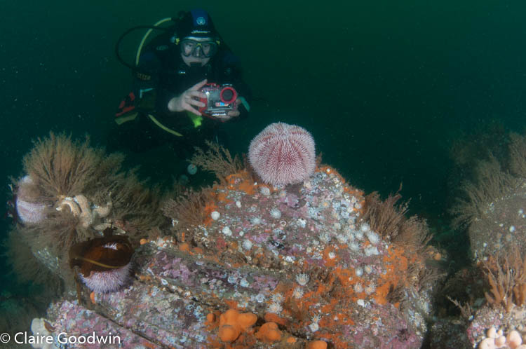
Steep vertical rocky reef with gullies from approx. 17-30 metres which leads to a gently sloping seabed with scattered boulders.

Biodiversity: A description of the species composition at the site. Species of interest are highlighted. Follow the links for more information about the species on the NBN Atlas Northern Ireland website

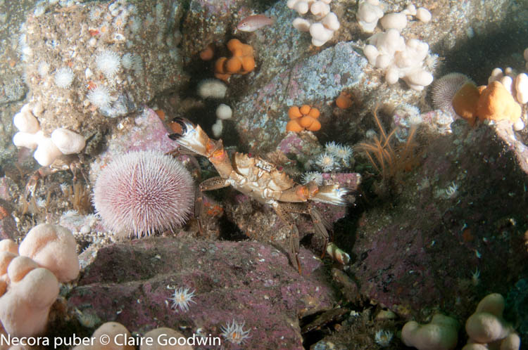
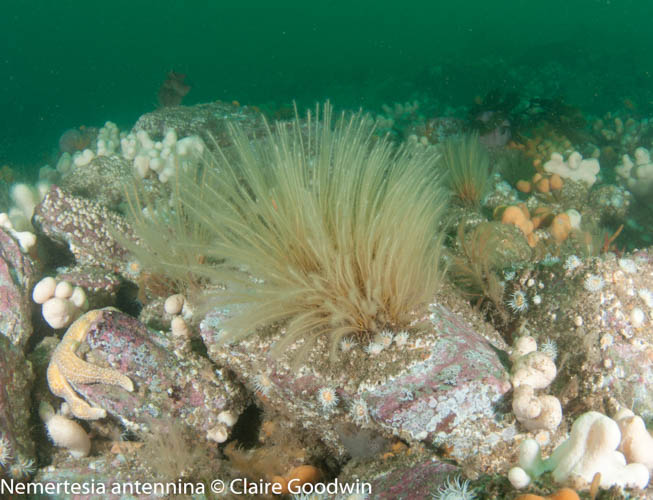
The bedrock wall supports a diverse community of marine invertebrate species, with clumps of the sandelled anemone Actinothoe sphyrodeta and the sponge Cliona celata.

View all species records from this site

A link to the dive site location on the NBN Atlas Northern Ireland website, showing all species records from within a 1km boundary of the site centroid. Any new species records from the site submitted to Seasearch, iRecord, CEDaR Online Recording or iNaturalist will appear here
Local Charters: A link to the website for the nearest Dive Centre to the site. A map of all dive centres is provided under ‘Go Diving’

DV Diving

Environmental and Historical Designations: A list of any environmental or historical designations attributed to the site, or overlapping it. Follow the link for more information

Strangford Lough MCZ
Strangford Lough SAC
Strangford Lough SPA
Strangford Lough RAMSAR

More Information: Links to additional information found online for the dive site

Diving.ie – Strangford Lough

Strangford Lough Diving Byelaw

Northern Ireland Marine MapViewer

Safety: Safety tips

  • In an emergency call 999 or 112 and ask for the coastguard.
  • Follow VHF radio Channel 16 (156.8 MHz), the international distress frequency. Send a distress alert followed by ‘MAYDAY, MAYDAY, MAYDAY’ and ‘This is [boat name]’.
  • Find nearest defibrillator (AED) here.
  • Portaferry Harbour Master: 028 9188 2377
  • When navigating within the harbour/marina, use VHF Channel 80
Latitude, Longitude: The approximate XY coordinates for the dive site in Decimel Degrees (DD). These can be converted to DMS or DDM by following the link below
54.3904013, -5.5789361

Leave a Comment

Dived here recently? Then let other divers know about this site from your experience!

Leave a Reply

Your email address will not be published. Required fields are marked *

This site uses Akismet to reduce spam. Learn how your comment data is processed.

Join our Mailing List