Wreck Wreck

S.S. Lagan

Belfast Lough

Average score: 0

Site name: S.S. Lagan
Location: Descriptive location referring to nearest landfall i.e. town, village, harbour or island
Belfast Lough
Type: Describes whether this dive site can be dived from the shore, from a boat, or both
Boat
Wreck: Dive sites which include a shipwreck (or part of a shipwreck) are labelled with a ‘Yes’
Yes
Min. dive depth (m): The approximate minimum depth of the dive given in metres
25
Max. dive depth (m): The approximate maximum depth of the dive given in metres
30

Max. seabed depth (m): The maximum depth of the seabed at the site taken from the intersect between the dive site point and the depth contour on an Admiralty Standard Nautical Chart
30

Diving experience (min level): The recommended minimum level of diving experience for a specific site, described as Novice (<50 dives in temperate/cold waters and minimum certification of PADI Open/Advanced Open Water, BSAC Ocean Diver or CMAS 1 star), Intermediate (50-100 dives in temperate/cold waters and minimum certification of PADI Rescue Dive, BSAC Sports Dive or CMAS 2 star) or Advanced (>250 dives in temperate/cold waters and minimum certification of PADI Divemaster, BSAC Dive Leader or CMAS 3 star
Advanced

Optimal wind direction: The general wind direction which causes minimal exposure at the site, corresponding to 8 points of the compass: North (N), North East (NE), East (E, South East (SE), South (S), South West (SW), West, North West (NW)
SW/W/NW

Exposure: The approximate level of exposure to wind and wave action at the site on any given day, described as Sheltered (inshore sites surrounded by a form of shelter on all sides), Moderate (sites which are partially sheltered) or Exposed (sites with little to no shelter)
Exposed

Tidal strength: Anecdotal description of tidal strength at the site

Marine Protected Area: A Yes or No highlighting whether or not the site occurs within a Marine Protected Area
Yes

Visibility: Anecdotal description of the typical underwater visibility at the site
Visibility typically ranges from 5-8 metres
Best time to dive: Anecdotal recommendation for the best time to dive the site for optimal underwater conditions. This typically relates to the stage of the tide
HW Belfast
Getting there: Directions for getting to the site

By boat from Bangor. The wreck is in the middle of the lough entrance, ~4km due north of Orlock Point.

Facilities: Details of nearest facilities to dive site i.e. public car parking and toilets, slipways etc

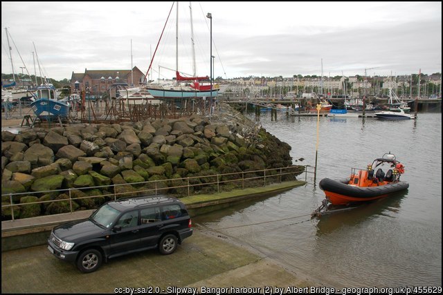
Bangor Marina and public toilets are available at South Pier. The slipway to the north of the car park is primarily a means of launching Bangor’s Atlantic 85 lifeboat and use is restricted to season ticket holders and Bangor Marina/harbour users. For more information, visit: http://www.quaymarinas.com/cookie-preferences-page/

Nearest tank filling is DV Diving, Mount Stewart, Newtownards.

Hazards: Anecdotal information on possible hazards at the site for divers and snorkellers

  • Close to the main shipping lane in and out of Belfast Lough (as well as recreational boat traffic)
Description: A general description of the physical features of the dive site

The wreck lies intact in a west-east direction on her port side on a sandy seabed at a charted depth of 30 metres. The funnel is beside the hull and the rudder is shattered in two. The seabed rises rapidly to the south of the wreck (deck side). Description from Irish Wrecks Online

History: The history of the wreck provided by the Senior Marine Archaeologist from the Department for Communities Historic Environment Division (only included for wreck sites)

Date of loss 31/03/1946. Three-masted steamship en route from Garston to Belfast when sank following collision with steamer Elmfield at mouth of Belfast Lough. Owned by John Kelly Ltd. (Sources Larn & larn 2002).

Information derived from Historic Environment Record of Northern Ireland (HERoNI), Department for Communities, Historic Environment Division.

See also Irish Wrecks Online.


Biodiversity: A description of the species composition at the site. Species of interest are highlighted. Follow the links for more information about the species on the NBN Atlas Northern Ireland website

View all species records from this site

A link to the dive site location on the NBN Atlas Northern Ireland website, showing all species records from within a 1km boundary of the site centroid. Any new species records from the site submitted to Seasearch, iRecord, CEDaR Online Recording or iNaturalist will appear here
Local charters: A link to the website for the nearest Dive Centre to the site. A map of all dive centres is provided under ‘Go Diving’

DV Diving

Environmental and Historical Designations: A list of any environmental or historical designations attributed to the site, or overlapping it. Follow the link for more information

North Channel SAC

More information: Links to additional information found online for the dive site

Irish Wrecks Online – S.S. Lagan

Northern Ireland Marine MapViewer

Safety: Safety tips

  • In an emergency call 999 or 112 and ask for the coastguard.
  • Follow VHF radio Channel 16 (156.8 MHz), the international distress frequency. Send a distress alert followed by ‘MAYDAY, MAYDAY, MAYDAY’ and ‘This is [boat name]’.
  • Find nearest defibrillator (AED) here.
  • Bangor Harbour Master: 028 9145 3297
  • When navigating within the harbour/marina, use VHF Channel 11.
Latitude, Longitude: The approximate XY coordinates for the dive site in Decimel Degrees (DD). These can be converted to DMS or DDM by following the link below
54.717483, -5.587383

Leave a Comment

Dived here recently? Then let other divers know about this site from your experience!

Leave a Reply

Your email address will not be published. Required fields are marked *

This site uses Akismet to reduce spam. Learn how your comment data is processed.

Join our Mailing List