All Dives Dive

Waterfoot MCZ Seagrass Bed

Cushendall

Average score: 0

Site name: Waterfoot MCZ Seagrass Bed
Location: Descriptive location referring to nearest landfall i.e. town, village, harbour or island
Cushendall
Type: Describes whether this dive site can be dived from the shore, from a boat, or both
Boat / Shore
Wreck: Dive sites which include a shipwreck (or part of a shipwreck) are labelled with a ‘Yes’
No
Min. dive depth (m): The approximate minimum depth of the dive given in metres
6
Max. dive depth (m): The approximate maximum depth of the dive given in metres
8

Max. seabed depth (m): The maximum depth of the seabed at the site taken from the intersect between the dive site point and the depth contour on an Admiralty Standard Nautical Chart
9

Diving experience (min level): The recommended minimum level of diving experience for a specific site, described as Novice (<50 dives in temperate/cold waters and minimum certification of PADI Open/Advanced Open Water, BSAC Ocean Diver or CMAS 1 star), Intermediate (50-100 dives in temperate/cold waters and minimum certification of PADI Rescue Dive, BSAC Sports Dive or CMAS 2 star) or Advanced (>250 dives in temperate/cold waters and minimum certification of PADI Divemaster, BSAC Dive Leader or CMAS 3 star
Novice

Optimal wind direction: The general wind direction which causes minimal exposure at the site, corresponding to 8 points of the compass: North (N), North East (NE), East (E, South East (SE), South (S), South West (SW), West, North West (NW)
S/SW/W/NW

Exposure: The approximate level of exposure to wind and wave action at the site on any given day, described as Sheltered (inshore sites surrounded by a form of shelter on all sides), Moderate (sites which are partially sheltered) or Exposed (sites with little to no shelter)
Moderate

Tidal strength: Anecdotal description of tidal strength at the site
Weak

Marine Protected Area: A Yes or No highlighting whether or not the site occurs within a Marine Protected Area
Yes

Visibility: Anecdotal description of the typical underwater visibility at the site
Good
Best time to dive: Anecdotal recommendation for the best time to dive the site for optimal underwater conditions. This typically relates to the stage of the tide
Anytime
Getting There: Directions for getting to the site

For a shore dive, from the Garron Road Car park in Waterfoot there is access to a path leading to the beach.

Or by boat from Cushendall head south for approx. 1km into the middle of Red Bay where the depth sounder reads ~4-5 metres.

Facilities: Details of nearest facilities to dive site i.e. public car parking and toilets, slipways etc

For a shore dive use the village of Waterfoot, taking the turning off Garron Road opposite the garage with red doors, where there is a public car park and toilets. You can access the beach from here on foot.

For a boat dive, free car parking and public toilets are available at Cushendall caravan park / Cushendall Sailing and Boating Club. There is a slipway, but priority is given to the RNLI and berthing is not allowed. For use contact Cushendall/Ballycastle Harbour Office: 02820768525 / 07803505084.

Nearest tank filling is Aquaholics, Portstewart/Ballycastle (call in advance: 028 7083 2584)

Hazards: Anecdotal information on possible hazards at the site for divers and snorkellers

Description: A general description of the physical features of the dive site

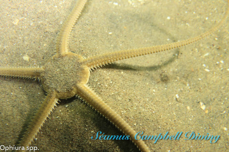
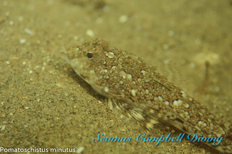
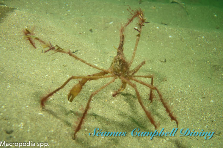
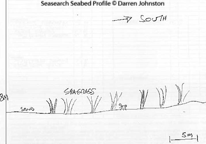
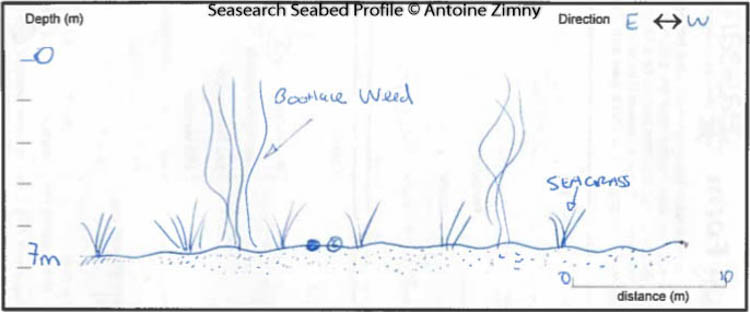
A large, patchy seagrass bed on a coarse sandy and gravelly seabed with some interspersed cobbles.

Biodiversity: A description of the species composition at the site. Species of interest are highlighted. Follow the links for more information about the species on the NBN Atlas Northern Ireland website

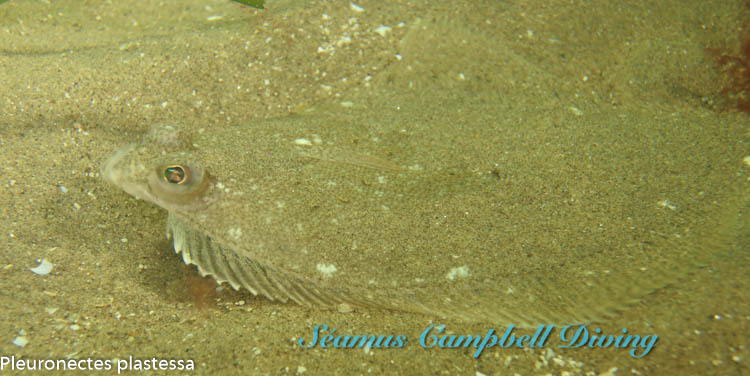
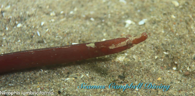
Crabs, pipefish and juvenile flatfish are found amongst the seagrass Zostera marina bed.

View all species records from this site

A link to the dive site location on the NBN Atlas Northern Ireland website, showing all species records from within a 1km boundary of the site centroid. Any new species records from the site submitted to Seasearch, iRecord, CEDaR Online Recording or iNaturalist will appear here
Local Charters: A link to the website for the nearest Dive Centre to the site. A map of all dive centres is provided under ‘Go Diving’

Aquaholics

Environmental and Historical Designations: A list of any environmental or historical designations attributed to the site, or overlapping it. Follow the link for more information

Waterfoot MCZ

More Information: Links to additional information found online for the dive site

Seasearch Red Bay Seagrass Proposal

Northern Ireland Marine MapViewer

Safety: Safety tips

  • In an emergency call 999 or 112 and ask for the coastguard.
  • Follow VHF radio Channel 16 (156.8 MHz), the international distress frequency.
  • Find nearest defibrillator (AED) here
  • Cushendall Harbour Office: 02820768525
Latitude, Longitude: The approximate XY coordinates for the dive site in Decimel Degrees (DD). These can be converted to DMS or DDM by following the link below
55.061637, -6.04472

Leave a Comment

Dived here recently? Then let other divers know about this site from your experience!

Leave a Reply

Your email address will not be published. Required fields are marked *

This site uses Akismet to reduce spam. Learn how your comment data is processed.

Join our Mailing List