Location:Descriptive location referring to nearest landfall i.e. town, village, harbour or island
Ballyhenry Bay
Type:Describes whether this dive site can be dived from the shore, from a boat, or both
Boat
Wreck:Dive sites which include a shipwreck (or part of a shipwreck) are labelled with a ‘Yes’
Yes
Min. dive depth (m):The approximate minimum depth of the dive given in metres
Max. dive depth (m):The approximate maximum depth of the dive given in metres
14
Max. seabed depth (m):The maximum depth of the seabed at the site taken from the intersect between the dive site point and the depth contour on an Admiralty Standard Nautical Chart
18
Diving experience (min level):The recommended minimum level of diving experience for a specific site, described as Novice (<50 dives in temperate/cold waters and minimum certification of PADI Open/Advanced Open Water, BSAC Ocean Diver or CMAS 1 star), Intermediate (50-100 dives in temperate/cold waters and minimum certification of PADI Rescue Dive, BSAC Sports Dive or CMAS 2 star) or Advanced (>250 dives in temperate/cold waters and minimum certification of PADI Divemaster, BSAC Dive Leader or CMAS 3 star
Novice
Optimal wind direction:The general wind direction which causes minimal exposure at the site, corresponding to 8 points of the compass: North (N), North East (NE), East (E, South East (SE), South (S), South West (SW), West, North West (NW)
NE/E/SE
Exposure:The approximate level of exposure to wind and wave action at the site on any given day, described as Sheltered (inshore sites surrounded by a form of shelter on all sides), Moderate (sites which are partially sheltered) or Exposed (sites with little to no shelter)
Moderate
Tidal strength:Anecdotal description of tidal strength at the site
Strong
Marine Protected Area:A Yes or No highlighting whether or not the site occurs within a Marine Protected Area
Yes
Visibility:Anecdotal description of the typical underwater visibility at the site
Visibility can be poor, between 2-4m, especially if sediment is disturbed and kicked up. However, it is possible under optimum conditions for 10-15 metres visibility.
Best time to dive:Anecdotal recommendation for the best time to dive the site for optimal underwater conditions. This typically relates to the stage of the tide
HW +1 to HW+5 (Strangford)
Getting there:Directions for getting to the site
By boat from Portaferry, Strangford or Killyleagh. The stern wreckage lies 300m SE off the bow of the Empire Tana ‘Inner Lees’.
Facilities:Details of nearest facilities to dive site i.e. public car parking and toilets, slipways etc
In Strangford, free parking is available above the marina and a slipway is available at the quays. Public toilets are available at the ferry terminal.
In Portaferry free car parking is available on Meeting House Street beside the arts centre, 300 metres from the harbour slipway. Public toilets are available in the town, close to Castle Park.
Killyleagh offers boat launching facilities at the town’s Yacht Club, which also has a car park and toilets.
Nearest tank filling is DV Diving, Mount Stewart, Newtownards.
Hazards:Anecdotal information on possible hazards at the site for divers and snorkellers
There can be quite a current on this wreck at certain times, so it is only diveable at slack tide.
Description:A general description of the physical features of the dive site
This part of the wreck lies in ~15 metres of water and usually breaks the surface. The wreckage is surrounded by a mixed sediment sand and gravel seabed.
History:The history of the wreck provided by the Senior Marine Archaeologist from the Department for Communities Historic Environment Division (only included for wreck sites)
Date of loss 1947. Steel steamship built in Trieste in 1923. LBD 123.8 x 16.48 x 10.05. Taken as a prize during the war and renamed the Empire Tana from 1943. Towed to the D-Day beachhead at Normandy and used as a block ship, ‘Gooseberry No. 5’ at Ouistreham. She was raised and en route to Lee’s Yard in Strangford Lough to be scrapped when she went aground and could not be refloated. She lay there from 1947 to 1996 when during a salvage operation a depth-charge exploded. Parts of the wreck are still visible above the water. (Sources: Larn & Larn 2002).
Information derived from Historic Environment Record of Northern Ireland (HERoNI), Department for Communities, Historic Environment Division.
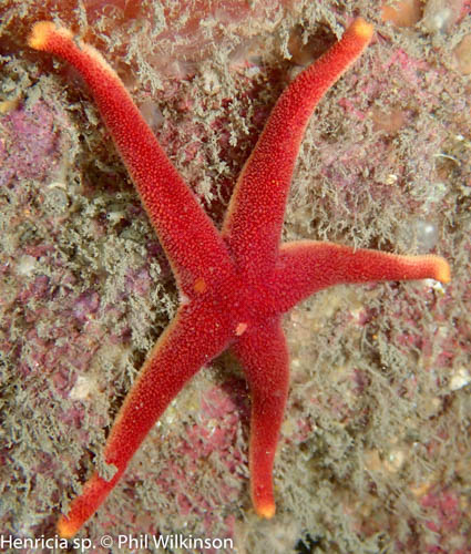
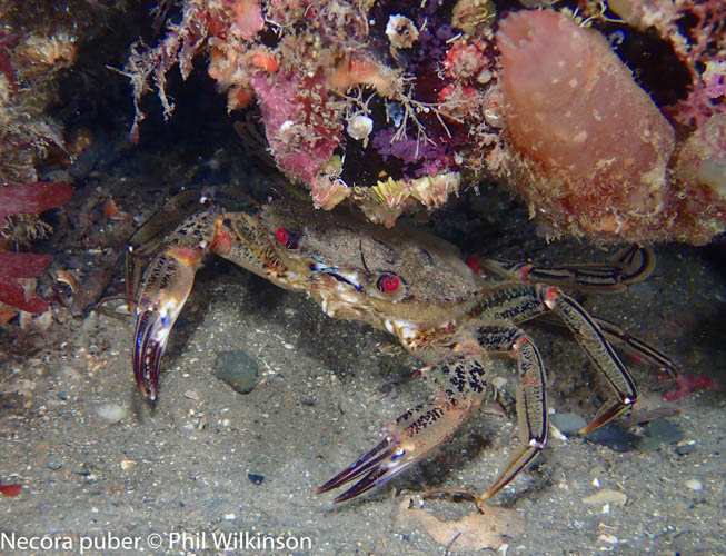
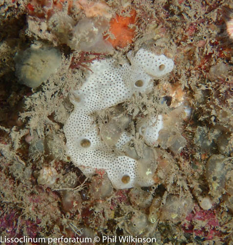
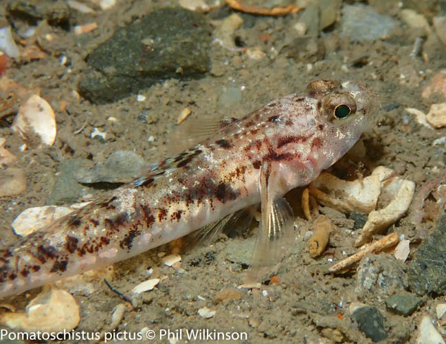
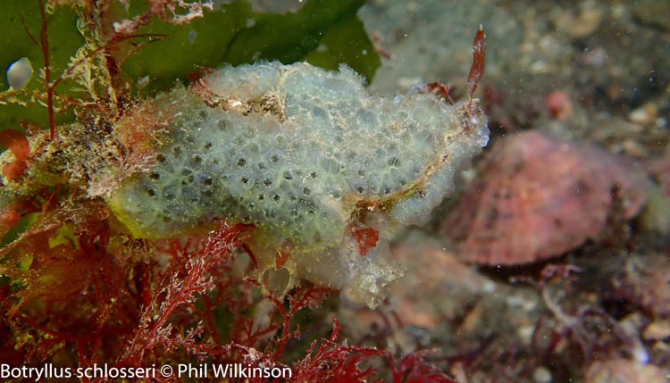
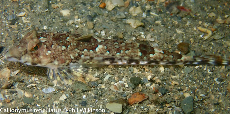
Biodiversity:A description of the species composition at the site. Species of interest are highlighted. Follow the links for more information about the species on the NBN Atlas Northern Ireland website
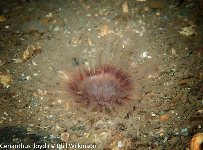
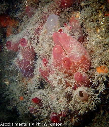
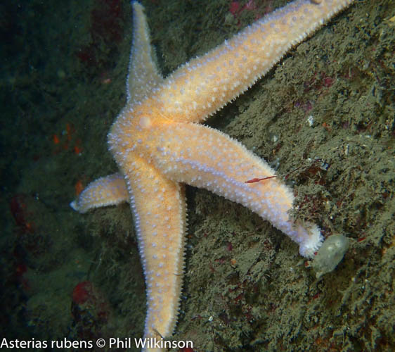
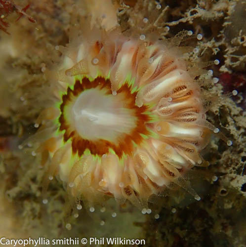
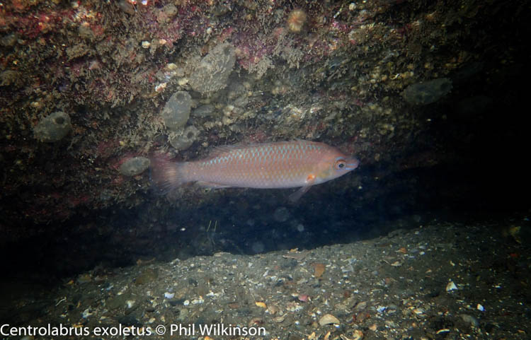
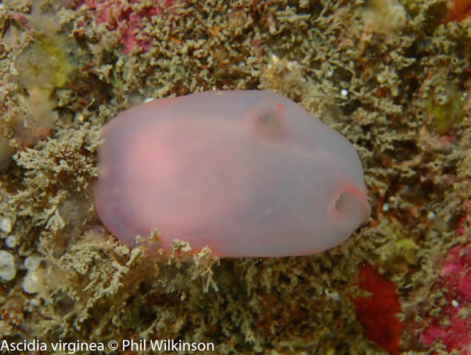
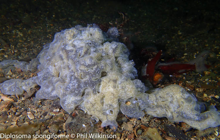
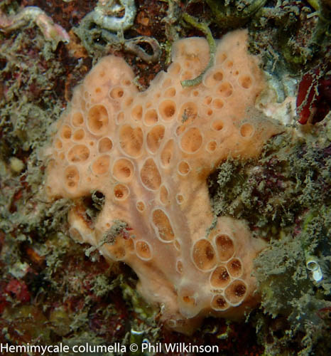
Dense kelp and mixed algae are found growing around the wreck. The wreck itself is home to wrasse, starfish, molluscs, crustaceans and the occasional octopus.
A link to the dive site location on the NBN Atlas Northern Ireland website, showing all species records from within a 1km boundary of the site centroid. Any new species records from the site submitted to Seasearch, iRecord, CEDaR Online Recording or iNaturalist will appear here
Local charters:A link to the website for the nearest Dive Centre to the site. A map of all dive centres is provided under ‘Go Diving’
Environmental and Historical Designations:A list of any environmental or historical designations attributed to the site, or overlapping it. Follow the link for more information
In an emergency call 999 or 112 and ask for the coastguard.
Follow VHF radio Channel 16 (156.8 MHz), the international distress frequency. Send a distress alert followed by ‘MAYDAY, MAYDAY, MAYDAY’ and ‘This is [boat name]’.
When navigating within the harbour/marina, use VHF Channel 80
Latitude, Longitude:The approximate XY coordinates for the dive site in Decimel Degrees (DD). These can be converted to DMS or DDM by following the link below


Leave a Comment
Dived here recently? Then let other divers know about this site from your experience!